Underwater ROV Systems Advance Ukraine’s Underwater Demining Efforts

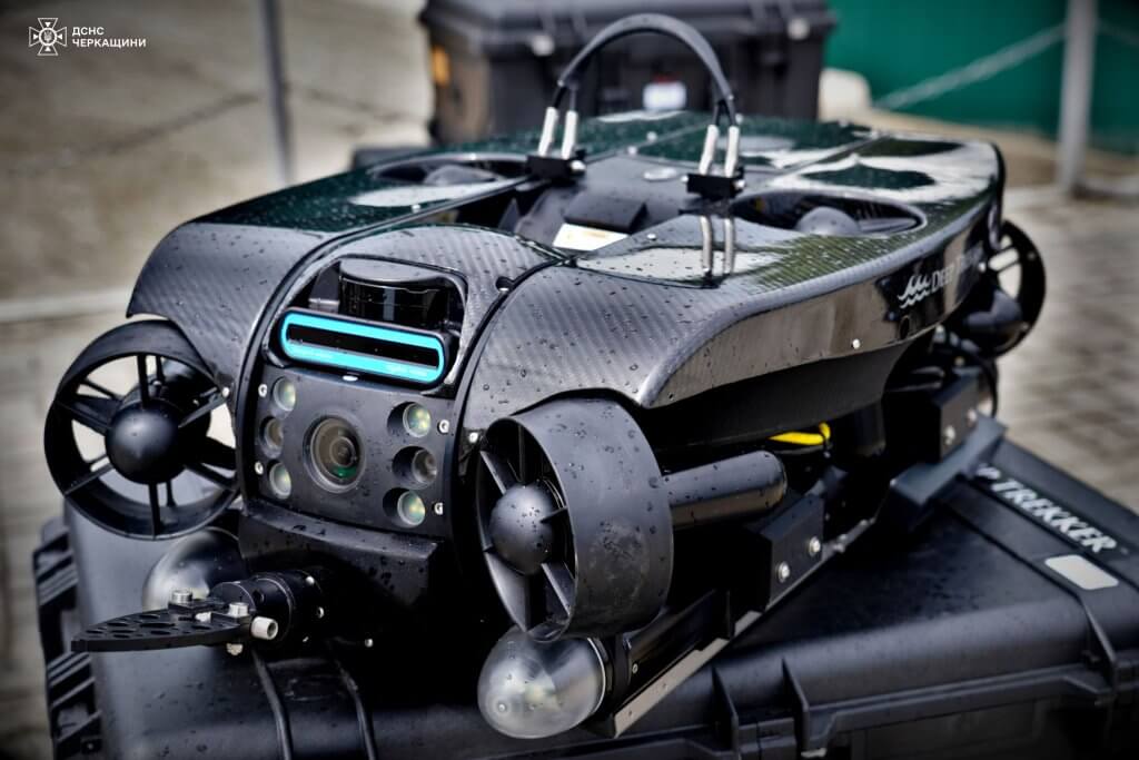
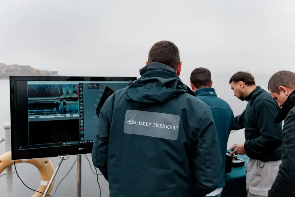
The The United Nations Development Programme (UNDP) is strengthening Ukraine’s national underwater demining capability by funding, delivering, and coordinating the equipment, training, and operational frameworks required for civil agencies to safely locate and identify explosive hazards in aquatic environments. Central to this effort is the deployment of the Deep Trekker REVOLUTION Remotely Operated Vehicle (ROV), paired with structured operator and instructor training for the agencies responsible for field operations.

With contamination estimated across 13,500 km² of rivers, canals, reservoirs, and coastal waters, Ukraine’s underwater demining challenge requires tools that can operate where visibility, currents, and risk make diver-first approaches impractical. Portable ROV systems now allow national agencies to perform remote visual identification and sonar assessment of suspected explosive remnants of war before committing divers.

Since early 2025, Deep Trekker has supported UNDP’s program through two dedicated missions in Ukraine, delivering hands-on training, technical support, and procedural development. These activities are focused on enabling SESUSSTS, the National Police, and National Mine Action authorities to independently conduct underwater search, identification, and survey tasks. A key outcome of this work is the establishment of Ukraine’s first unified group of certified underwater ROV instructors, tasked with training operators nationwide.

UNDP’s Civil Demining Program in Ukraine

UNDP’s Mine Action Programme is focused on restoring safe access to critical waterways, supporting local communities, and reducing the long-term impact of explosive remnants of war, concentrating on providing the funding, equipment, training, and operational frameworks that enable Ukrainian authorities to carry out underwater demining activities.

Current estimates indicate that only 1.41% of contaminated aquatic territory has been cleared to date (approximately 190 km²), despite the removal of more than 2,800 explosive devices by SESU dive teams since the start of the full-scale invasion. This gap reflects the scale and complexity of underwater explosive contamination rather than a lack of operational effort.

By supplying ROV systems and coordinating multi-agency training, UNDP is addressing a critical bottleneck: the ability to assess underwater hazards safely and consistently before diver deployment. This approach reduces risk to personnel while allowing agencies to prioritize clearance operations based on verified data.

This mission is funded through international donor support, with contributions from France, Korea, the Netherlands, and Denmark, all of which play a decisive role in enabling equipment delivery and capacity-building efforts across Ukraine.

Deployment of the REVOLUTION ROV Across Ukrainian Agencies

To date, a total of 52 REVOLUTION ROV systems have been delivered under UNDP-supported civil underwater demining initiatives in Ukraine.

The first tranche, consisting of 16 REVOLUTION ROVs, was delivered to the State Emergency Service of Ukraine (SESU/DSNS) and placed into operational service. Building on this foundation, the second tranche of 36 underwater drones has now been assigned across four national agencies:

The second tranche allocations include 22 REVOLUTION systems to the Special State Transportation Service (SSTS), a Ministry of Defense–dependent civil authority; 8 systems to the State Emergency Service of Ukraine (SESU/DSNS), building on its Tranche 1 deployment; 4 systems to the National Police of Ukraine for evidence documentation and hazard marking; and 2 systems to the National Mine Action Center (NMAC) to support coordination of national standards and demining methodology.

These allocations confirm the REVOLUTION as the benchmark for civil underwater demining inside Ukraine.

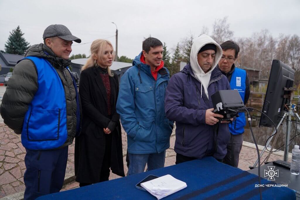
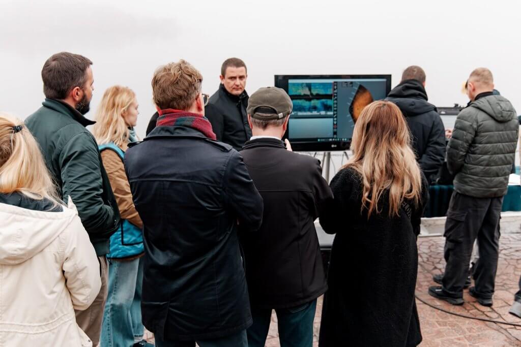
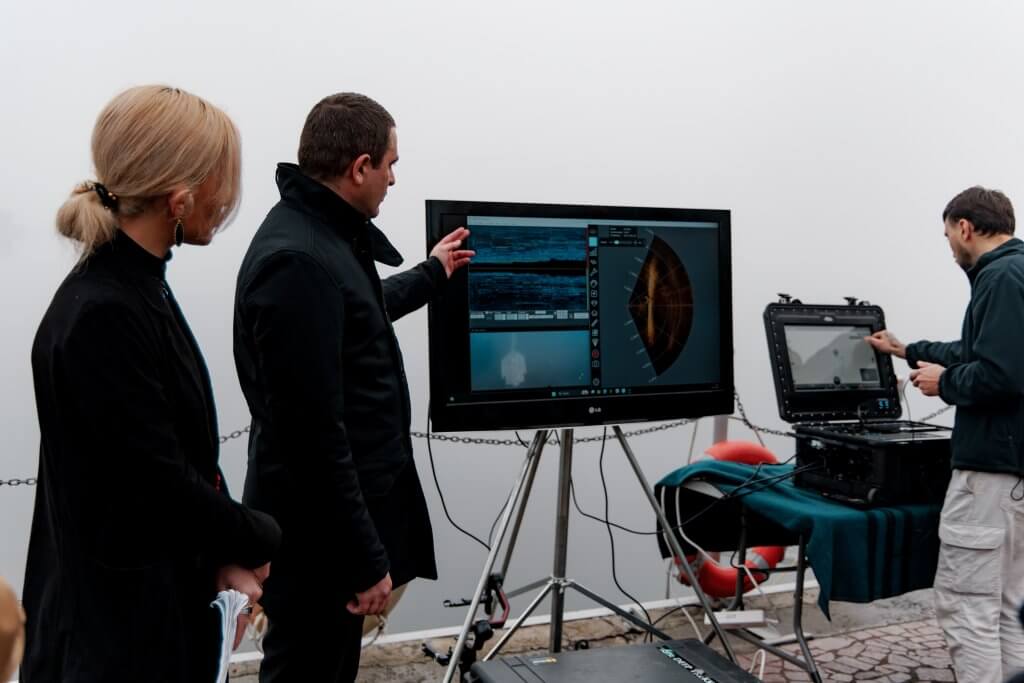
Field reports from recent deployments show immediate operational utility. During training in Cherkasy, SESU operators used the ROV to inspect missile damage to a dam on the Dnipro River, collecting sonar and video data in strong currents and turbid water – an environment unsuitable for divers.

Training Framework: From Operator Skills to Instructor-Level Capability

Deep Trekker has delivered two structured training phases in Ukraine during 2025, aligned with UNDP’s capacity-building objectives.

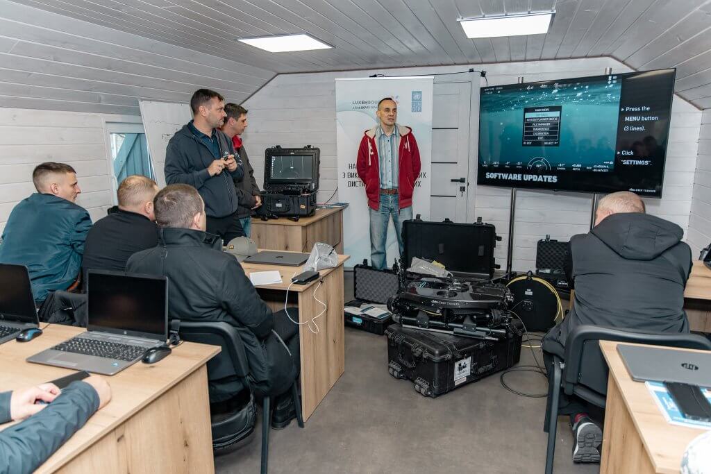
Operator-Focused Training (May 2025)

  • Three training groups
  • Approximately three days per group
  • Curriculum included system setup, tether handling, imaging sonar use, navigation methods, data capture, and underwater demining mission workflows

This course was structured to rapidly qualify operators across SESU, SSTS, NPU, and NMAC, producing teams capable of deploying the REVOLUTION in real missions shortly after instruction.

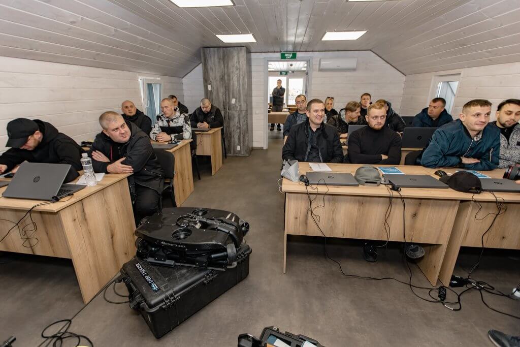
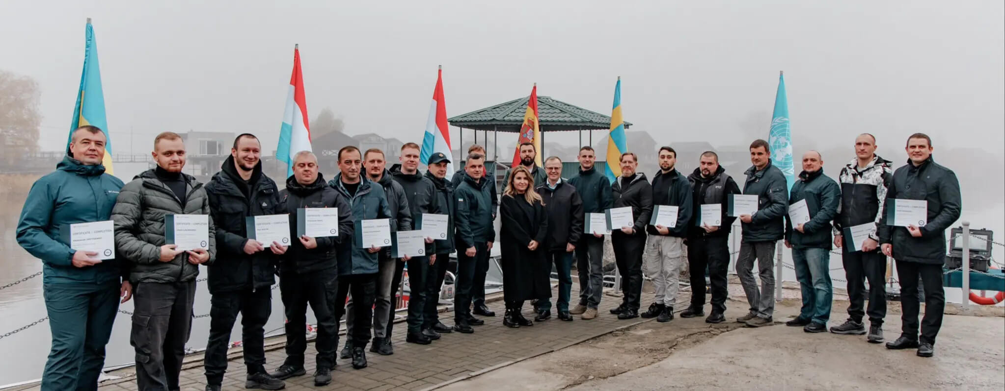
Train-the-Trainer Program (November 2025)

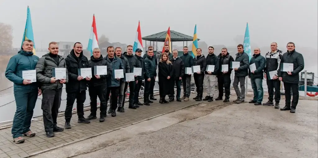
  • 15 specialists certified as national instructors
  • Participants drawn from all key agencies
  • Emphasis on teaching methodology, advanced mission planning, multi-sensor interpretation, and data management

This second phase was designed in collaboration with UNDP to build a permanent national training body. These certified instructors can now deliver standardized instruction across every region, ensuring consistent procedures and scaling future capability without external support.

UNDP emphasized the importance of this milestone during the graduation event:

“This ToT is a game-changer because it moves beyond simply providing equipment or technical know-how – it’s about institutional building, self-sufficiency, and national ownership,” El-Houjeiri said. “By establishing a coordinated national action, Ukraine can ensure coherent implementation and long-term sustainability across all key state entities. This is a strategic investment in Ukraine’s future, enabling the country to manage the long-term clearance effort efficiently and safely.”

Technical Advantages of the REVOLUTION ROV for Demining Workflows

Ukraine’s inland and coastal waters present persistent operational constraints for underwater demining dive teams:

  • Zero to near-zero visibility in many rivers and reservoirs
  • Strong and variable currents in the Dnipro system
  • Heavy siltation obscuring and concealing targets
  • Obstructions and debris fields from wartime damage

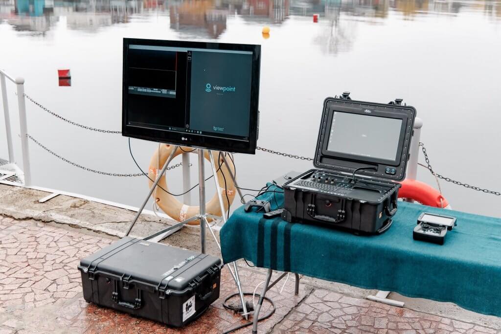
The REVOLUTION ROV’s modular architecture, vectored thruster layout, and integrated imaging sonar provide controlled maneuvering and repeatable data collection under these conditions. The underwater ROV is rated to 300 m depth, covering environments from irrigation channels to deep hydraulic structures.

SESU operators emphasized the impact on diver safety and the value of remote identification capabilities:

“ROV technology fundamentally transforms how we approach underwater demining,” said Yevhen Radchenko, an underwater deminer and instructor with SESU who participated in the course. “In near-zero visibility and strong currents, we can now deploy these robots to safely locate and identify explosive devices before any diver enters the water. This isn’t just about efficiency – it’s about bringing our people home safely every day.”

These features directly reduce risk to dive teams while increasing the speed at which waterways can be assessed and prioritized.

Multi-Agency Integration and National Standard Development

The November 2025 Depth of Safety: National Conference on Underwater Demining in Lviv – supported by the Ministry of Defense, UNDP, and the Government of the Republic of Korea – represents the next step in building a coordinated national approach.

Key objectives:

  • Establish harmonized national standards for underwater demining
  • Share operational data from SESU, SSTS, NPU, and NMAC
  • Align ROV-based workflows with diver procedures
  • Increase interoperability among agencies

Deep Trekker has been selected as one of the few technology providers to present at the conference, reflecting the underwater ROV system’s operational relevance and its broad adoption across Ukraine.

Humanitarian and Economic Significance of Clearing Waterways

Underwater contamination affects far more than infrastructure safety. It has direct implications for food security, irrigation, river transport, hydropower, and coastal logistics. Clearing explosive hazards underwater is directly linked to Ukraine’s economic recovery.

Deputy Economy Minister Ihor Bezkaravainyi highlighted the economic impact:

“The Black Sea coastline and the Ukrainian part of the Danube Delta are vital waterways for Ukraine’s grain exports, and when we clear them, we’re tackling global food insecurity,” Bezkaravainyi said. “This training boosts the sophisticated capacity needed to protect critical infrastructure, restore our export logistics, and return waters to safe use – in particular for irrigating the fields of southern Ukraine.”

From irrigation channels in southern oblasts to ports supporting global grain supply chains, the ability to assess and clear underwater hazards is central to Ukraine’s recovery.

The Role of Donor Nations

This initiative is made possible through the support of international partners including France, Korea, the Netherlands, and Denmark, whose funding directly contributes to equipment procurement, training, and long-term capacity building.

As stated by the Netherlands:

“The Netherlands is proud to stand with Ukraine and our fellow donor partners in supporting the Mine Action Programme,” said Robert Dekker, Head Political Department, Counsellor, Embassy of the Netherlands. “Clearing these waterways is a humanitarian necessity and a prerequisite for lasting peace and recovery. This initiative exemplifies how targeted technical support from international and national actors can directly enhance the safety and resilience of the Ukrainian people.”

Their contributions ensure Ukrainian agencies have the tools and knowledge to conduct this work and independently sustain underwater demining operations over the long term.

Advancing Ukraine’s Civil Underwater Demining Capacity

Through its partnership with Deep Trekker, UNDP is delivering the equipment, training systems, and organizational structures that enable Ukrainian civil agencies to conduct underwater demining safely and at national scale. With 52 underwater ROV systems deployed and a certified national instructor group established, Ukraine now has a sustainable framework for underwater explosive hazard identification and prioritization.

This work directly supports civilian safety, infrastructure recovery, and economic stability. Deep Trekker continues to provide technical support and training for the agencies performing underwater demining operations across Ukraine, and remains committed to supporting these frontline humanitarian operations with proven, mission-ready underwater systems – and to standing alongside the operators who put them to work.

For product information, visit the H2O Drones website.

The solution everyone is looking for: sonar and ROVs

Familiar with a firewater tank, culvert, or ship? Then it is nice to have an insight into the status of these structures. The objects just mentioned are just one example of what we can inspect with our ROVs thanks to sonar. Dry pumping or docking is a thing of the past, thanks to this development in the field of underwater inspections.

For us, the importance of inspection is preventive. We want to know if there is damage to an underwater asset that could pose a risk in the short or long term. You don’t need to inspect some structures as often as others, simply because their use is lower. You don’t need to inspect a bridge every time a car drives over it.

Your best friend on board
Ships are therefore a separate case. Unknown damage to a ship can have nasty consequences. Being aware of the status of the bow or plane before you set sail is useful information. A small leak, some rust or a lot of fouling are damage factors you want to keep a close eye on for optimal sailing. But putting the ship in dry dock or swimming underneath to keep an eye on it are not exactly the easiest or cheapest options right now.

While you stand dry on board, leaning on the gunwale, driving the ROV or letting us do the work, is then a better option. Not only is it easier, but also much more accurate.

Up to 200 metres crisp visibility
That accuracy is thanks to sonar. Our ROVs are equipped with this state-of-the-art technology to detect every hairline crack. Visibility in most waters is far from clear, making underwater surveys difficult with the naked eye.

Sonar sees right through floating sediment and other disturbing factors. This allows you to detect objects up to 200 metres away at the same quality as 10 centimetres. A tool that has already helped detect damage to underwater infrastructure, ships and during search and rescue missions on many occasions.

Time and again, the technology of sonar on our ROVs proves itself in underwater inspections. We hear nothing but positive feedback when we deliver our reports using sonar. At least, we do hear that it is sometimes difficult to read the sonar. That is why we explain what is visible on the sonar and compare it with our 4K camera images, if possible. Transparency is of great importance to us.


Below is a video of a ship inspection with both 4K images, and sonar. Judge for yourself the quality of our sonar and who knows, you might see a solution in your own area!

Underwaterdrones in unexpected places!

Under water drones are often used to make the work of divers easier and for safety reasons. Situations like this often occur in rivers, pipelines and locks. But ROVs can also be used with less obvious assets. These are locations that you never think about, or didn’t know about!

Drones in nuclear power plants

Especially in nuclear power plants, drones can be of great importance. The water in which underwater drones can enter is usually cooling water, in which various assets are located. Because this water can be hot and may contain radiation, it is less desirable to take divers into the water. Of course, it is important to check whether everything is still in order at a nuclear power plant in order to prevent disastrous consequences!

See here how an inspection of a nuclear power plant can look like!

Water in the food industry

ROVs can also be used in large factories in the food industry. Not so much in consumer goods, of course, but mainly in the factory’s cooling waterpipes and outlets. By deploying an ROV here, a cooling water pipe can remain active, and the factory does not have to be shut down.

Extinguishing watertanks and basements

Extinguishing water is used for exactly what you expect it to be used for – extinguishing fires. Fire water tanks are often connected to large fire hydrants or sprinkler systems. It is not necessary for this water to be potable, but the tanks must not have sand at the bottom. This can cause a crucial obstruction in pipes and must be removed from the tank.

Instead of emptying the tank and removing both all of the water and the sand, this is also possible with a suction robot! The DT640-VAC can drive over the bottom and pick up sediment from the bottom with a kind of vacuum head. In this way, there is much less water loss and the result can be seen immediately with a camera in this vacuum robot.

Why under water drones?

Drones are quick and easy to deploy, do not require safety regulations and are compact. The camera and sonar capabilities make data processing smart and fast.
With many possible accessories, a drone or robot can be customised to meet any challenge!


Do you want to know more about drones, or see if they can be used at a location of your choice? Then contact us here.

Or follow on of our social media channels:

Spie Netherlands’ experiences with H2O Drones

One of the most common inspections for our drones, is inspecting water infrastructure. We are talking about locks, sheet piles, bridge piers, and everything that is underwater. These inspections – often commissioned by the Department of Public Works or Dutch municipalities – are done by various companies, including Spie Nederland. We went along with Arjen Geelhoed, superintendent at Spie Nederland, and Mario Bergman, drone pilot at Spie Nederland, to an inspection of the Middensluis in IJmuiden. There we talked about the cooperation between H2O Drones and Spie.


Spie is a global multi-technology service provider and partner of H2O Drones. They too use our drone, the DTG3 from Deep Trekker. “We use the drone mainly when inspecting locks and lock gates,” says Arjen Geelhoed, performer at Spie. Geelhoed has been using Deep Trekker’s DTG3 for inspections for a while now. “It is fully integrated into the work process. We use it weekly during inspections and often for a few days in a row. Especially if they are large inspections.”


H2O Drones and Spie in cooperation
Now both H2O Drones and Spie work partially in the same sector, but we were not yet well acquainted with each other. Of course we knew Spie, but not vice versa. Thanks to a common partner, we came into contact with each other. “I started looking on the Internet for underwater drones that we could deploy,” explains Geelhoed. “I saw that RPS was already using underwater drones and after a phone call I heard that they were very satisfied with the drones and service. Then I learned which company was behind the drones: H2O Drones. Soon I had contact with Karst Beens, director of H2O Drones. After some conversations we started an enthusiastic cooperation.”

Geelhoed reveals that they also worked with an underwater drone before, but that the quality of the drone, the service of the company and the communication were not what Spie was looking for. “I won’t say too much about it, but it wasn’t for us. Parts and maintenance took way too long; it was all just a hassle,” says Geelhoed. “With you guys, it’s the opposite. The service is very fast and reliable. Suppose our drone is broken and we have no time to repair it, then we can get a replacement model from you. That assurance is very nice and reassuring, especially if you have a busy schedule or an important inspection coming up. Or we can ask if you can do the inspection for us. All no problem.”


“With the DTG3, we can execute everything very quickly, without the additional safety checks required.”
– Executive Arjen Geelhoed of Spie Nederland

The DTG3

The DTG3 is a relatively small and maneuverable underwater drone from Deep Trekker. H2O Drones is the officially certified retailer of all Deep Trekker products in the Netherlands. Equipped with a 4K low-light camera, clear and sharp images are a guarantee. Perfect for clear and deep water, such as that near locks. The work in itself with the drone also offers a significant plus. “With the DTG3, we can do everything very quickly, without the additional safety checks required. This allows us to meet our deadlines more easily. After all, fines are quickly incurred if a project takes too long. Also, the drone can be deployed quickly, so we can act immediately in the event of a malfunction report, for example.”

As with all of Deep Trekker’s other drones and crawlers, the DTG3 is controllable from the side via a controller. “You can move up and down with the camera and move horizontally and vertically with the drone. That gives a lot of possibilities, but can be a bit confusing at first.” Geelhoed emphasizes that it’s mainly an advantage. “The precise descending and sailing back to the surface is very nice for this kind of inspection. You then have to master the controls, but there is a handout with the drone and we received training in this from H2O Drones. Once you get the hang of the controls, it really works perfectly. The small size of the drone also makes inspections easy. Simple and efficient.”


“Dit lost simpelweg ons probleem op met inspecties”
– Dronepiloot Mario Bergman bij Spie Nederland


Future

Spie has been using H2O Drones’ underwater drones for a while now, but are there any plans for the future?
“We are satisfied with this model for now. It meets everything we need. But if a client like the Department of Public Works says they want to see more of inspections with, for example, sonar or other objects that are difficult to see, then expanding to a second drone will be highly likely,” says Geelhoed.

According to Mario Bergman, drone pilot at Spie Nederland, what is missing now is moving laterally along a wall with the DTG3. “This makes inspecting an entire wall a bit less efficient. It is possible with other drones from H2O Drones, though, so who knows if we’ll purchase a second drone.”


Satisfied?
“Yes, we are super happy with the drone” , says Bergman. “This simply solves our problem with inspections. And should there be a problem with the drone, which by the way we haven’t had yet, we know that we will be helped quickly by a service provider in the Netherlands. This saves a lot compared to suppliers abroad.”

[awl-slider id=7513]


Do you have questions about our cooperation with Spie? Or our work with the drones in general? Contact us here.

Or follow us on Social Media, to stay updated!
Facebook

LinkedIn

YouTube

Flood protection in Germany

Last year we explained how the Netherlands protects itself against a flood. The reason for this was the floods that affected the Netherlands, Germany and Belgium You can read all the information about it here.

But looking back at last year and the events, we also wanted to take a closer look at flood protection in Germany. The events have also made it clear to us that we can also do our part with our drones. You can read more about how we see this happening next. First, let’s briefly explain what happened in July 2021. Then we will take a closer look at flood protection in Germany.

What happened in July 2021?

In July 2021, heavy and continuous rain broke out in the regions of Rhineland-Palatinate and North Rhine-Westphalia. This resulted in more water than the rivers could withstand. Especially the Arthal, Rhineland-Palatinate, was affected. To show how quickly everything happened, we show how the situation in the Arthal changed. The WDR (West German Broadcasting) even developed an hourly summary of the events.

On Wednesday morning, the government had already warned of heavy storms, consisting of heavy and continuous rain. The flood control centres were also informed directly. At around 11 a.m., Rhineland-Palatinate declared the second-highest risk level, red, for some areas.

Then, at 5 p.m., the state environmental agency declared the highest risk level, purple. The ‘crisis team’ was then formed. A crisis team is a meeting of experts in which the resolution of an emergency is discussed.

At 19.30, the high water level of 2021 has already exceeded the level of the 2016 flood. The State Environmental Agency also continues to adjust its water level forecast.

At 9 pm, the water level was measured for the last time. At first, it was assumed that this was due to a power failure. Later, it turned out that the house to which the measuring device was attached had been washed away.

The rain continued all night. In the picture you can see how the water level rose in one night.

Landesamt sah den Pegelstand von sieben Metern um 20 Uhr voraus – Evakuierungsaufruf erfolgte um 23.09 Uhr - Rheinland-Pfalz - Rhein-Zeitung

The effects, however, only became clear the next day. Already in the morning, 1,300 people were missing.

Arthal after the floods:


Flood protection in Germany

Many people still wonder why warnings about the floods were issued so late. Unfortunately, we can’t answer that either. Nevertheless, we asked ourselves how flood protection works in Germany and whether we could perhaps contribute to it.

However, flood protection in Germany is not generally regulated, but can be determined by each federal state itself. But there are also plans that go beyond the federal state. One example is the flood risk management plans for the Rhine catchment area. These apply to various federal states on the Rhine, but also internationally.

The general objectives of flood management are as follows (Quelle: IKRS, 2014)

Bericht zur Koordinierung der Hochwasserrisikomanagementplanung - PDF Kostenfreier Download

Prevention: In order to avoid further disasters, special care is taken to ensure that no buildings are erected in risk areas. In addition, buildings already constructed in these areas are adapted to the circumstances. The last point is the promotion of appropriate land use. Here, for example, the type of vegetation in the risk areas must be taken into account. Large plants prevent water from draining away and can lead to waterlogging.

Protection: Protection should ensure that floods are reduced in certain regions. This protection can be structural or non-structural. The best-known examples of flood protection are dams and walls. However, there are also flood retention basins to dampen the flood wave. To do this, the excess inflow is temporarily stored and slowly released again. Other construction measures include dams, which are constructed similarly to flood retention basins but can also be used to supply drinking water.

Preparedness: Preparedness refers primarily to informing the population. In the first instance, it is about informing people in affected situations about the risks and the correct behaviour.

Of course, we cannot help in all these areas. And we don’t want to presume to say that we can prevent big catastrophes like the one in July. Nevertheless, it got us thinking and we think that even small help is important, especially since floods will happen again and more often. You can read about how we want to do our part and how you can help as a private person in our blog next week.


Continue reading “Flood protection in Germany”

How our ROVs help prevent flooding

Many pipes in the Dutch water network were laid years ago. Often they are more than 30 years old. Depending on the risk involved (both financial and physical risk), inspections or replacements are scheduled. But if the risk is small, aren’t these pipes/dikes being neglected? These were constructed to move water and provide a flow without obstruction. But often an obstruction is actually found there. So what should be done with that?

High risk vs. low risk:

Most high-risk pipelines are located in residential areas where many people depend on the pipeline. Think, for example, of drinking water pipes or sewers. If these suddenly break down and stop working, many streets could be without water. There is also a risk of subsidence in a densely populated area. These pipes are therefore often well mapped out and regular maintenance or an inspection can be scheduled here.

High-risk culverts often carry a large amount of damage if something goes wrong. This usually involves bridge culverts, where the integrity of a bridge can also be at stake if the culvert fails. With a busy freeway, it cannot be the case that there is a risk here.

But pipes and culverts with relatively little risk or impact are also important to the Netherlands. Culverts are maintained by municipalities and water boards but often have a somewhat lower priority. Nevertheless, the flow through a culvert can be important.

Our findings

The video above shows that a culvert is often full of silt. When the bottom of a culvert is full of silt, the flow of water is reduced. Especially at the end of the video you can see that there is a large obstruction to be found, which in the long run can stop the flow in its entirety.

If the flow of ditches, for example, stops at a culvert, water can start to accumulate and naturally overflow the banks. This can cause roads or bicycle paths to flood and become inaccessible. This can never be the intention.

Plan of action: improve flow

Nowadays, culverts, even those with low priority, are being imaged more frequently and more quickly. Nowadays it is possible to check whether the culverts have been properly flushed and therefore whether all the sludge has been removed. After this, the culvert or pipe can be properly imaged to determine its state of service.

Also, using our sonar from Blueprint Subsea, developed a method to determine the amount of silt in pipes and culverts! This is only possible with drones equipped with sonar, because it can only be read on the sonar images. In both round and square (or rectangular) tubes we have developed methodologies that can accurately determine the amount of silt or sand on the bottom. This is crucial to determine the flow of culverts and pipes.

This method can also be seen in our video above, from 40 seconds you can see how we do this, and what the result is.
In this way it is also possible to check whether a culvert has been properly cleaned, and whether there is still a risk of flooding.
In this way, large and small floods can be prevented, and there is less chance of permanent damage!


Would you like to know more about the innovative way of measuring sludge? Or are you curious about other possibilities with our drones? Then contact us here, or follow us on one of our social media channels: