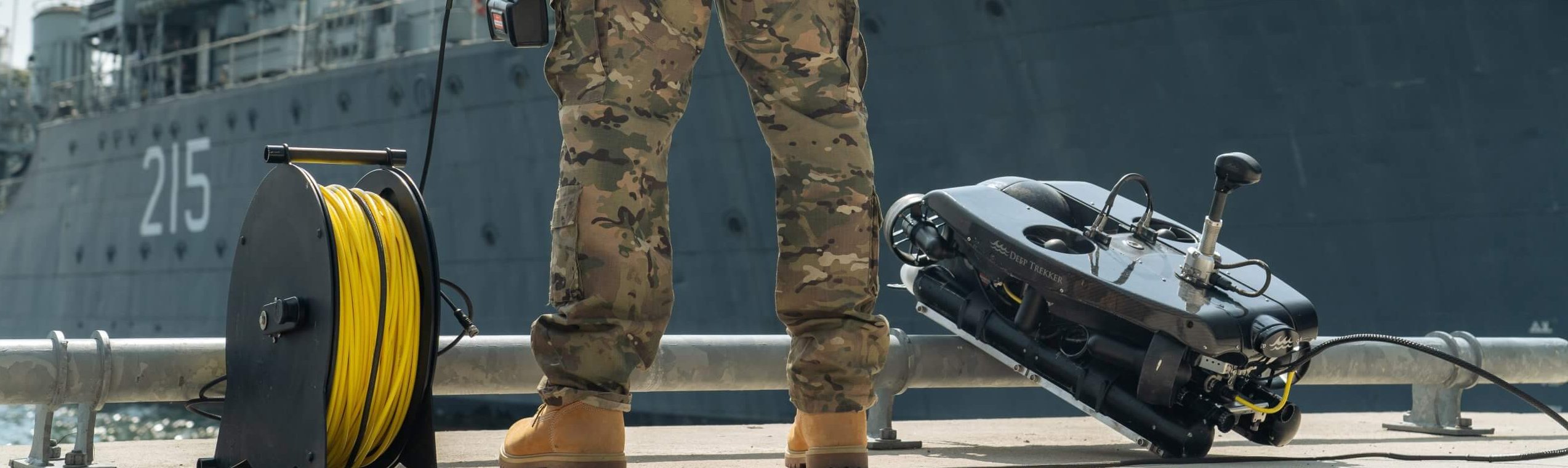
War often does not end the moment the last fighting ceases. Beneath the water’s surface, its consequences can remain visible and dangerous for years to come. Sea mines, unexploded ordnance, damaged bridges, quays, harbours and underwater structures pose a threat to the safety, economy and reconstruction of affected areas. It is precisely at this stage that underwater drones are playing an increasingly important role.
At H2O Drones, we are seeing how modern ROVs (Remotely Operated Vehicles) are becoming indispensable tools for organisations responsible for safety, infrastructure and recovery operations. Thanks to advanced sonar, camera and inspection technology, areas can be surveyed without divers or explosives experts having to take unnecessary risks.
The hidden danger beneath the water
In virtually every maritime conflict, sea mines and other explosives are deployed to block off ports, coastal areas and key waterways. Although some of this ordnance is detonated during a conflict, a significant number of explosives remain on the seabed, in rivers and in harbours. Some of these objects remain there even decades later. According to Deep Trekker, our partner in ROVs, large numbers of unexploded maritime explosives are still present worldwide in waters that were used during historical conflicts.
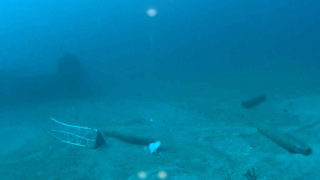
Military foreign objects, detected using an ROV
Before a port can become fully operational again, shipping can resume safely or restoration work can begin, these risks must first be identified. Traditionally, this meant that specialist divers had to carry out surveys in potentially hazardous areas. This is not only time-consuming, but also entails significant safety risks.
First the drone, then the specialist
Just as with search and rescue operations, information is crucial in mine clearance work. The better the situation is assessed in advance, the safer the operation will be.
Underwater drones make it possible to inspect suspicious objects remotely first. Using high-resolution cameras and imaging sonar, operators can approach, classify and document an object without people having to enter the water immediately. This provides a clear picture of the situation before explosive ordnance disposal (EOD) services or military EOD teams take further action.
Deep Trekker describes how modern ROV systems are used to detect, identify and re-locate mine-like objects on the seabed. Real-time video footage and sonar data prove invaluable in reducing uncertainties during inspections.
The result is an operation in which fewer people are directly exposed to risks and in which decisions are based on up-to-date and reliable information.
Sonar makes invisible threats visible
One of the biggest challenges in mine clearance is the limited visibility underwater. Ports, estuaries and coastal waters often contain large amounts of suspended sediment, which means that traditional cameras are of limited use.
That is why sonar is an essential component of professional underwater drones. Sonar works using sound waves and can detect objects that are completely invisible to the human eye. This enables operators to systematically scan the seabed and identify anomalies that require further investigation. H2O Drones has optimised this technology so that infrastructure is clearly visible and foreign materials on the seabed are easily detectable.
A quay where the damage is visible thanks to sonar
Moderne Deep Trekker-systemen combineren sonar met videobeelden, waardoor operators zowel een akoestisch als visueel beeld van de omgeving krijgen. Dat vergroot de kans op een correcte identificatie en maakt het eenvoudiger om onderscheid te maken tussen bijvoorbeeld een stuk puin en een potentieel explosief object.
Reconstruction begins after the war
Once explosives have been cleared, the next challenge often arises: assessing damaged infrastructure.
Bridges, quay walls, locks, harbours and underwater foundations can sustain significant damage during a conflict. This damage is often located precisely in places that are difficult for inspectors to reach. At the same time, a rapid assessment is essential to get transport, logistics and economic activities back on track.
This is where underwater drones once again offer a significant advantage. Instead of deploying divers straight away, inspections can be carried out quickly and safely from the water’s edge or from a vessel. Thanks to high-quality cameras, powerful lighting and advanced navigation systems, structures can be examined in detail without the infrastructure having to be taken out of service.
Detailed inspections for better decision-making
Recovery projects are all about reliable data. Engineers and asset managers want to know exactly where damage is located and how severe it is before repair work is carried out.
Deep Trekker has therefore developed its systems to collect high-quality inspection data. Modern ROVs can not only film underwater structures, but also capture them for 3D modelling and photogrammetry. This creates a digital model of a structure in which wear, cracks, corrosion or impacts are made visible.
For organisations responsible for the reconstruction of ports, bridges or defence-related infrastructure, this means that inspections can be carried out more accurately and repairs can be planned more effectively.
Safety remains the key benefit
Although the technological capabilities are impressive, safety remains the main reason for deploying underwater drones. Whether in mine clearance operations or inspections of damaged infrastructure, any task that can be carried out remotely reduces the risk to personnel.
Deep Trekker emphasises that ROVs have been developed specifically for challenging and potentially hazardous environments to support professionals in inspection, security and reconnaissance missions. Thanks to their manoeuvrability, real-time imaging and rapid deployment, crucial decisions can be made without exposing people directly to danger.
A technology that goes beyond inspection
The use of underwater drones in mine clearance and reconstruction demonstrates just how wide-ranging the possibilities of this technology have now become. Whilst ROVs were once primarily seen as tools for inspection, they are increasingly evolving into essential systems for security, defence and recovery operations.
At H2O Drones, we believe that underwater robots make a significant contribution to a safer world. Whether it involves locating explosives on the seabed, inspecting damaged harbours or assessing critical infrastructure following a conflict, the power of an underwater drone ultimately lies in one simple principle: first gaining insight, so that people can carry out their work more safely and with greater awareness.
When a report comes in that someone has fallen into the water, a race against the clock begins.Emergencyservicesmustactquickly, whilstalsoensuringtheyworksafely. Underwaterconditionsareoftenfarfromideal. Visibilityislimited, currentscanbetreacherousandtheenvironmentisusuallyunfamiliar. Itispreciselyforthisreasonthatanincreasingnumberofsafetyregionsarechoosingtodeployanunderwaterdronetosupporttheirdivingteamsandsearchandrescuemissions.
The reality of an underwater search operation To outsiders, underwater search and rescue can sometimes seem relatively straightforward: a diver enters the water and begins searching. In practice, however, it is one of the most challenging disciplines within the emergency services. In many waters, underwater visibility is often no more than one to two metres. As a result, divers must rely largely on their training, experience and instincts.
This entails certain risks. There may be obstacles underwater, such as cables, branches, wreckage, jetties or other structures in which a diver could become entangled. Furthermore, emergency responders do not always know in advance what the situation is like beneath the surface. Every operation therefore begins with a certain degree of uncertainty.
Within the fire service, therefore, there is an important guiding principle: to minimise risks as much as possible without losing sight of the quality of the rescue operation. Technology can play a key role in this.
Look first, then dive At H2O Drones, we do not see an underwater drone as a replacement for a fire service diver in search and rescue operations, butas an extra pair of eyes underwater. Whereas a diveris immediately exposed to the conditions, an ROV (Remotely Operated Vehicle) can first reconnoitre the environmentwithout putting people at risk.
This provides incident commanders and dive coordinators with valuable information. Even before a diver enters the water, it is possible to determine what the search area looks like, what obstacles are present and where potential areas of concern are located. This allows divers to be deployed in a much more targeted manner and significantly increases the safety of the operation.
Particularly in search and rescue operations, where speed is crucial, this approach can save a great deal of time. There is less need to work on the basis of assumptions, and the likelihood of unexpected surprises underwater is reduced.
Sonar sees what the human eye cannot The real power of modern underwater drones lies not only in the camera, but above all in the sonar. Whilst cameras rely on visibility and lighting, sonar uses sound waves to reveal objects and structures. As a result, the system continues to function effectively in dark, murky or muddy water.
Mensen zijn op sonar onderwater goed zichtbaar ongeacht de waterkwaliteit
This makes it possible to identify potential locations of victims or objects more quickly. In many cases, this means that a diving team no longer needs to systematically search a large area, but can instead concentrate its efforts on a much smaller and more clearly defined zone.
Rotterdam-Rijnmond Safety Region as a pioneer One of the first safety regions in the Netherlands to embrace the benefits of underwater drones was the Rotterdam-Rijnmond Safety Region. During a demonstration by H2O Drones, it became clear how a Deep Trekker REVOLUTION ROV can support the work of fire service divers during search operations for people who have fallen into the water.
ProjectleaderRickKoedoot, whowasinvolvedintheprocurementprocess, emphasisedatthetimethattheaimwasnottoreplacedivers. Rather, thetechnologywasprocuredtoenablethemtoworkmoresafely. AccordingtoKoedoot, divingremainsahigh–risktaskandeveryeffortmustbemadetominimisethoserisks.The underwater drone helps with this by providing advance insight into the conditions underwater. This development fits in well with the wider digitalisation within the fire service.
South Holland South also opts for innovation The South Holland South Safety Region, too, recognised the added value of underwater drones for its fire service diving teams. The region invested in a Deep Trekker REVOLUTION ROV, with the primary aim of enhancing safety during search operations for people in distress and sunken objects.
Water-related incidents play a significant role within this safety region. Its operational area encompasses several major rivers, heavily used waterways and extensive bodies of water. This makes the rapid and safe deployment of search resources particularly important.
By first deploying an underwater drone equipped with sonar, the team gains a quicker understanding of the situation. This enables divers to begin their mission better prepared and increases the efficiency of the entire operation.
Technology that can save lives The role of underwater drones in Search & Rescue will only continue to grow in the coming years. Modern systems from Deep Trekker combine the latest cameras with state-of-the-art sonar, enabling operators to build up a detailed picture of the underwater environment even under difficult conditions.
At H2O Drones, we believe that innovation only truly delivers value when it supports people in critical situations.The experiences of the Rotterdam-Rijnmond Safety Region and the South Holland South Safety Region show that underwater drones are now much more than just a technological innovation. They have become a valuable tool enabling fire service divers to carry out their work more quickly, more effectively and, aboveall,more safely.
We usually post blogs and updates about our inspections of critical infrastructure, offshore facilities or, for example, ports. However, there are sites we don’t talk about much, even though we do inspect them. These include power stations, such as nuclear power stations. The reason you don’t see much about them on our site is that the interiors and infrastructure of these sites are off-limits to the public for safety reasons. That’s understandable, of course. That’s why, in this blog, we’re discussing the role of underwater drones in inspecting nuclear power stations.
Water plays a key role in various parts of a nuclear power station. Storage pools, reactor pits and cooling water systems must be kept in good condition at all times to ensure safe operation. Regular inspections make it possible to identify anomalies at an early stage and to plan maintenance work in a targeted manner.
As well as assessing the general condition of structures, inspections provide valuable information on potential wear, corrosion or other forms of degradation. This information forms the basis for informed maintenance decisions and helps to prevent unexpected downtime.
Inspecting underwater structures within a nuclear environment often requires extensive preparation. In some situations, specialist diving teams are deployed, whilst in other cases temporary facilities are required to enable an inspection to take place.
This approach can lead to higher costs, longer inspection times and a greater organisational burden. Moreover, safety is always paramount. Any method that can limit the presence of personnel in potentially hazardous areas therefore deserves serious consideration.
How underwater drones make a difference
Underwater drones make it possible to carry out complex inspections without inspectors having to enter the water. From a safe location, the operator can manoeuvre the drone precisely through basins, canals and other underwater structures.
Whilst the inspection is taking place, video footage is transmitted directly to the inspection team. This allows findings to be assessed immediately and, if necessary, the inspection to be extended to focus on specific areas of concern. This results in a more efficient process and a more complete picture of the situation underwater.
Greater safety, better data
Within the nuclear sector, safety has always been the top priority. Underwater drones contribute to this by minimising human presence in challenging environments. At the same time, modern systems provide high-quality imagery that enables structures to be assessed in detail.
The data collected can be stored, analysed and incorporated into advisory reports. This not only provides insight into the current situation, but also enables changes over time to be monitored accurately. This facilitates a predictable and proactive maintenance strategy.
Applications within the nuclear sector
Underwater drones can be deployed for a wide range of inspection tasks. These include assessing the condition of spent fuel storage pools, inspecting reactor-related structures or checking components of cooling water systems. Even during planned maintenance outages, drones can quickly survey large areas, ensuring that available downtime is utilised to the full.
It is precisely in situations where access is limited or safety is of paramount importance that these systems offer clear added value.
The H2O Drones approach
At H2O Drones, delivering reliable inspection data is our priority. Every assignment begins with an analysis of the site, the objectives and the specific circumstances of the project. An inspection plan is then drawn up, designed to ensure safe and efficient execution.
During the inspection, clients receive real-time access to the imagery and findings. Afterwards, the results are compiled into a clear and concise report, so that the information gathered can be used immediately for maintenance decisions, asset management and further inspection planning.
The use of underwater drones is transforming the way inspections are carried out within nuclear power stations. By combining high-quality inspection data with a significant improvement in safety, a solution is created that meets the high standards of the nuclear sector. For organisations striving for maximum reliability, minimal risks and efficient maintenance processes, underwater drone inspections represent a valuable step towards the future.
Would you like to find out how underwater drones can make inspection work within your nuclear or industrial facility safer and more efficient? H2O Drones would be happy to work with you to develop a suitable inspection approach for your specific situation.
Underwater positioning plays a key role in subsea operations, enabling precise location tracking for tasks ranging from detailed surveys to asset maintenance. The unique challenges of underwater navigation require specialized solutions, and Remotely Operated Vehicles (ROVs), or underwater drones, have become an essential tool for meeting these requirements.
This article explores the fundamental methods of underwater navigation and demonstrates how the underwater drones we sell and operate – manufactured by Deep Trekker – overcome traditional subsea navigation challenges through advanced technologies such as Dead Reckoning, USBL, IMU systems, and ROV GPS.
What Is Underwater Positioning?
Underwater positioning refers to the techniques used to determine the exact location of an object, vehicle, or asset beneath the water’s surface during underwater operations.
Using waypoints for accurate inspections
Unlike terrestrial environments, where GPS provides reliable positioning data, subsea navigation requires alternative methods due to signal attenuation in water. Because conventional GPS signals cannot penetrate water, underwater tracking relies on technologies such as acoustic positioning systems, inertial navigation, and dead reckoning, each suited to different operational requirements and environments.
The Main Methods of Underwater Positioning Acoustic Positioning
Systems such as USBL (Ultra Short Baseline) use acoustic signals to triangulate the position of an underwater vehicle relative to surface transceivers or fixed seabed stations. DVL (Doppler Velocity Log) systems measure the vehicle’s speed relative to the seabed and integrate this data to provide positional information.
This method is often combined with additional technologies to improve accuracy and is widely used in deep-water environments due to its long-range precision.
Dead Reckoning
Dead Reckoning is a navigation technique that estimates the current position based on a known starting location, combined with speed and direction of travel. While it does not provide an absolute position, it offers continuous positional updates, especially when other positioning methods are unavailable.
Inertial Navigation
Systems such as IMUs (Inertial Measurement Units) track movement and orientation using accelerometers and gyroscopes. When combined with Dead Reckoning, they provide continuous positioning data even when no external signals are available.
Surface GPS
Although GPS is ineffective underwater, it can be used to track surface vessels or floating buoys. This data can then be integrated with other navigation methods to improve positioning accuracy whenever the ROV surfaces.
Each positioning method has its own strengths and limitations. In many cases, a combination of technologies is used to ensure consistent and accurate positioning throughout underwater operations. Deep Trekker underwater ROVs utilize a blend of these technologies, enabling precise control and reliable navigation even in complex underwater environments.
Industry Overview: The Evolution of Underwater Positioning
Accurate positioning has always been one of the greatest challenges in underwater operations, particularly for surveys and inspections. Historically, underwater navigation relied on simple mechanical compasses and manual tether management, offering only limited accuracy.
Over time, acoustic positioning methods such as Long Baseline (LBL), Short Baseline (SBL), and Ultra Short Baseline (USBL) systems emerged, using underwater acoustics to determine ROV positions. Together with DVL technology, these methods became industry standards for subsea navigation.
Today, advancements in inertial measurement systems—including MEMS (Micro-Electro-Mechanical Systems) sensors and Fiber Optic Gyroscopes (FOG)—enable real-time ROV tracking, significantly improving data collection capabilities.
By combining acoustic positioning systems with ROV GPS, Deep Trekker underwater robots deliver exceptional accuracy. The integration of technologies ranging from Dead Reckoning to USBL enables these ROVs to operate efficiently across marine research, asset maintenance, offshore inspection, and many other applications.
Why GPS Does Not Work Underwater
Global Positioning Systems (GPS) do not function beneath the water’s surface because radio-frequency signals rapidly attenuate in water. While radio waves travel efficiently through air, they are absorbed by water molecules, rendering GPS unusable for underwater operations.
As a result, underwater ROV operators rely on acoustic positioning and inertial navigation systems to achieve accurate location tracking.
Our Navigation Innovations Powered by Deep Trekker Technology
Deep Trekker ROVs utilize a range of advanced navigation technologies designed to address the unique demands of underwater operations. From Dead Reckoning to ROV GPS, each system plays a vital role in ensuring accurate positioning in environments without direct reference points.
ROV GPS
Deep Trekker’s ROV GPS introduces a new level of accuracy and control for surface-based positioning during underwater operations. Designed for seamless integration with the REVOLUTION and PIVOT ROVs, the GPS module can be easily mounted on the vehicle and provides real-time positional updates whenever the ROV surfaces.
The system automatically calibrates using GPS data, ensuring stable and accurate tracking throughout missions. By working in conjunction with Dead Reckoning technology, ROV GPS enhances operational accuracy and can achieve positioning precision of up to 2.5 cm with RTK/SBAS compatibility, supporting GPS, GLONASS, BeiDou, and Galileo satellite constellations.
Although traditional GPS is ineffective underwater, Deep Trekker’s ROV GPS system leverages surface positioning to keep the ROV on course. Through integration with Mission Planner, operators can track the vehicle’s surface position and correlate it with known coordinates, ensuring precise navigation during underwater surveys, inspections, and maintenance activities.
Revolution with ROV GPS
Dead Reckoning for ROVs
Dead Reckoning is a fundamental navigation method used when GPS signals are unavailable. It calculates position by tracking distance traveled and heading from a known starting point. Deep Trekker ROVs combine this method with sensor data to maintain accurate positioning even in complex underwater environments.
Using inertial sensors, gyroscopes, accelerometers, advanced algorithms, and acoustic navigation technologies such as DVL, Deep Trekker’s Dead Reckoning implementation allows operators to maintain a precise spatial understanding and confidently navigate without GPS.
This approach is especially valuable for long-duration missions where continuous position tracking is essential. Operators can monitor the ROV’s position relative to predefined waypoints or planned routes, helping ensure inspections remain on track and all target areas are thoroughly covered.
Mission Planner
Deep Trekker’s Mission Planner feature uses advanced routing algorithms that allow operators to pre-program mission paths. The system integrates data from the ROV’s various navigation systems to provide a complete overview of the mission route.
After calibration, the ROV can be ready to follow planned routes within seconds. Waypoints can be added via drag-and-drop functionality or uploaded using preset coordinates from a CSV file.
Once configured, the ROV autonomously navigates between waypoints using adjustable speed and depth parameters while simultaneously recording mission data. Operators can monitor progress in real time, make adjustments during the mission, or analyze collected data afterward, ensuring no survey or inspection area is overlooked.
Controller with Mission Planner
The Importance of Precision in Underwater Surveys and Inspections
Subsea environments often lack reliable visual reference points, making it difficult to determine the exact location of assets or hazards. This challenge becomes even more significant in deep-water environments, where visibility is limited and human access is often impossible.
In underwater operations, precision is critical for tasks such as structural inspections, bathymetric surveys, and resource exploration. These activities frequently cover large areas where accurate data collection is essential.
Deep Trekker ROVs achieve this level of precision by integrating multiple technologies that work together to provide continuous positional updates.
Examples: Subsea Construction
Engineers rely on ROVs to monitor and support the construction of subsea infrastructure such as offshore oil platforms and wind farms. Accurate positioning ensures proper installation and reliable inspections before, during, and after construction.
Environmental Monitoring
Scientists use ROVs to observe and monitor marine ecosystems. Accurate positioning ensures that data is consistently collected from the same locations, enabling effective long-term biodiversity monitoring.
For underwater inspections, the ability to return to precisely the same points is essential for tracking changes or degradation over time. Acoustic positioning systems such as USBL, combined with ROV GPS, enable operators to accurately repeat previous inspection routes.
For underwater surveys, DVL and Dead Reckoning provide reliable positioning even when satellite signals are unavailable. These technologies help ROVs maintain accurate positioning, which is critical for creating dependable 3D models of underwater structures.
Revolution ROV Exploring a Shipwreck
Key Underwater Applications That Benefit from Reliable Positioning:
Asset Maintenance: Routine inspections of subsea assets such as offshore platforms and aquaculture nets depend on precise tracking to ensure complete inspection coverage.
Underwater Surveys: Scientists and engineers conducting geological or ecological surveys require accurate positioning data to map the seabed and monitor ecosystems.
Pipeline Inspections: Oil and gas pipelines require ongoing inspections to detect leaks or corrosion, often across many kilometers of subsea infrastructure.
Improving Underwater Data Collection Through Positioning Technologies
Accurate positioning technologies are essential for improving both data quality and operational efficiency in underwater inspections and surveys. Reliable positioning ensures thorough inspections and consistent data collection while reducing the risk of incomplete assessments.
When positioning is accurate, operators can gather comprehensive datasets without gaps or overlaps, enabling more detailed analysis. For asset maintenance, precise location data allows targeted repairs and minimizes operational downtime.
In underwater surveying, accurate positioning supports the creation of detailed 3D models of underwater terrain and structures. This capability is particularly valuable for environmental monitoring, where changes in seabed topography or marine life must be tracked over time.
In commercial applications such as subsea cable installation, precise navigation helps avoid costly mistakes, including unnecessary rerouting or missed inspection points.
Advancements in underwater navigation continue to help engineers and scientists increase data resolution, reduce errors, and minimize the need for repeat visits during inspections and surveys.
Underwater Positioning Diagram
Choosing the Right Navigation Method for Different Underwater Operations
The selection of the right underwater navigation method depends on the specific operational environment and mission objectives. From confined spaces to open-water operations, each scenario presents unique challenges. Below is an overview of the navigation methods best suited to different subsea applications, along with practical examples.
Hull Inspections
For ship hull inspections, Dead Reckoning and ROV GPS provide effective navigation solutions. Dead Reckoning is particularly well suited because there is no need to deploy a USBL system, which may experience limitations when the vessel itself blocks acoustic signals. Dead Reckoning enables accurate positioning along the hull, even in GPS-denied environments. When combined with Gyro-Only Mode, Dead Reckoning avoids issues caused by magnetic interference and provides precise measurements throughout the inspection.
When the ROV surfaces, ROV GPS recalibrates the vehicle’s position and provides accurate tracking relative to the vessel. While USBL is commonly used in shallow-water applications, it is often less practical for hull inspections because acoustic signals can be obstructed by the vessel.
Recommended navigation method: Dead Reckoning with Gyro-Only Mode, combined with ROV GPS for continuous, interference-free tracking and accurate surface recalibration.
Search and Recovery Operations
Search and recovery missions often take place in unpredictable environments, ranging from shallow coastal waters to deeper offshore locations. Dead Reckoning is valuable for continuous tracking when GPS or acoustic positioning systems are unavailable, such as in turbid or cluttered underwater environments. Mission Planner is also highly beneficial for tracking search patterns and avoiding repeated coverage of areas that have already been inspected.
Recommended navigation method: Dead Reckoning for uninterrupted tracking in low-visibility or signal-restricted environments, combined with Mission Planner to manage coverage and prevent duplication of effort.
Port Security Inspections
Port security inspections often occur in turbid or confined waters. In these situations, IMU-based navigation combined with Dead Reckoning is highly effective, particularly where acoustic signals may be distorted by reflections from port infrastructure. These technologies allow ROVs to maintain accurate positional awareness even when visual references or external signals are limited.
Recommended navigation method: Dead Reckoning, supplemented by USBL or ROV GPS in more open sections of the port.
Marine Science and Surveying
Marine science missions, such as seabed mapping and ecological surveys, require a broad range of navigation capabilities. USBL is often preferred in open-water environments because of its high positioning accuracy across varying depths. For deep-sea exploration, DVL can assist in maintaining accurate velocity measurements relative to the seabed, while ROV GPS provides a surface reference when operating near the water surface.Recommended navigation method: USBL for deep-water operations, supported by DVL and ROV GPS for near-surface tracking.
Offshore Inspections
Offshore inspections of oil platforms, pipelines, and subsea infrastructure require a high degree of positioning accuracy and the ability to navigate around complex structures. USBL systems are commonly used for precise positioning, while IMU systems support Dead Reckoning to maintain positional awareness in areas where acoustic signals may be obstructed by large structures.
Recommended navigation method: USBL combined with IMU-based Dead Reckoning for reliable positioning around complex offshore infrastructure, or ROV GPS and Dead Reckoning depending on the structure’s location and operating conditions.
Nuclear Facility Inspections
Inspections inside nuclear facility water tanks and cooling ponds require precise navigation in confined environments. Dead Reckoning is often the preferred solution because it enables continuous navigation where external signals such as GPS or acoustic tracking are blocked by metal structures.
Recommended navigation method: Dead Reckoning for accurate tracking in confined, signal-obstructed environments.
Aquaculture Cage Inspections
Aquaculture cage inspections are commonly conducted in coastal waters where Dead Reckoning and ROV GPS are often more suitable than USBL, as nets and fish can interfere with acoustic signals. Dead Reckoning enables precise navigation inside the cage structure even when GPS signals are unavailable. ROV GPS can assist with surface positioning to ensure complete coverage of the cage perimeter and infrastructure, including nets and mooring points.
Recommended navigation method: Dead Reckoning for continuous underwater tracking, supplemented by ROV GPS for surface recalibration and perimeter coverage.
Pipeline or Tunnel Inspections
For internal inspections of pipelines or tunnels, Dead Reckoning enables continuous navigation in confined or long, linear environments. Acoustic positioning systems such as USBL are often less effective in these scenarios due to signal reflections and obstructions caused by the pipeline walls.
Recommended navigation method: Dead Reckoning for confined, linear inspection environments.
For external inspections of seabed pipelines or cables, the ROV can take advantage of acoustic positioning systems such as USBL. Depending on the depth and inspection distance, regular resurfacing for recalibration may not be desirable. In such cases, USBL integrated through the NAV package is often the preferred solution for conducting the survey.
Recommended navigation method: USBL with Differential GPS.
Water Tank Inspections
For water tank inspections, acoustic positioning systems such as USBL are often unsuitable because of the reflective properties of tank walls. Dead Reckoning is the most effective approach for continuous tracking in these confined environments, providing accurate positioning even in the absence of acoustic or GPS signals.
Recommended navigation method: Dead Reckoning for confined water tank environments.
Other Underwater Operations
Other applications, including bridge inspections, dam maintenance, and offshore wind turbine inspections, frequently rely on acoustic positioning systems such as USBL for precise navigation. For inspections in confined environments, Dead Reckoning remains the primary navigation solution, while ROV GPS provides additional support for surface tracking when operations take place near the water surface.
Recommended navigation method: USBL or ROV GPS combined with Dead Reckoning for confined or complex infrastructure environments.
Deployment of the Deep Trekker ROV Family
Advanced Underwater Navigation for Enhanced ROV Operations
Underwater navigation is an essential component of modern ROV operations, enabling operators to conduct inspections, surveys, and maintenance activities with exceptional precision.
Deep Trekker’s innovations in Dead Reckoning, ROV GPS, and mission-planning software provide reliable solutions to the long-standing challenges of underwater navigation. These technologies not only improve operational efficiency but also enhance the safety and reliability of subsea operations.
By continuously advancing its navigation systems, Deep Trekker empowers organizations, engineers, and researchers to perform underwater tasks with confidence, ensuring consistent and dependable performance across a wide variety of underwater environments.
Our experienced team is ready to provide professional guidance for a broad range of applications, including hull inspections, water tank assessments, and underwater surveys across numerous industries. We deliver tailored solutions designed to meet your specific requirements.
When you are ready to invest in a Deep Trekker underwater ROV, feel free to contact us.
Deep Trekker manufactures portable Remotely Operated Vehicles (ROVs) and pipe crawlers for various industries and applications. Thanks to their robust design and versatility, these systems are used worldwide by professionals.
One of the main sectors in which these systems are used is infrastructure. Municipalities, service companies and contractors fall within this category. In this sector, the systems are used to carry out inspections.
Although these applications fall within one category, there are different types of systems. When people think of municipal water and infrastructure systems, they often only think of drinking water and drainage. In reality, there are several components involved. This blog provides an overview of pipelines and their related applications.
Within the infrastructure sector, there are three main systems in which Deep Trekker systems are used: sewer and sanitation systems, stormwater systems and water management.
1. Sewer and sanitary pipelines
This segment relates to wastewater and sewage. This includes water from showers, sinks, toilets and washing machines. The water is discharged through an underground network of pipes. It is then directed to larger pipes and tunnels connected to a treatment facility.
If these systems are not inspected regularly, risks arise. Leakage can cause contamination of soil and waterways. Regular inspections are therefore necessary.
With Deep Trekker systems, operators can inspect pipelines after they have been flushed. The systems are easy to use and can be deployed quickly.
As urban areas grow, the demand for proper drainage systems increases. Poorly managed systems can lead to flooding and damage to the surrounding environment and infrastructure. Pollution can also spread through the water.
Deep Trekker systems are used to monitor these networks. Regular inspections help detect problems at an early stage.
In the Netherlands, Belgium and Germany, municipalities and contractors use these systems to inspect pipelines without deploying divers. ROVs and Pipe Trekker crawlers make it possible to inspect hard-to-reach areas. In addition, sediment present in the pipes is not disturbed.
This segment relates to water that is treated for consumption. Before water can be used, it must undergo a treatment process to remove contaminants.
Water treatment facilities consist of multiple components. These systems often contain confined and narrow spaces. This makes inspection by divers difficult or impossible.
If these facilities are not inspected regularly, issues with water quality can arise. Inspection is therefore essential.
A Deep Trekker ROV combined with a pipe crawler is suitable for inspection work within these facilities. Operators can use these systems to inspect different parts of the installation. Regular inspections ensure safe and efficient operation.
This provides an overview of the main pipeline systems within infrastructure. In some cases, these systems work together or depend on each other.
Using Deep Trekker systems makes it possible to inspect different types of pipelines with a single solution. This improves efficiency and reduces costs.
When you are ready to purchase your own ROV, please contact us at info@h2o-drones.com to request a customized quotation tailored entirely to your requirements.
It is important for ship owners and operators to regularly inspect their vessels’ hulls. From paint coatings to checks for contraband, monitoring the condition of a ship’s hull is essential for maintaining structural integrity and minimizing damage and costs caused by wear and tear over time.
In this blog, we explore why hull coating inspections are so important. Marine coatings are unique because they must be specifically designed to withstand a wide range of water temperatures, currents, ocean environments, and marine growth.
Biofouling organisms
Biofouling is the accumulation of organisms, plants, algae, or animals on a wet surface, such as a ship’s hull. Over time, these fouling organisms build up and can negatively impact vessel performance. Even more concerning, a fouled hull can transport non-native species from one location to another.
To combat invasive and harmful species, antifouling paint was developed to coat ship hulls as they travel between countries transporting goods, materials, and food. Antifouling paint is a specialized coating applied as the outermost layer of a vessel’s hull to reduce the accumulation of marine growth and, in some cases, also provide corrosion protection. While antifouling coatings help reduce biofouling, their ingredients can also raise certain environmental concerns.
Regardless of one’s view on the benefits and ecological implications of antifouling coatings, the external surfaces of a hull—with or without antifouling protection—must be inspected regularly to ensure they remain in good condition and free from marine growth. Over time, painted surfaces will deteriorate and require reapplication.
Monitoring the condition of hull coatings can be a complex and costly task. Traditional hull inspection methods include hiring a dive team or dry-docking the vessel (completely removing it from the water). Both methods are relatively expensive, which can result in inspections being carried out less frequently. This is concerning because not only can vessel performance suffer, but the hull can also become a means of transporting invasive species into new waters.
The DTG3
An underwater drone from Deep Trekker, such as the DTG3 ROV, enables ship owners and operators to monitor and assess the condition of their hulls on a daily basis, combat the buildup of marine organisms, and reduce operational costs at the same time. In situations where antifouling coatings are not used (which may become the norm for all vessels in the future due to environmental regulations), the importance of regular inspections will only increase.
Deep Trekker ROVs are built to last. These rugged systems are fully portable and can be deployed within minutes. Their ease of use means that virtually any crew member can operate the underwater drone. To learn more about how Deep Trekker ROVs are the perfect tool for monitoring your vessel’s hull, please contact us at info@h2o-drones.com.
The debate surrounding the security of our offshore infrastructure has intensified significantly in recent times. The North Sea is a dense network of cables, pipelines and wind farms, and geopolitical tensions make it clear that these systems are vulnerable to sabotage. But whilst attention is focused primarily on the sea, another vulnerability remains strikingly overlooked: the security of our onshore water infrastructure.
Locks, dykes, weirs and pumping stations form the backbone of our protection against flooding. They are built to withstand extreme natural forces, but are not always designed with modern threats in mind. It is precisely below the waterline that a risk arises, because there is less visibility, less control and often less frequent inspections.
Why underwater parts of waterworks are particularly vulnerable
Anyone considering onshore safety soon realises that the underwater part of our infrastructure forms a sort of shadow world. It is an environment where damage, wear and tear, or even suspicious situations can easily go unnoticed. Divers cannot reach every area; inspections depend on conditions and are often scheduled to fit in with maintenance routines. As a result, there is a time lag between a problem arising and the moment it is discovered.
At a time when malicious actors are becoming increasingly creative, this is a risk we cannot ignore. A damaged sheet pile wall, a undermined lock gate or an object deliberately left in a vulnerable spot can have serious consequences. Not only for water safety, but also for the economy and the quality of life in the areas behind the defences.
How underwater drones make a difference
Underwater drones offer a way to reduce this blind spot. They provide visibility in places where there are normally no eyes. A drone can be in the water within a few minutes of arriving on site. This makes it possible to quickly assess the situation, whether it involves a technical fault, damage or a situation that requires further investigation.
In addition, underwater drones make it possible to carry out inspections much more frequently. Whereas inspections used to be mainly scheduled, they can now take place whenever necessary, without entailing additional risks or high costs. As a result, subtle changes are detected sooner. A small crack that is slowly growing, a subsidence that is developing, or an object that wasn’t there yesterday: underwater drones provide the insight before it becomes a problem, thanks to the monitoring of the asset underwater.
Another advantage is that underwater drones can provide a form of continuous monitoring of onshore flood defences. By regularly returning to the same locations and inspecting them, a baseline is established. Any deviation from this becomes apparent more quickly. This makes it easier to determine whether the issue is due to natural wear and tear or something that may indicate sabotage or deliberate tampering.
From reactive to proactive water management
The use of underwater drones is changing the way organisations view water safety. Whereas inspections used to focus primarily on maintenance, the focus is now shifting towards safety and resilience. Underwater drones help to respond more quickly, monitor more effectively and understand what is happening sooner. This creates a form of proactive water management that is suited to the challenges of our time.
Discussing this topic requires care. No one benefits from fear or speculation. But ignoring vulnerabilities is of no help either. The Netherlands is a country of water, and our safety depends on infrastructure that is, in part, decades old and much of which lies underwater. That is precisely why it is wise to invest in technology that helps us see better what is happening in places where we are normally blind.
Taking the pressure off through innovation
Underwater drones are not a panacea, but they are an essential tool in a modern onshore safety strategy. They enable operators to respond more quickly, monitor more effectively and understand what is happening sooner. We are seeing more and more organisations taking this step and the market for underwater drones in the Netherlands is growing. Not because they have to, but because it is sensible and ultimately helps to take the pressure off the sector.
Onshore safety deserves the same attention as offshore safety. Perhaps even more, because the consequences of failure have a direct impact on our villages, towns and economy. By investing in underwater visibility, we strengthen the protection of the waterworks that keep our country dry.
What is Storm water?
stormwater is any type of precipitation that runs off a surface such as roofs, sidewalks, parking lots or roads into which it cannot seep. Cities continue to expand, with more roads, parking lots, and buildings being constructed.
As a result, managing precipitation run-off becomes more important and challenging. Therefore, water cannot stay on the surface without causing damage. It can weaken buildings and other constructed surfaces. As a result, systems have been developed and engineered to manage storm water as it rains and snows. ROV inspection could provide a solution for stormwater systems.
What is a Storm Water System
Storm water runoff management is an intricate system that many of us take for granted on a daily basis. As a result, these systems move rainfall and collected water to basins and away from homes. In addition, mini ROVs like the Deep Trekker Revolution are often used to inspect them. ROV inspection of stormwater systems helps ensure these networks remain functional, efficient, and free from blockages. This approach also supports regular monitoring and maintenance of these systems. Stormwater systems can be inspected using ROV inspection to identify potential issues before they become serious problems.
For a brief moment, let’s look at the basics of the water cycle:
The Global Water Cycle
As you may notice in this diagram, this is a completely natural environment. Regular surface runoff cannot occur once buildings, roads and other impermeable surfaces are constructed. As a result, this disrupts the water cycle and causes a variety of issues. The solution is to transfer the water in a similar pattern mechanically.
Here is a diagram of a storm water system:
Urban Water and Wastewater Infrastructure
An important note to make from this is that the storm water and sewer lines are separate. Stormwater falls as precipitation and flows over buildings and roads into manholes. After that, it travels through pipe networks to storage basins and ponds. However, these man-made lakes are not natural recreation areas. Wildlife may live nearby, but the water is often contaminated. It can contain oil, pesticides, and heavy metals, especially near industrial areas. This water is not treated or used for drinking purposes generally because of these contaminants.
Why Manage Stormwater
It is crucial to manage stormwater for several key reasons. For example, from the health of local waters and aquatic life to flood risk mitigation, the correct management of stormwater is imperative.
Maintain the Hydrologic Cycle Improperly managed stormwater can reduce moisture replenishment in the soil and minimize groundwater recharge. Soil moisture is essential for vegetation, while loss of groundwater recharge can severely reduce stream baseflow – water necessary for aquatic life. Stormwater must be managed correctly. As a result, the hydrologic cycle can be maintained to support healthy plant and aquatic life.
Prevent Flooding Without adequate stormwater maintenance, the risk of flooding, especially in urban areas, is greatly increased. Concrete cannot absorb water and covers large parts of cities. Therefore, excess rainwater must be managed to prevent flooding and damage.
Prevent Stream Erosion Erosion is a normal part of stream behaviour. However, excess stormwater can greatly increase erosion during storms. This extra water increases both the volume and rate at which water – and the sediment in the water – is delivered to streams. As a result, this extra water can increase erosion on stream banks and beds, damaging the natural form of these streams. The degradation of these streams can lead to a massive decline in plant and animal diversity. Proper stormwater management can effectively mitigate these risks.
Storm Water Management There are many measures besides drainage systems to protect drinking water. This is especially important near cities and roads close to reservoirs. For example, here are some additional features throughout our cities that you may not realize are for storm water management:
Minimizing Directly Connected Impervious Areas City planners will try to include a grassed area between a road and a water source. Grass lawns or other permeable, biological surfaces naturally filter some of the contaminants through the soil before the water finds its way into the aquifer.
Concrete Grid pavement Voids in pavement allows the storm water to percolate through to permeable materials and then be filtered naturally.
Grassed Swales Shallow, vegetated ditches directly beside roads that reduce the speed and volume of the runoff. However, filtering can occur but the swales must shallow enough that they do not collect water to a point of being a small basin themselves.
Buffer Strips Combinations of trees, shrubs and grasses planted along a stream. These strips should consistent of three zones: four to five rows of trees, then two rows of shrubs and finally 20 to 24 feet of wide grass. This reduces the velocity of the runoff and removes a good portion of solids before mixing with drinking water.
Filter Strips Gently sloping vegetated areas surrounding a surface body of water. These hold the soil in place and act as a filter before storm water reaches the body of water.
Storm Water Ponds or Wetlands Permanent ponds where solids settle between storms are created to collect the water. Storm water drainage efforts in surrounding areas are directed to the pond. These ponds often are used as visual features in communities or parks. Therefore, the damage to the environment is minimal if managed properly and if the sediment is removed every seven to ten years.
Infiltration Practices Narrow, stone-filled excavated trenches. These trenches are deeper than grassed swales and store runoff between stones. The water slowly infiltrates into the soil. This method is often combined with pre-treatment practices such as a swale. As a result, it can filter up to 98% of contaminants.
Swirl-type Concentrators Underground vaults that are designed to create circular motion, creating sedimentation and oil and grease removal. The currents rapidly separate out settleable grit and floatable matter. Therefore, the cumulative effects of runoff being left unchecked can be dangerous. Inspection of each part of the storm water management system is key to maintaining the water cycle balance over the long term. ROV inspection helps stormwater systems be inspected safely and effectively. Deep Trekker ROVs are used to inspect these networks. If do you have a system that’s overdue for an inspection, contact us to hear how we can help you.
Deep Trekker Vehicles Deep Trekker builds robust underwater inspection systems, including pipe crawlers and remotely operated vehicles (ROVs). These systems are designed to be portable and easy to deploy in different environments. As a result, no additional equipment such as generators or service trucks is typically required. As a result, this reduces operational costs and makes inspections in remote areas more accessible.
Revolution for Stormwater Systems
The Deep Trekker Revolution ROV is a reliable tool for inspecting stormwater systems. It is designed to operate in complex and confined environments. The system uses a patented pitching system for precise movement. As a result, the ROV can move up, down, and side to side with ease. Operators control it using a game-style controller with a bright display. This makes inspections simple and efficient for operators in the field.
Revolution Applications
The Revolution is well suited for inspecting pipes, basins, and stormwater networks. For example, operators use it to detect blockages, damage, and sediment buildup. It helps identify issues early before they become serious problems.
In addition, the compact design allows the ROV to access tight and difficult spaces. The rotating camera provides clear and detailed visuals during inspections. Therefore, operators can inspect systems thoroughly and with confidence. The system performs well in dark and murky water conditions. This is important because stormwater systems often have limited visibility.
Operators lower the ROV into the system using a tether. They monitor the live footage on the controller screen in real time. If needed, inspections can be recorded for further analysis. As a result, inspections become safer, faster, and more cost-effective. The Revolution helps improve maintenance and supports long-term system performance.
Why Inspect Stormwater Systems Like any structural system, infrastructure requires regular monitoring and maintenance. Regular inspections to ensure the condition of the pipes, drains, basins and other structures are imperative for safe storm water management. Submersible remotely operated vehicles (ROVs) are an effective, easy and cost-saving option for infrastructure inspection.
Deep Trekker’s underwater ROVs provide a safe and cost-effective alternative to hiring divers, while pipe crawlers allow operators to explore pipes that are inaccessible to humans. The battery powered robots do not require topside power, making them easily portable and easy to deploy. Powerful cameras provide operators with a complete view of the area they are inspecting while also allowing for inspections to be recorded or photographed for further review. Add ons for the underwater ROVs and the pipe crawlers give operators advanced options such as laser scalers, Cygnus thickness gauges, and elevating arms.
Municipalities and contractors can be confident that they are providing the best possible storm water management system with regular inspections of key structures. Inspectors must regularly check inflows, outflows, pipes, and basins. This ensures they operate correctly and prevents problems. Frequent inspections are key, as deficiencies can often multiply and compound as time goes by. Regular ROV inspection in stormwater systems helps prevent costly damage and ensures long-term performance. By conducting consistent inspections, imperfections can be addressed before they become a costly issue.
For the Municipality of Roermond, we carried out an inspection that was anything but standard. It involved a pipeline that had not yet been fully mapped and ran partly alongside and even beneath railway tracks. This location made it particularly complex, as parts of the route were simply inaccessible due to strict railway safety regulations. However, it became possible using an underwater drone.
Nevertheless, insight into the condition of the sewer was essential. The municipality needed to understand its state and assess potential risks. A subsided sewer beneath a road or railway can cause serious safety issues.
“We were dealing with a very specific problem,” says Niek Joris, sewer and water specialist at the Municipality of Roermond. “We first tried using an aerial drone, but that wasn’t a solution. Then we started looking for alternatives and found H2O Drones, a company we hadn’t worked with before.”
Why standard inspections did not work “What stood out to me immediately was how safely H2O Drones operates and how they actively think along with you,” Joris explains. “This case was new to us, but their expertise gave us instant confidence.”
This was far from a standard inspection. The pipeline was largely dry and had a relatively small diameter, making human entry unsafe. A wheeled sewer robot was also not an option due to the risk of it falling into a manhole and being lost. A different approach was needed.
The solution was underwater To make the inspection possible, the pipeline was sealed at both ends with inflatable stoppers and partially filled with water. This created a controlled environment where an underwater drone could operate without entering the railway area.
However, someone still had to enter the manhole to install the stoppers. Our colleague Thom Huitema, professional diver and ROV operator, carried out this task together with Erik Pluim and Roy Strijker.
Ready to enter the manhole
Dion de Vries, technical specialist in gas detection and breathing protection at Boels, supported the work as a safety advisor. “In 35 years, I have never seen anything like this: an underwater drone inspection inside a sewer.”
Safety and craftsmanship The preparatory work was carried out using breathing apparatus due to the confined space. Equipment included a breathing air system, a rescue davit and approximately 110,000 liters of water.
Work inside the manhole
De Vries was impressed: “In one word: fantastic. You can see the level of control and that safety always comes first. Every detail is considered.”
The inspection itself After preparation, the inspection was carried out using a Deep Trekker REVOLUTION ROV underwater drone. It features a camera for above water sections and sonar for underwater mapping. ROV operator Erik Pluim mapped the entire route step by step, including areas that were physically inaccessible.
The REVOLUTION ROV
“Many companies stick to fixed methods,” says De Vries. “What I saw here was innovation on a scale I had never experienced before.”
Data driven inspection The inspection produced both camera footage and sonar data. This revealed a masonry culvert, with clear wear in the joints. Based on these insights, the municipality can take informed next steps, such as preventive relining.
“All previously unknown sections have now been identified and recorded,” says Joris. The sonar data, however, was less familiar and harder to interpret.
That is why we process the sonar data into one clear and complete visual, a method we call sonar optimization.
A section of the sewer generated using sonar optimization
Looking ahead According to De Vries, this project shows how safety and innovation go hand in hand. “Especially considering the team consisted of relatively young professionals.”
For the municipality, this was an eye opener. “We will definitely use underwater drones more often,” says Joris.
“It was a strong combination of people and technology,” concludes De Vries. “Safety is clearly central.”
Joris adds: “The team’s expertise gave us great confidence. Everything felt controlled, professional and above all safe.”
If you work in the shipping industry or own a vessel (whether it be a tugboat or a massive freight ship), completing regular hull inspections can be one way to avoid damage and decay on your boat. Completing a hull inspection on your vessel can give insight as to whether or not the structure of your ship is compromised, the paint job is holding up or if the hull is clean of barnacles and other marine life. Visual hull inspections simply provide ease of mind that everything is as it should be.
Hull inspections are important but how should they be carried out? Dry docking and other measures are used in the shipping industry and at marinas. Procedures enacted by regulatory bodies and companies are important to ensure that vessels are operating properly. Sometimes taking your vessel completely out the water when you believe it’s not required can seem like a waste of time. However, it may be important from a financial and structural point of view to inspect your hull between mandatory dry-docking. With a system like Deep Trekker’s DTG3 ROV, you can have eyes in the water in less than 5 minutes and do hull inspections any day you desire.
With that in mind, here are 4 ways to improve your hull inspections with a Deep Trekker ROV:
1. Set your ROV to be Positively Buoyant
When Deep Trekker ROVs are shipped, they are adjusted to be neutrally buoyant in the water. That being said, by using the little metal plates attached to the unit handles, you can add more weight or remove weight to set your unit to be positively or negatively buoyant.
Take off a plate from under each handle on the ROV to make your unit positively buoyant. This means that when the unit is in the water it will no longer stay at the depth you drove it to but will rise slowly in the water. This can help when performing a hull inspection to ensure that you are sticking close to the vessel hull and not sinking down.
2. Use Crawler Wheels
Crawler Wheels | DTG3
This suggestion should be paired with the tip above. Once you have set your Deep Trekker ROV to be positively buoyant, consider adding our Crawler Wheel accessory. (No, these are not the same wheels that come with our Pipe Crawler Systems.) Crawler wheels replace the top handles of a unit. When it is floating up toward the hull, it has wheels attached so that you can drive it along the hull of the vessel. By pointing your camera directly up you can now gain a clear view of any discrepancies in your hull.
Auxiliary Lighting – DTG3
3. Auxiliary lights
Lighting, lighting, lighting! By adding auxiliary lights to your ROV you can ensure that you can undertake a complete a hull inspection anywhere, at any time of day. Enjoying a nightly cruise and accidentally hit something? Want to make sure the hull is fine before you leave your boat in the water overnight? Auxiliary lights on your ROV can ensure that no matter where you are or what time of day it is, you can complete your inspection in a timely manner.
4. Side facing cameras
Deep Trekker’s DTG3 ROV camera has a 320-degree field of view up, down, fore and aft. However sometimes you need to capture a shot directly from the side. With various auxiliary camera options, you can equip your ROV to include side facing cameras. Then, simply drive the ROV by the hull and capture footage from different vantage points to gain an accurate depiction of the state of your vessel.
These are just 4 ways that you can improve hull inspections with a Deep Trekker ROV. We have a number of add-ons that you have the option of including in your ROV package that can help with various shipyard projects.
Contact us today to learn more about some of the great add-ons to assist with hull inspections and to improve the cost and time you invest in your project.