Improving Offshore Operations with ROVs

Remotely Operated Vehicles (ROVs) are essential tools in offshore operations, providing critical support in underwater inspections, maintenance, environmental and asset monitoring, and more.

This article explores how underwater ROVs improve the accuracy and efficiency of inspections, reduce operational costs, and provide a safer alternative for underwater missions in offshore applications within the maritime industry.

Underwater ROV Offshore Applications with Maritime

Oil and Gas Inspections

Offshore energy inspections are critical for identifying potential issues before they escalate into major problems, thus preventing catastrophic failures and environmental disasters. Effective inspections ensure that energy production operates safely, efficiently, and responsibly, preserving the integrity of vital infrastructure and protecting human lives and the environment.

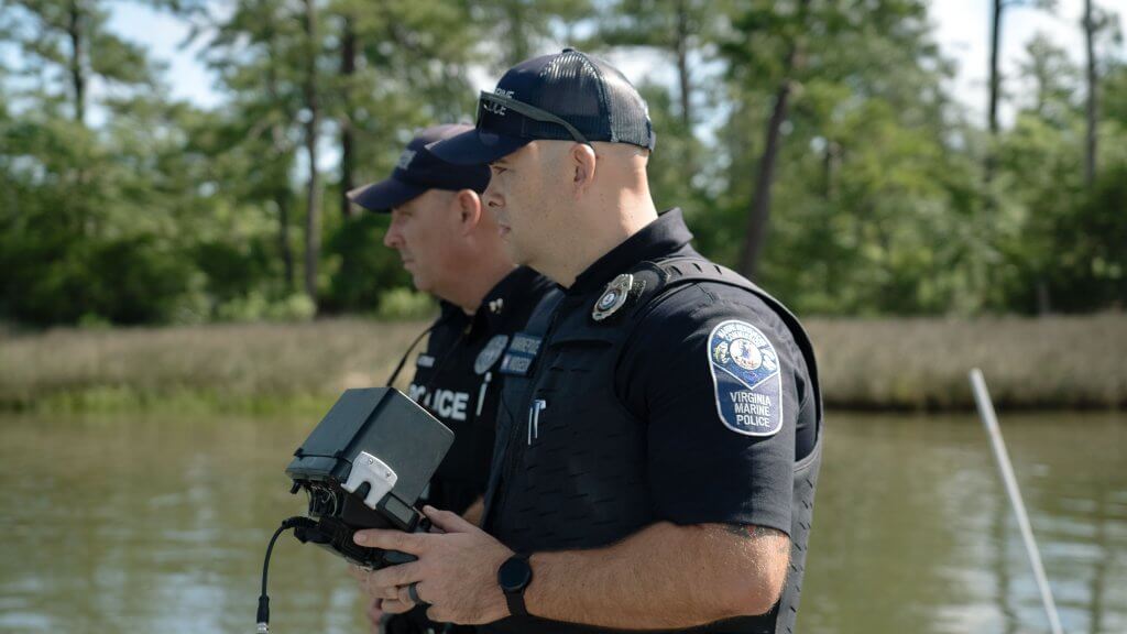
The management of offshore assets and infrastructure is inherently complex, hazardous, and costly. Consequently, the use of underwater ROVs is becoming the industry standard, as their advantages over traditional inspection methods are increasingly acknowledged. ROVs eliminate the need for scaffolding, sky-lifts, cherry pickers, and expensive helicopter aerial views. Moreover, ROVs minimize the need for inspectors to dive in hazardous conditions or perform rope-access work in dangerous heights or confined spaces, such as inside ballast tanks.

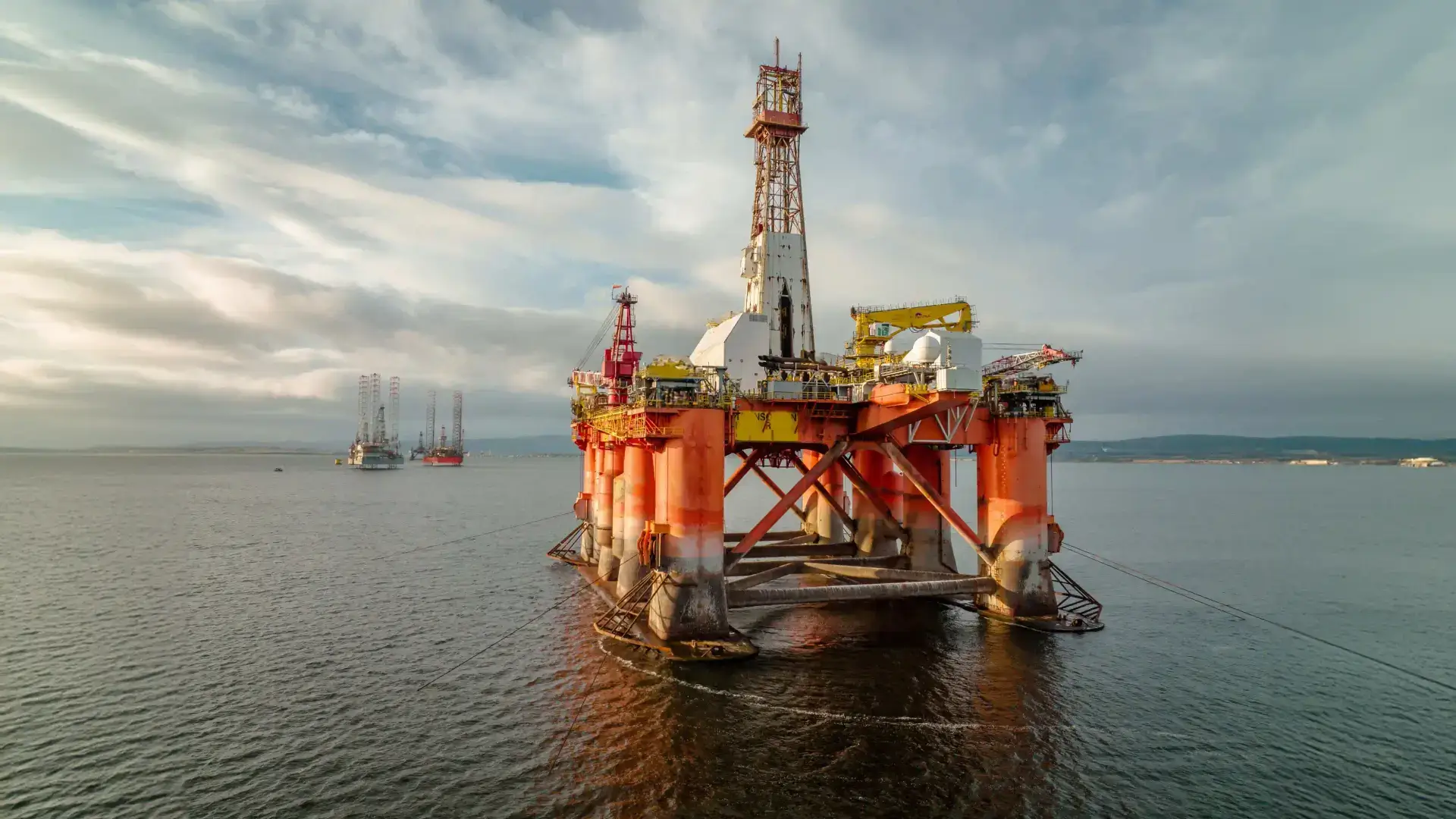
Platform and Rig Inspections

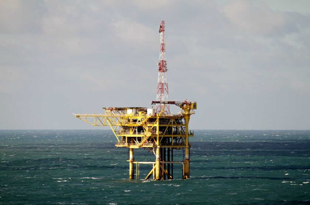
Oil platforms are complex structures engineered to withstand extreme temperatures and pressures. These systems require routine inspections and maintenance to ensure structural integrity, efficiency, and safety. ROVs play a crucial role in these inspections, enabling the detection of rust, corrosion, and other potential hazards that could otherwise lead to severe incidents.

Underwater ROVs can be deployed to inspect various assets of offshore platforms, including:

  • Platform legs
  • Mooring systems
  • Risers
  • Cooling and ballast tanks
  • Flare stacks
  • Gas emissions in confined spaces
  • Wellheads


By utilizing ROVs, operators can efficiently monitor for leaks, mitigate negative environmental impacts, and respond quickly to emergencies when they arise.

Pipeline Inspections

Offshore pipelines, which extend over vast distances on the seabed, and risers connecting the seabed to surface platforms, are prone to corrosion and damage. Regular monitoring and inspection are essential for maintaining safe and efficient operations. Traditionally, this required hiring and scheduling divers, which was both expensive and time-consuming.

ROVs offer a streamlined alternative, significantly reducing inspection times and costs. A single operator can deploy an underwater ROV and complete an inspection within hours, compared to the weeks needed for divers. Additionally, using ROVs eliminates the risks associated with human divers, as working in marine environments presents numerous hazards.

FPSO Inspections

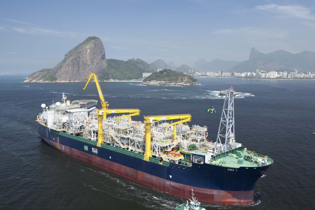
Floating Production Storage and Offloading (FPSO) units, which process and store oil and gas in deep water, require robust inspection routines to ensure their operational safety. ROVs offer a cost-effective and rapid alternative to traditional dry-docking and diver inspections.

ROVs can conduct comprehensive underwater hull inspections in Lieu of Dry-Docking (UWILD) inspections, monitoring for biofouling, cracks, structural defects, corrosion, and the condition of protective coatings. They can also inspect other FPSO components such as rudders, propellers, and confined spaces like sea chests and ballast tanks. By avoiding the need for divers in hazardous environments, ROVs significantly enhance safety and reduce the risk of accidents.

Site Exploration

Underwater ROVs also play a key role in oil and gas exploration by assessing the suitability of new drill sites, providing real-time data and reducing the need for extensive preparatory work. They can survey and sample the seafloor, providing vital data for determining the viability of potential drilling locations.

This data is invaluable for evaluating the geological and environmental conditions of a site, helping to determine its suitability for drilling, allowing for the precise mapping of underwater terrain, identification of potential hazards, and analysis of sediment composition. Collecting samples enables geologists to assess the presence of hydrocarbon reserves and evaluate the environmental impact of drilling. Thorough assessments are essential for strategic planning, as it ensures that drilling operations are conducted in viable and safe locations, minimizing the risk of costly failures and environmental damage.

Subsea Construction and Maintenance

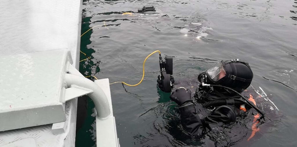
ROVs conduct essential pre-dive checks to verify site integrity before human divers enter, and monitor divers during operations to ensure safety. During the installation of underwater equipment, pipelines, and cables, ROVs assist with precise placement, ensuring correct positioning and secure attachment of components. They also provide real-time data and visuals of the work site, aiding in accurate project estimates.

In subsea maintenance, underwater ROVs offer notable advantages. They can stabilize equipment during repairs or installations and navigate confined spaces that might be challenging or unsafe for divers. Additionally, ROVs can perform temporary fixes, such as patching or stabilizing components, until permanent repairs can be scheduled. This capability not only facilitates ongoing maintenance but also reduces downtime and disruptions, ensuring that systems remain functional and safe throughout their lifecycle.

Wind Energy

Offshore wind farms are expected to increase their contribution to generation from less than 0.1% today to 15% by 2050, according to the 2023 World Energy Outlook Report, necessitating efficient and cost-effective inspection methods to maintain these platforms. Wind turbine blades, which exceed 200 feet in length, present inspection challenges due to their size and the restricted access allowed for inspectors.

ROVs offer a solution to these challenges by providing comprehensive imaging of the entire turbine structure. They facilitate regular, thorough inspections, revealing internal corrosion, cracks, and other potential issues. This capability supports the development of efficient maintenance schedules and ensures a safer working environment by minimizing the need for human inspectors to access hazardous or hard-to-reach areas.

Maritime Archaeology

ROVs can be used to locate submerged historical sites with precision, capturing detailed images and video of artifacts that are often inaccessible due to depth or conditions. By providing a close-up view of shipwrecks and other submerged relics, ROVs help archaeologists assess their condition and develop strategies for preservation.

Additionally, ROVs are capable of creating detailed 3D models of archaeological sites through photogrammetry. By capturing high-resolution images from multiple angles, ROVs produce comprehensive digital representations of sites. These models allow for in-depth examination of structural details and provide permanent records for monitoring changes over time, supporting preservation efforts and enhancing research into cultural resources.
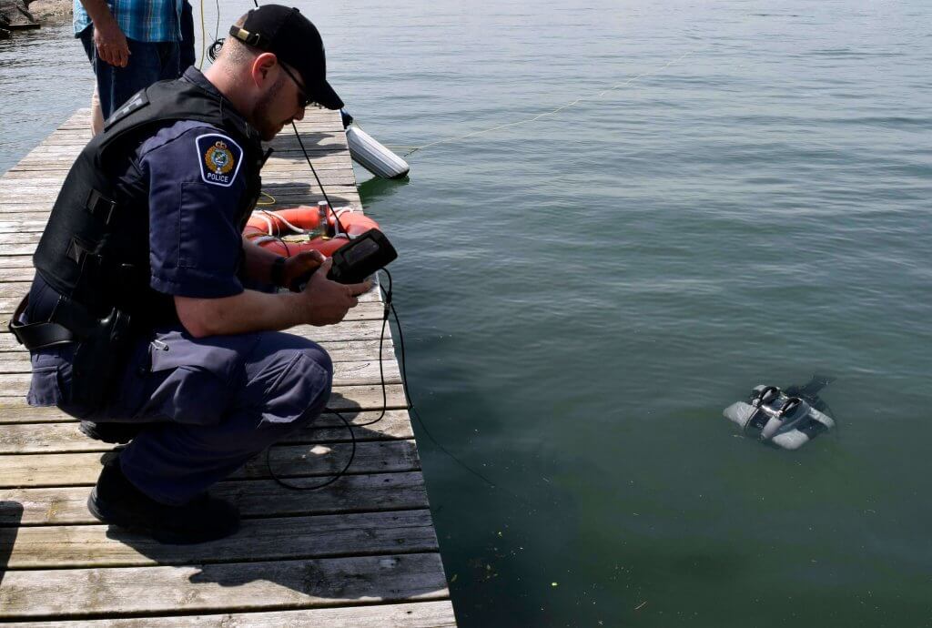
Search and Recovery

ROVs can provide valuable assistance in locating and, when possible, recovering missing people and objects such as boats, planes, and submarines. Equipped with high-resolution cameras and advanced sensors, ROVs can navigate challenging underwater environments, making them essential for conducting searches in conditions where traditional methods may be limited or impractical.

ROVs also gather critical evidence and data during these operations, aiding in investigations by providing real-time visual documentation and detailed information about the scene. This capability not only improves the accuracy of recovery efforts but also supports first responder teams by reducing their exposure to dangerous conditions. The use of underwater ROVs enhances the efficiency, safety, and effectiveness of search and recovery operations.

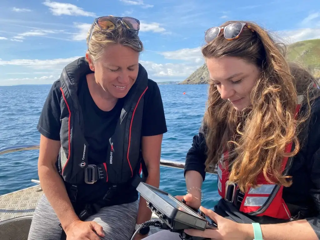
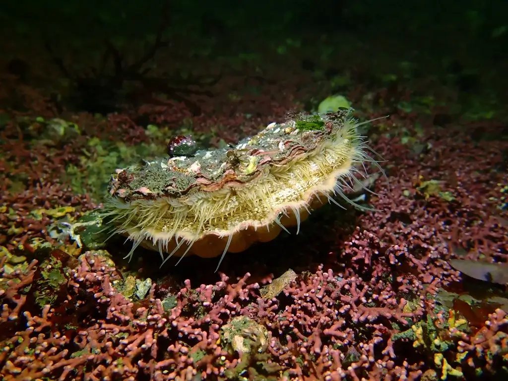
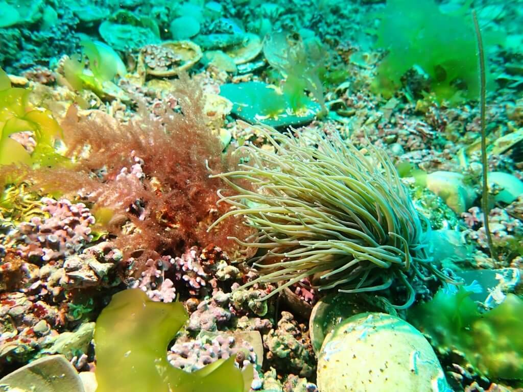
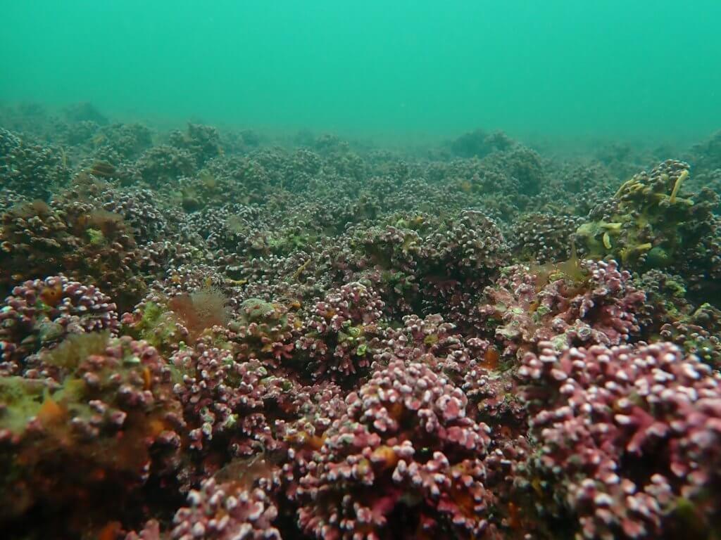
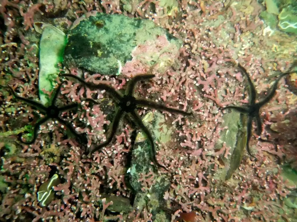
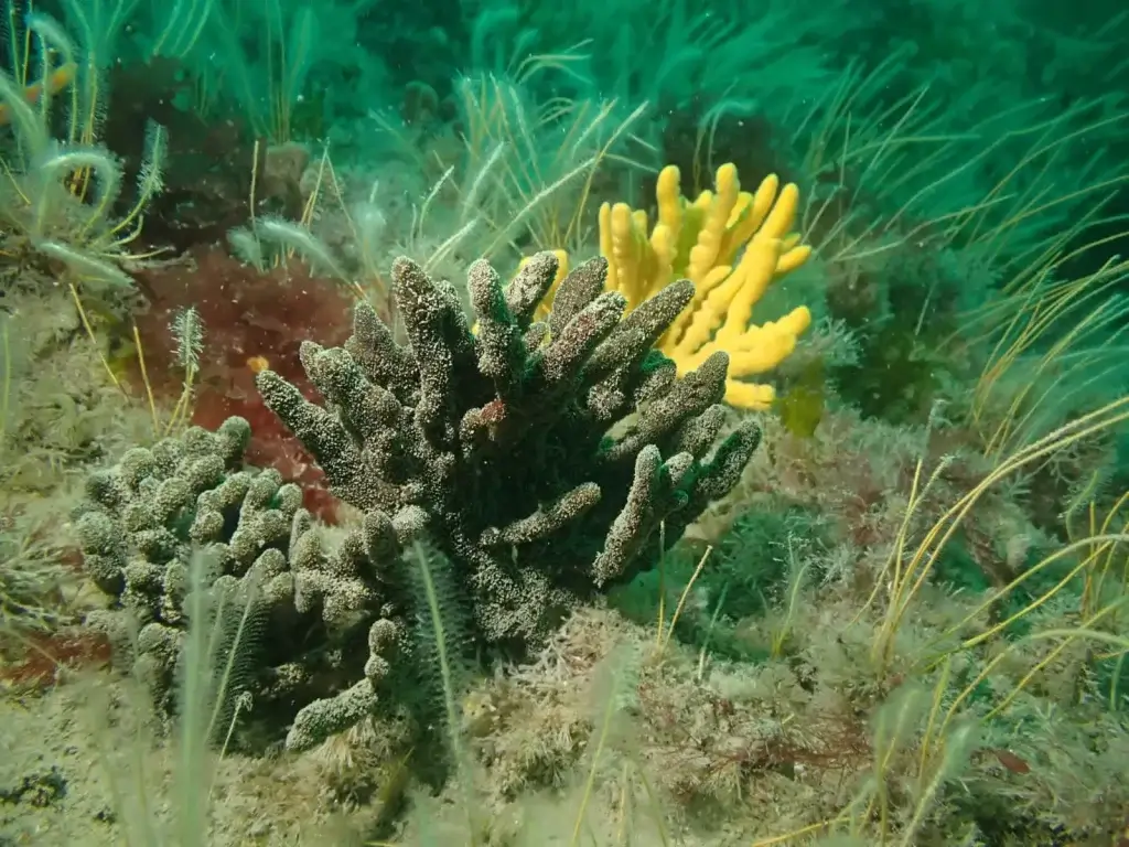
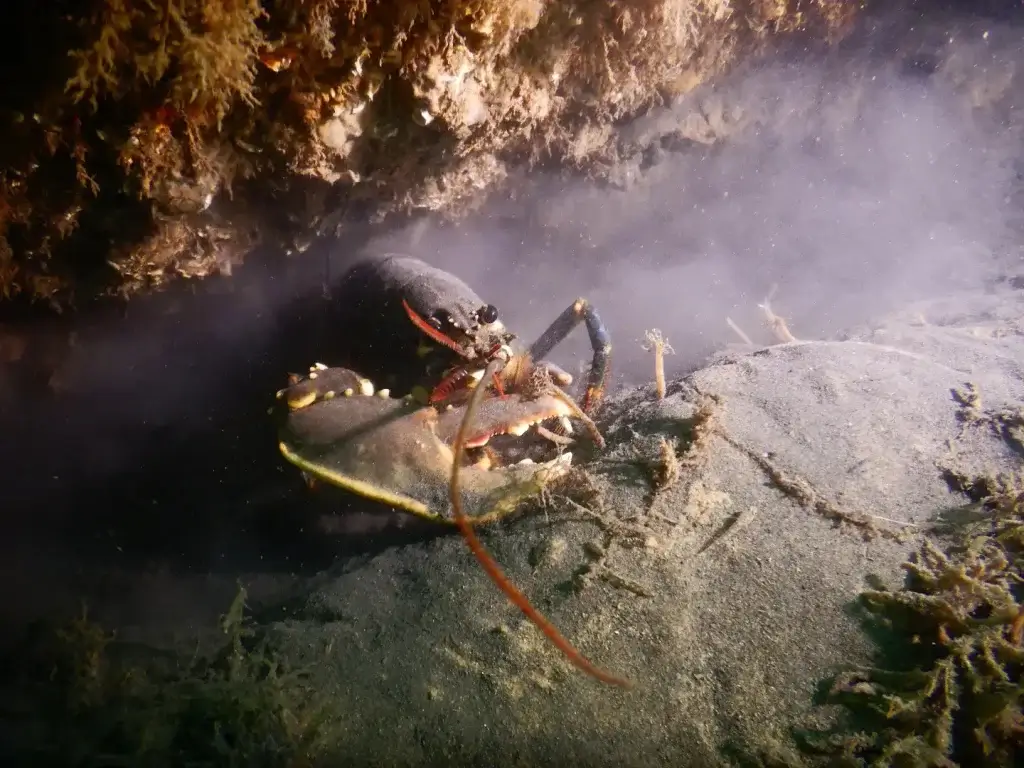
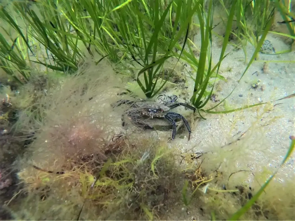
Environmental Monitoring

Environmental monitoring is essential for offshore operations due to the potential impact that energy production can have on marine ecosystems. Accidents or faulty equipment can cause severe damage to the environment, making it critical to conduct regular and thorough inspections.

ROVs are ideal for performing detailed inspections of offshore infrastructure, allowing operators to identify potential issues such as leaks, cracks, corrosion, or spills before they become major problems. By utilizing ROVs, operators can detect and address these issues proactively, mitigating the risk of catastrophic damage. This proactive approach supports the integrity of offshore structures and reduces the likelihood of incidents that could have far-reaching environmental consequences.

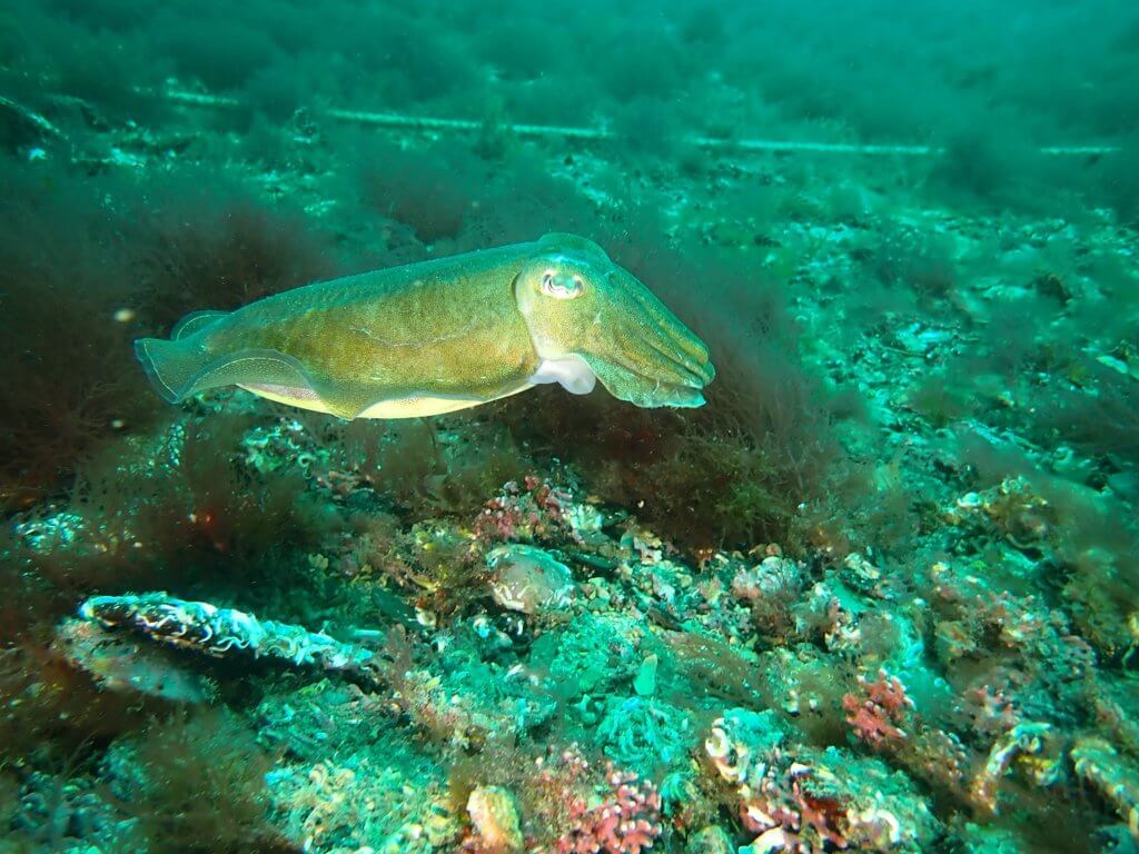
Underwater ROVs also contribute to monitoring environmental impacts by evaluating species and habitats, conducting water and sediment sampling, analyzing water quality, and performing seafloor surveys. Additionally, ROVs aid in the recovery of ghost fishing gear – lost or discarded equipment that poses a threat to underwater ecosystems. They also assist in assessing the impacts of commercial shipping, such as the spread of invasive species, by inspecting hulls and other structures to prevent further ecological disruption.

Benefits of Using ROVs for Offshore Applications

The use of underwater ROVs in offshore inspections is a game changer. Traditional methods are known to be quite complex, difficult, expensive, and dangerous. Advancements in technology and robotics have changed that, streamlining the process and making it much more efficient, safe, and affordable.

Here are just a few of the benefits that ROVs bring to offshore energy inspections:

  • Cost – Reduce the need to hire commercial divers, buy or rent special equipment, schedule helicopters.
  • Safety – ROVs handle hazardous tasks, collaborating with divers to reduce their exposure to dangerous conditions and improve overall safety.
  • Efficiency – ROVs can examine offshore facilities much quicker than divers can, and can be deployed at any time, without the need to schedule inspectors or shut down systems.
  • Easier Data Recording Capabilities – With cameras and data recording software, operators are able to compile inspection reports that illustrate an accurate history of asset status monitoring, which allows for more economical forecasting of routine repairs.
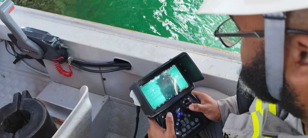
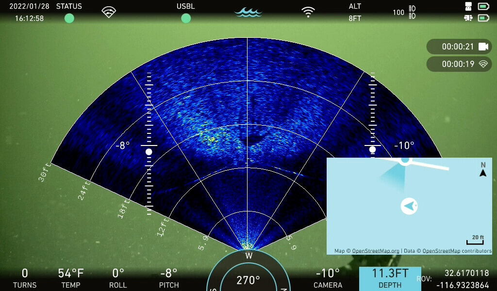
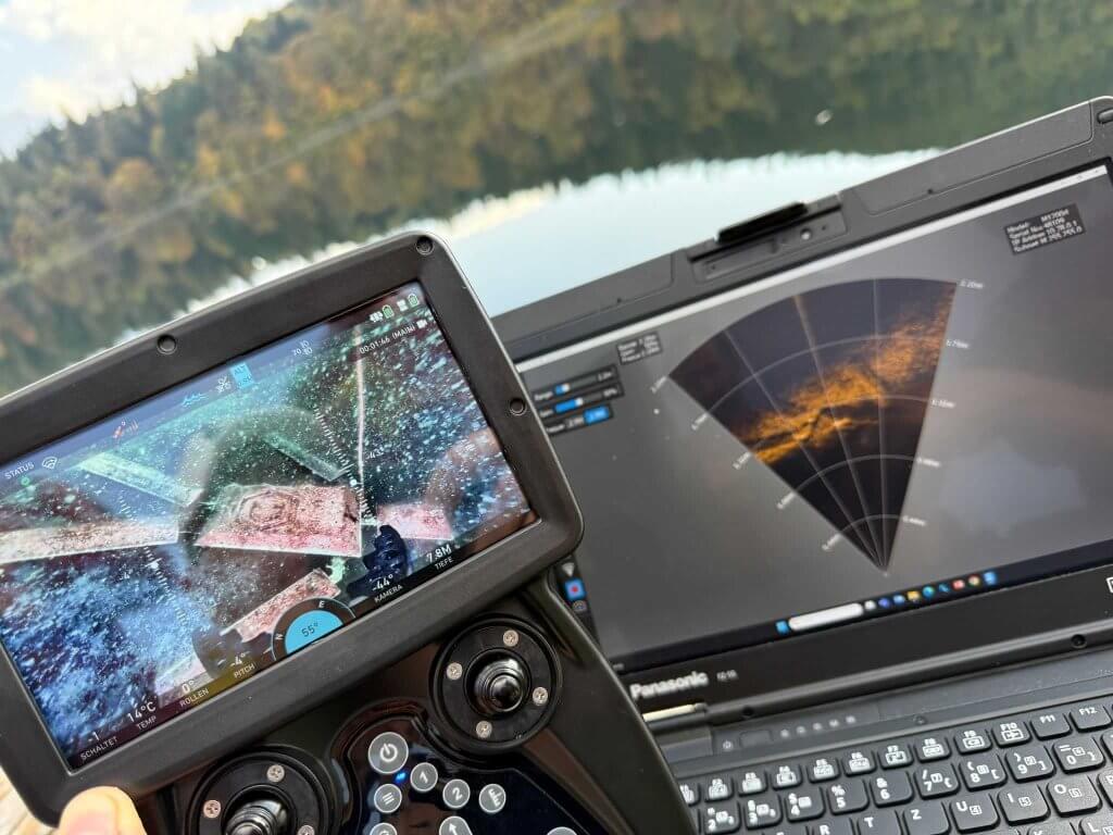
  • High-Quality Imaging – ROVs feature enhanced 4K cameras (with color correction, auto white balance, turbidity filter, dewarping, and digital zoom), sonar, and location mapping for low-visibility conditions.
  • Modular Add-ons – Easily incorporate tools such as manipulators and NDT sensors, such as UT thickness gauges and CP probes for comprehensive data collection.

How is the Offshore Industry Evolving with ROVs?

The adoption of underwater ROVs in the offshore sector has surged dramatically. Since the 1980s, the use of ROVs has grown from around 500 units globally, being used primarily for industrial and military operations, to tens of thousands worldwide, reflecting their growing importance in offshore operations and maintenance. Companies across the industry are increasingly integrating ROVs into their operations, highlighting a shift towards more advanced, automated technologies.

This change is also reshaping the job landscape within the offshore industry. New career opportunities are emerging, such as ROV pilots, ROV supervisors, and Oceaneering. These roles involve operating and overseeing ROVs during offshore inspections and operations.


For instance:

Underwater ROV Pilots operate ROVs to perform inspections and gather data. They often work for companies like Oceaneering, a leader in ROV operations. To become an ROV pilot, one typically needs specialized training and certification. The salary range for ROV pilots varies, but it generally falls between $60,000 and $90,000 USD annually, with potential for growth as the industry expands.

ROV Supervisors manage underwater ROV operations, ensuring equipment is used effectively and safely. This role requires extensive experience and knowledge of ROV systems. Supervisors earn an average salary between $80,000 and $120,000 USD per year.

Oceaneering, a prominent player in the underwater ROV industry, offers a range of roles from pilot positions to supervisory roles, setting a benchmark for others in the field. As ROV technology continues to advance, the demand for skilled professionals in this sector is expected to rise, offering promising career prospects for those interested in offshore operations.

The expected growth for careers in underwater ROV operations is promising due to the increasing reliance on ROV technology in various offshore activities, including oil and gas exploration, renewable energy projects, and underwater infrastructure inspections. The demand for skilled ROV pilots and supervisors is anticipated to rise steadily over the next decade.

The Bureau of Labor Statistics (BLS) projects that employment in fields related to underwater ROV operations, such as commercial diving and underwater welding, will grow faster than the average for all occupations. Specifically, the offshore oil and gas industry, along with the renewable energy sector, is expected to drive this growth.

This positive job outlook reflects the industry’s shift towards more automated and remote technologies, enhancing safety and efficiency in offshore operations. As companies continue to adopt ROVs, the need for qualified professionals to operate and manage these systems will continue to increase.

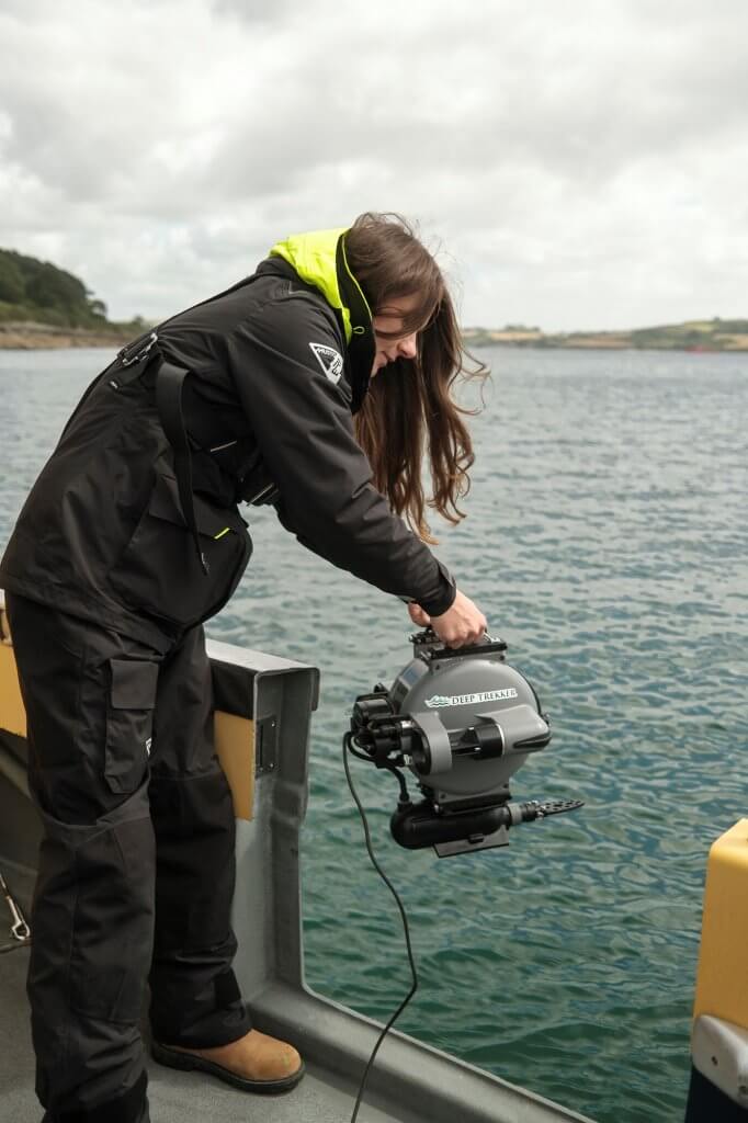
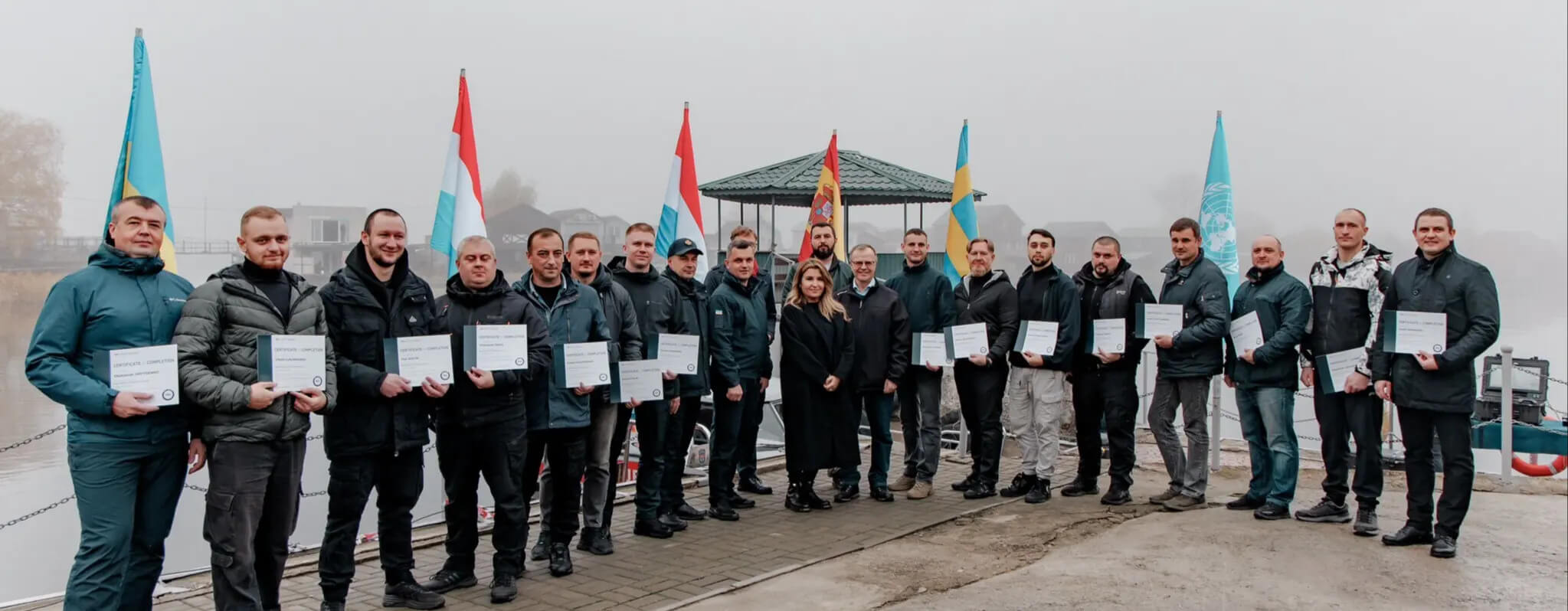
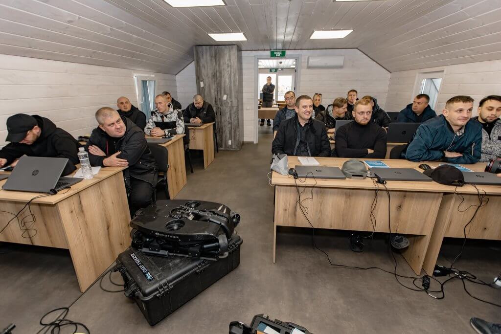
Case Studies: Underwater ROVs in Offshore Applications

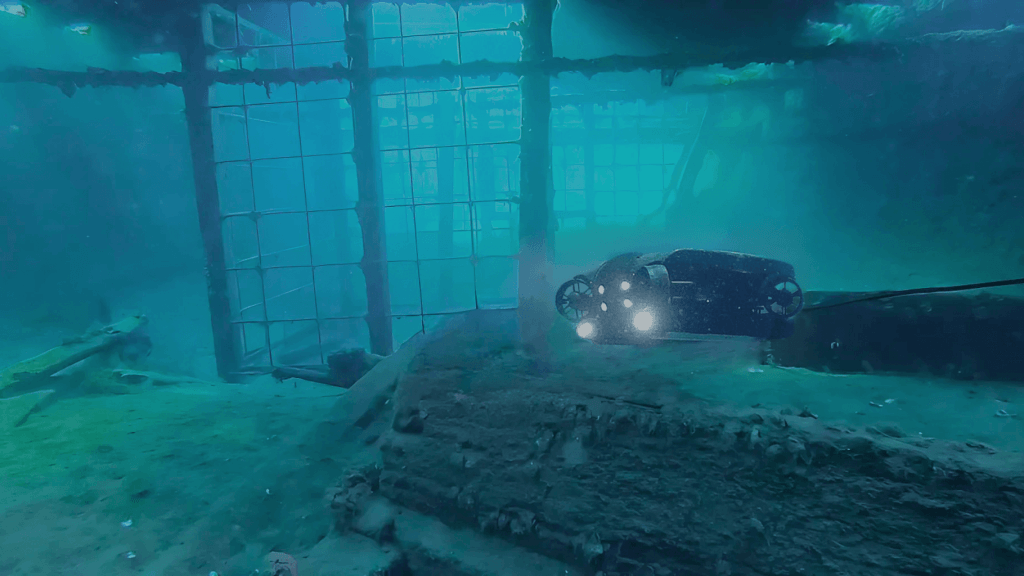
Miko Marine AS: Using an Underwater ROV to Inspect Sea Chest Covers

Miko Marine AS, headquartered in Oslo, Norway, showcased their use of Deep Trekker ROVs in a significant marine salvage project. They designed and implemented cofferdam and sea chest covers using magnetic adhesion technology. This project aimed to improve seal integrity and water defense for an offshore drilling company. The system featured four Miko MAM permanent magnets, each with a holding capacity of up to 450 kg, providing a secure and immediate watertight seal without additional fastening mechanisms.

The covers were deployed off the coast of Haugesund, Norway, at a depth of 16 meters. An inspection ROV was utilized to assess the effectiveness of the covers externally, while an internal camera verified the absence of leakage.

Miko Marine also explained that, “When the job is finished, each magnet is simply freed by having its release lever lifted by a diver or ROV, so the cofferdam can then be retrieved.”

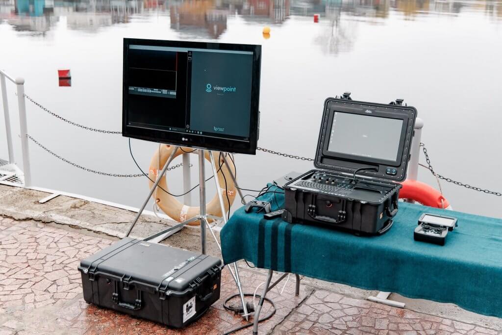
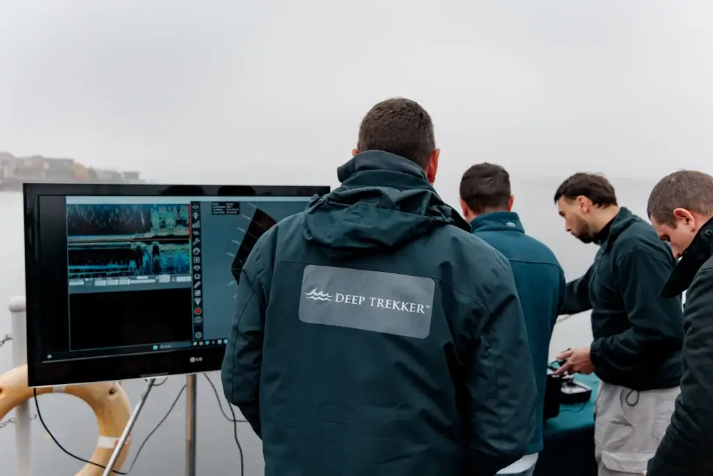
Orange Force Marine: Underwater ROV Photogrammetry of Offshore Wellhead

Orange Force Marine Ltd. utilized a Deep Trekker ROV to generate a 3D photogrammetry model of a submerged wellhead for one of their clients. Known for its innovative marine solutions, OFM chose the Deep Trekker ROV for its reliability and precision in underwater inspections.

The process began with the deployment of the underwater ROV to the wellhead site, where it captured a series of high-resolution images from various angles. These images were then processed using photogrammetry software to develop an accurate and detailed 3D model of the wellhead. Derek Niles, President at Orange Force Marine Ltd., remarked, “The clarity and stability of the ROV’s footage were crucial in capturing the necessary data for an accurate model.”

The resulting 3D model provided Orange Force Marine and their client with a comprehensive view of the wellhead’s condition, enabling detailed inspections and analysis without the need for divers. This model supported better decision-making and maintenance planning, saving both time and resources. Derek highlighted the benefits, stating, “The precision of the Deep Trekker ROV allowed us to generate a model that exceeded our expectations, providing invaluable insights into the wellhead’s structural integrity.”

The Deep Trekker ROVs performance and ease of use were particularly appreciated by the team at Orange Force Marine. “The ROVs intuitive controls and rugged design made it an indispensable tool for our operation,” Derek added. The success of this project demonstrates the value of integrating advanced underwater ROV technology into marine inspection workflows.

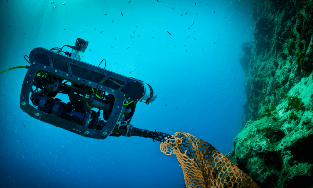
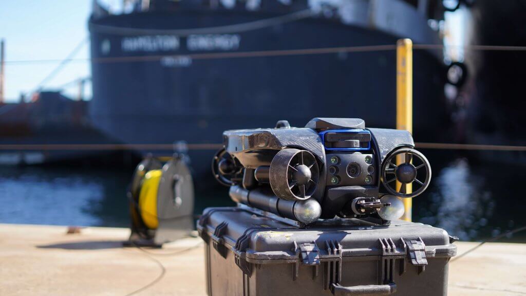
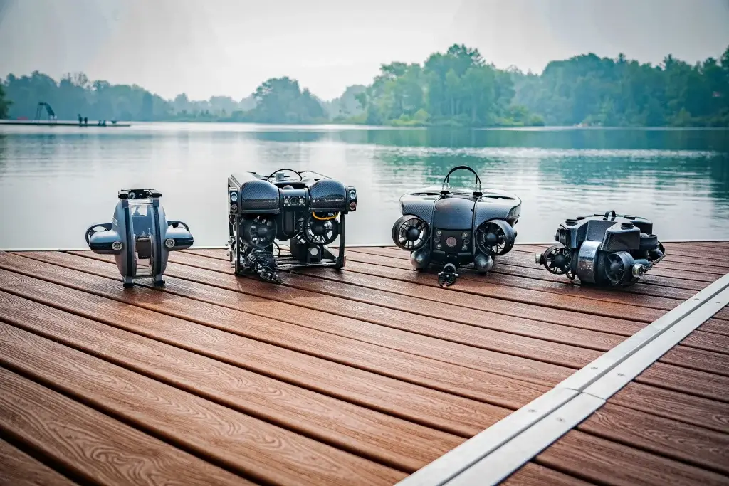
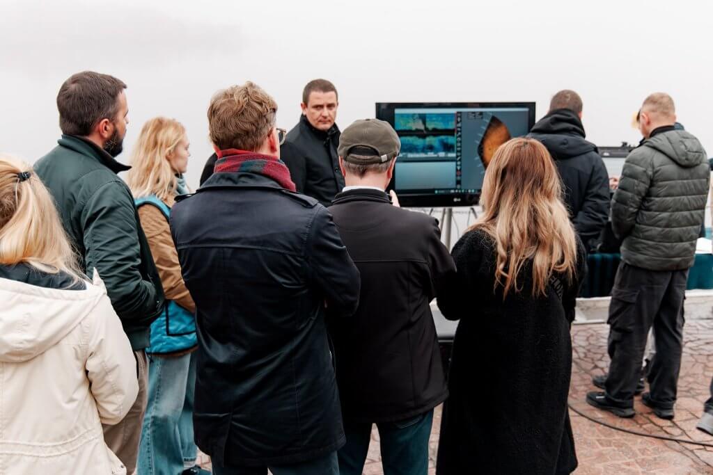
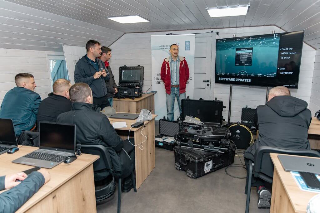
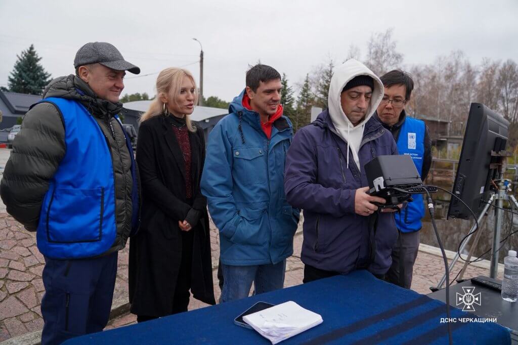
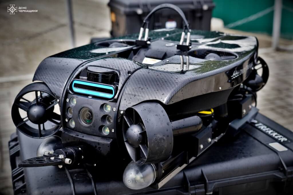
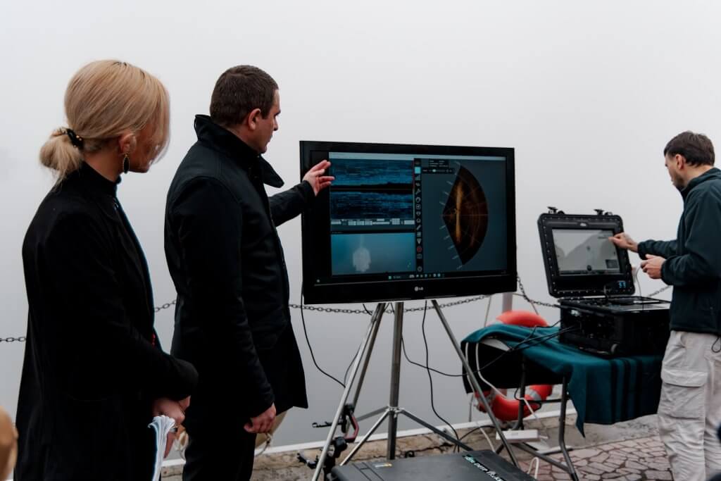
Deep Trekker ROVs for Offshore Applications

Deep Trekker ROVs are designed to withstand the toughest conditions, featuring maneuverability, quick deployment, and ease of use, making them ideal tools for offshore applications.

The PHOTON is a lightweight mini observation class ROV, perfect for confined and hard-to-reach spaces, enhancing inspection safety and efficiency. This quickly deployable underwater ROV can reach depths of 120 meters and is equipped with an ultra-high-definition camera with a rotating head, bright LED floodlights, and tether options up to 300 meters.

For operations requiring more payload capacity, greater depths, and modular options such as sonar imaging, the PIVOT and REVOLUTION models provide a robust suite of features.

With six vectored thrusters, these ROVs ensure peak stability and maneuverability. They are equipped with intelligent sensors, a 200-degree rotating ultra HD 4K camera head, BRIDGE integration, and modular tool add-ons, making them suitable for a wide range of tasks in challenging environments.

Investing in a single underwater ROV can significantly reduce operating costs, potentially saving hundreds of thousands of dollars. These ROVs deliver accurate and thorough data of assets consistently, improving efficiency and safety in offshore operations by providing higher quality data and minimizing the need for human divers to enter hazardous spaces. This approach ensures the health of critical infrastructure and creates a safer environment for offshore workers. It’s a win-win for everyone, ultimately.


Murky Water Search & Rescue Using an Underwater Drone

What is Murky Water Search?

Murky water search and recovery refers to locating and retrieving objects, evidence, or individuals in bodies of water that have low visibility or turbid conditions. The term “murky water” refers to water that is cloudy, muddy, or otherwise obstructed, making it difficult to see clearly underwater.

Murky water is inherently dangerous to navigate through. Below the surface, visibility can range from a few feet to mere inches away, and in some cases, the water is so dark, or dense with particulates, you would not be able to see your hand, even millimeters from your face.

In conditions where visibility is dangerously low, murky water search & rescue operations are extremely difficult to perform. As it is impossible to ascertain the parameters of the dive area, safety becomes a greater concern for divers facing unknown and potentially threatening conditions.

Murky water searches are typically conducted by specially trained divers that use a range of equipment, including:

  • Underwater lights
  • Underwater communication systems
  • Underwater search cameras
  • Sonar devices
  • Remotely operated vehicles (ROVs)
  • Specialized diving gear designed for low visibility conditions


These types of missions are typically conducted by professional search and recovery teams, such as police, fire, first responders, or organizations specializing in underwater recoveries. The primary objective of these operations is to locate and recover missing persons, evidence or objects related to investigations such as weapons or contraband, or other incidents that occurred in bodies of water with poor visibility.

Challenges When Performing Murky Water Search and Rescue

Search and rescue, and search and recovery missions can be incredibly complex and difficult, especially when working in murky water conditions. Teams face a range of challenges, including, but not limited to:

  • Low visibility
  • Time Constraints
  • Depth restrictions
  • Environmental factors


Low Visibility

Low visibility environments can be extremely dangerous to navigate within, often making it impossible to ascertain parameters for the dive and leaving divers to rely on touch to locate the target. This creates a high risk for the divers since they are not able to avoid unknown objects that could entangle them and trap them underwater, or cause injury.

“One of our biggest problems is that, if a person is missing underwater, our divers go in and search but sometimes the areas they go into are too dangerous and we can’t commit divers in dangerous areas,” said LMSRS (Limerick Marine Search and Rescue Service) treasurer Mal Sherlock.


Time Constraints

Divers also have a limited amount of time they are able to remain underwater, as well as a limited depth they are able to search in. Working in murky water requires meticulous and systematic search techniques, which means inspections must be conducted slowly and methodically, searching small areas at a time.

The limited bottom time also results in low search accuracy, puts added stress on the divers, and is physically demanding, making these missions even more emotionally and mentally taxing.

Depth Restrictions and Environmental Factors

This process is repeated until the mission is complete, since divers have a limited depth they can reach and limited amount of time they can spend below the water before it becomes even more dangerous for them.

Depending on the water temperature and other external, or environmental factors such as weather, divers can be extremely limited in their time under the water. If they are under for longer periods of time, the divers are at risk of serious health concerns such as hypothermia or decompression sickness. With the lack of clear visual reference points, they are also not able to establish direction and distances to objects of interest, which increases the risk of disorientation and becoming lost in the search area.

Ensuring the safety of the divers is paramount in search and recovery missions, which is why it’s so important to find alternative methods that are safer and more efficient for everyone. The use of ROVs to aid the divers is currently the best proven option available for these operations.

Technological Advancements in Murky Water Search and Recovery

Technological advancements have made search and recovery missions much safer and more effective than ever before. Though the human eye cannot see through murky water, technology is providing individuals the ability to navigate and identify targets in low to zero visibility environments.


Sonars

The utilization of this technology has proven to be of immediate benefit to search and recovery teams. In outfitting themselves with navigational sonar systems, for example, first responders and volunteer search and rescue organizations have begun to see the benefit of this cutting edge technology. Sonar has granted greater success rates in finding lost or discarded targets, and the execution of safe and effective recovery missions.

Mr. Sherlock of LMSRS explains how their Deep Trekker ROV, equipped with sonar, is the ideal solution in low visibility environments. “What the unit does is actually phenomenal, and because we deal mostly in zero visibility, the sonar facility on the drone is able to cast a shadow across the seabed and we can decipher on what we are looking at by breaking down elements of the shadow.”

Side scan sonar systems, for instance, are generally towed behind boats to conduct a sweep of a large body of water, or attached to the hull. The entire area would be divided into a search grid. The side scan would then be dragged throughout the entire grid and each area would be checked twice to ensure that the location has been completely explored.

Once the side scan has completed its sweep of the area, search and recovery teams are able to mark areas of interest where their target may be located. Traditionally, divers are deployed at this point and must navigate through the murky water and hope to come across their object of interest. With zero visibility, these divers must rely on touch to move around and to locate their target, which is a very slow and arduous process.

“When we are diving we may miss something alongside us that might be only three feet away, whereas this drone is breaking down that barrier of misses,” Mr Sherlock explained.

Remotely Operated Vehicles

This is why Remotely Operated Vehicles (ROVs) are becoming more widely used in search and recovery missions. Not to replace divers – but to work in tandem. Similar to traditional methods, after the side scan has completed its sweep and areas of interest have been identified, the ROV can be quickly deployed to find and identify the target.

In a murky water search, the standard camera on the underwater drone will work similar to a human eye; it will struggle with visibility. This is where the multibeam imaging sonar systems come into play. From the surface, the ROV pilot navigates through the low visibility water solely using the sonar’s heads up display (HUD), similar to how a pilot would rely on their plane’s instruments when they fly through a fog.

Pilots can also track the location of the ROV in real time using USBL positioning systems, and maneuver with precision in difficult areas using DVL stabilization and station holding. Deep Trekker ROVs also include an intuitive mission planner that allows operators to input waypoints to plan and map out a mission route, or to create a path for the ROV to follow autonomously, enabling operators to put their focus solely on the sonar scan and search.

Once the underwater drone successfully identifies the target, divers are able to follow the ROV’s tether directly to the target and prepare it for retrieval. If the location is a crime scene, the ROV can record and document the area to assist in the investigation. Most importantly, the diver’s safety can be closely monitored from the surface while the retrieval is being conducted.

Leveraging technology and tools such as sonar and ROVs is the best way to avoid unforeseen dangers and guarantee a safe and effective execution of recovery strategy that keeps divers safe and improves the efficiency and success rates of finding targets on these difficult missions.

Deep Trekker ROVs for Murky Water Search

The Deep Trekker DTG3, PIVOT, and REVOLUTION ROVs are designed to be a truly portable solution. This is made possible by the internal rechargeable batteries, allowing the entire DTG3 package to fit into one carrying case, and the Pivot and Revolution in just two carrying cases.

The DTG3 is battery-operated and portable which provides search teams the ability to work beyond what a normal diver would be able to do. A 90-minute recharge is all it needs to be back and ready for another day’s work. This drastically increases possible search times far beyond what would be capable using divers and traditional methods, since divers only have a finite amount of time they can spend underwater.

Portability of ROVs is extremely important during a search and recovery mission. With bodies of water being located in some of the most remote areas on the planet, air transportation or on foot travel may be the only access. Since the Deep Trekker DTG3 is housed in a single Pelican carrying case, it can be transported and deployed easily in isolated areas.

Versatility and Customization of Deep Trekker ROVs

Deep Trekker underwater drones are capable of being equipped with a grabber arm to pick up a submerged target and retrieve it to the surface, or they can attach a carabiner and rope with the grabber arm if the target is not able to be picked up directly.

Having the right tools for the job is crucial, and Deep Trekker ROVs are designed for versatility with modular integrations and customization options to meet your specific mission requirements. Deep Trekker’s BRIDGE Software enables fully integrated solutions for add-ons such as imaging sonars, positioning systems, and more all in one place.

ROVs combined with imaging sonar systems are some of the most beneficial tools for search and recovery missions in murky waters, allowing for visualization of environments that would not be possible without using this technology. With the revolving head of the Deep Trekker REVOLUTION ROV, pilots can even adjust the pitch of the sonar, making scanning areas even easier and more thorough.

Cost and Time Efficiency of Deep Trekker ROVs

Large submersibles and rescue tools can be extremely expensive and can require a lot of set up time. Many of these expenses can be replaced with a single ROV purchase, and maintenance costs of Deep Trekker robots have proven to be very low to non-existent, even after years of use.

This allows teams to allocate their budget in more productive ways, as well as allowing them to utilize their time more efficiently, freeing up more time to conduct the actual searches as quickly as possible.

Also, with extended depth capabilities, Deep Trekker ROVs can search larger areas faster than what is possible using dive teams. This allows search and recovery teams to complete missions much faster and more thoroughly, and with higher success rates than conducting searches with traditional methods.

The proven cost-effectiveness and time-saving benefits of using Deep Trekker ROVs compared to traditional methods makes them the perfect complement to first responder teams working in murky water.

Benefits of Deep Trekker ROVs

Deep Trekker ROVs are engineered to be tough enough to survive harsh underwater conditions and deliver dramatic power, enhanced capabilities, and performance. Modular integrations such as multibeam imaging sonar, USBL positioning systems, and DVL stabilization and station holding take those capabilities even further, making them must have tools for search and recovery missions.

If you need help finding the right technology for your missions, reach out to our robotics experts to find the right option for your applications and budget. We are happy to help.

Advancing Marine Research with ROVs: Natural England’s Habitat Mapping

Natural England, the UK Government’s environmental advisory body, adopted remotely operated vehicle (ROV) technology to support habitat monitoring projects across the English coastline. This case study highlights how the organization leveraged a Deep Trekker ROV to improve marine protected area (MPA) assessments, reduce survey costs, and expand environmental research capabilities.


Maerl dive survey team. Credit © Natural England/Mike Anselmi

Using ROVs in Environmental Surveys and Habitat Mapping

Meg Hayward Smith, Marine Higher Officer for the Devon, Cornwall, and Isle of Scilly area team at Natural England, shared how the team first introduced the Deep Trekker ROV into their marine monitoring work, primarily to support exploratory surveys and ground truth existing habitat records. It was their first experience using an ROV, and while they were initially unfamiliar with its full range of capabilities, they quickly recognised the substantial benefits the technology provided. As the team gained hands-on experience, they saw the significant value it added to their monitoring efforts. Looking ahead, they hope to expand its use for more detailed habitat mapping.


Meg Hayward Smith deploying the DTG3 ROV. Credit © Natural England/Mike Anselmi

Meg explained that this was the team’s first experience using an ROV. “We weren’t familiar with other systems, so in those early surveys, we focused on using it to support environmental monitoring – checking habitats, carrying out pre-dive assessments, and ground truthing locations before deploying divers.”

This functionality proved particularly valuable, allowing the team to assess underwater conditions efficiently and validate habitat records before committing diver time. With each deployment, the team became more confident in operating the ROV and more aware of its capabilities.

“After conducting several surveys back-to-back and learning how best to integrate the ROV, we realised it had much greater potential across our work,” Meg said. This prompted a shift in thinking – moving beyond initial applications toward exploring how the ROV could be more strategically embedded in their survey processes.

In particular, they started thinking about incorporating more advanced techniques, such as using the ROV for transects and deploying it to specific locations for more targeted data collection.

The team is now considering future applications such as conducting structured transects and targeted deployments to collect more consistent and high-resolution data. “We’re at the point where we see it as a valuable tool,” Meg explained. “Now the question is: how can we get the most benefit from it and apply it more widely across different surveys?”

Operational efficiency is also an important consideration. So far, both Natural England’s in-house dive team and regional area teams have utilised the ROV to support marine monitoring work. While the current model has proven effective for exploratory work and ground truthing, a more advanced system in the future could support detailed habitat mapping and provide stronger evidence to inform conservation decisions. This would help ensure that future surveys are carried out as effectively and efficiently as possible. The ROV already offers a cost-effective means of optimising survey time and resources, supporting more informed planning and decision-making across projects.

“The ROV provides valuable support to our surveys by enhancing our in-house capabilities, complementing the work of external contractors. As the first ROV in our organisation, it has already proven to be a useful tool in improving our monitoring efforts.”

To enhance flexibility and cost-efficiency in marine surveys, the ROV offers valuable support for exploratory work and effectively complements established survey programs.

“While we currently work within certain constraints, the ROV supports exploratory work by enabling us to survey potential new sites more flexibly and at a lower cost,” Meg explained. “This helps make our surveys more efficient and effective, working alongside our existing survey methods to enhance overall monitoring capabilities.”

Why Use an Underwater ROV for Marine Habitat Surveys?

Natural England is responsible for advising the UK government on environmental protection. A core component of their work involves monitoring MPAs to assess habitat types, health, and density along England’s coasts.

“At Natural England, we advise the government on environmental issues across England. As part of this role, we carry out marine monitoring to assess the condition of Marine Protected Areas along the English coastline. This includes improving our understanding of habitat types, evaluating their health, and identifying the extent of key habitats.”

According to Meg, the team typically conducts habitat monitoring using a combination of side scan sonar and diver surveys. However, many coastal sites are difficult or costly to access with divers or large vessels. The addition of an ROV created a new way to conduct environmental assessments in challenging or unverified areas.

Reducing Risk and Costs of Diver Deployments

ROVs enabled Natural England to perform preliminary checks in uncertain locations where the presence of protected species or habitats – like maerl beds or seagrass – was unconfirmed.

“We pre-selected our sites based on previous records and data from Seasearch,” Meg explained. “In some cases, we weren’t entirely certain whether maerl was present. Records suggested it might be there, but confirmation was needed. Rather than deploying divers and using air resources – limiting their availability for the rest of the survey – we used the ROV to ground truth those records and verify the presence of maerl. This approach has already proven highly effective. It also allowed us to conduct exploratory surveys at potential new sites where we don’t yet have records. While we currently focus the ROV work on confirming known sites, we hope to expand its use for more detailed habitat mapping in the future.”


King Scallop Pecten maximus on Maerl. Credit © Natural England, Danielle Agnew

This approach provided several advantages:

  • Minimized air consumption by divers during verification stages
  • Reduced reliance on chartering survey boats
  • Eliminated the need to contract external services for initial site assessments

“We usually conduct two dives a day, but divers need to observe their surface intervals before diving again to ensure safety,” noted Meg. “During these intervals, we use the ROV to inspect other sites, which greatly improves our efficiency. It has worked really well for us.”

Improved Survey Efficiency and Habitat Mapping

The team used the ROV to conduct “ground-truthing” passes, capturing video and imagery of seagrass beds and maerl habitats. This data helped them decide where to focus diver efforts and confirmed habitat presence in real-time.

“Our dive sites are pre-selected based on our methodology and previous Seasearch records,” Meg noted. “Once on site, we gather around the ROV screen to assess the habitat in real time. If we identify maerl using the ROV, we proceed to send divers down to survey the site; if the site isn’t suitable, we move to the next point. We can quickly redeploy the ROV to a different location, and when we confirm a promising site, we send the divers down. This approach has been invaluable for ground truthing and has saved us significant time.”


Maerl bed with snakelocks anemone and diverse seaweeds-Credit © Natural England, Angela Gall

Enabling Stakeholder Engagement

The ROV also improved stakeholder understanding during site visits. Natural England could show real-time underwater footage of sensitive habitats, offering transparency and educational value without requiring others to dive.

“The marine environment is largely hidden from view, making it difficult to convey what lies beneath the surface. The ROV enables us to directly show stakeholders and partners the specific habitats we are monitoring, helping them gain a clearer understanding of these areas and the importance of protecting them. This has been invaluable for building awareness and support.”

How Difficult Was It to Learn ROV Operations?

Natural England had no prior experience operating ROVs. According to Meg, the team learned basic skills quickly:

  • Half-day familiarization session before deployment
  • Guidance from a drone pilot on angles and positioning
  • Trial runs before live projects

“This was our first time working with an ROV in the organisation, so there was a learning curve,” Meg explained. “With a short initial training session – about half a day – we were able to get comfortable with the system and begin integrating it into our survey work.

The technology proved intuitive and accessible, even with minimal formal training.

I also make time for additional learning and practice between surveys to maintain familiarity with its operation ahead of survey deployments. I had some prior experience with ROVs earlier in my career, though the model we use now is much more user-friendly and suited to our needs in the field.”

When asked which features of the ROV proved most beneficial, Meg highlighted the lights, high quality camera, and tether as key assets for their projects:

“The lighting was especially valuable – maerl has a distinctive bright pink colour when alive, but without proper illumination, it’s difficult to distinguish. The high-quality video and still imagery played a crucial role as well; we captured extensive footage that helped identify potential future dive sites and build a detailed visual record. This also allowed us to anticipate which species we might encounter before deploying divers. During deployments, we often observed cuttlefish, spider crabs, scallops, and other marine life. Additionally, the tether was an important feature, providing confidence and control by ensuring the ROV remained securely connected throughout the survey.”


Typical maerl bed in the Fal estuary-Credit © Natural England, Angela Gall

What Species and Habitats Were Monitored?

The primary focus areas included:

  • Seagrass beds: Vital habitats for fish nurseries and coastal protection
  • Maerl beds: Rare, slow-growing pink calcified seaweed resembling coral, critical for biodiversity

Natural England used the ROV to locate and map maerl patches previously identified only by rough records, creating a clearer picture of species distribution in Cornwall’s coastal waters.

For a more detailed examination of Natural England’s research on seagrass and maerl beds, refer to the following publications from BBC and the UK government.


Brittlestars on a Maerl bed in St Austell Bay, Cornwall-Credit © Natural England, Angela Gall

Natural England’s Use of the ROV for Marine Protected Area Monitoring

Supporting Marine Protected Area Assessments

Natural England is responsible for monitoring and assessing the condition of England’s Marine Protected Areas to ensure habitats remain in favorable condition. As part of their approach, the team uses the Deep Trekker ROV to support environmental surveys and habitat mapping.

Meg illustrates how the ROV provides flexibility for validating areas of interest identified during acoustic surveys.

“We see the ROV as a complementary tool that works alongside our existing methodology, enhancing and aiding our data collection and monitoring efforts. It helps bridge the gap between diver-based surveys and broad-scale vessel mapping, allowing us to validate specific areas and make more informed decisions about when diver deployment is necessary.”


Sponges, Bideford to Foreland Point MCZ. Credit © Natural England, Angela Gall

The ROV is regularly used for ground-truthing habitats and pre-dive checks, providing live video feedback and reducing risks in challenging conditions. Its compact size and portability allow deployment in remote locations where larger equipment is impractical.

Mackenzie Normandeau, Account Executive at Deep Trekker, explains how the ROV fits into common environmental workflows:

“We’ve had people use it after a side-scan sonar run to narrow down areas of interest or to inspect a target that they weren’t able to confirm from the sonar. I’ve also seen folks use it for object detection and light retrievals – marine debris, sensors, or ghost gear that needs to come out of the water.”

Habitat Types and MPAs Surveyed

Natural England’s Deep Trekker ROV supports the survey of diverse habitat types including:

Rocky Reefs and Sedimentary Habitats

The ROV is often used to survey rocky reef ecosystems, which are critical for supporting marine life such as fish, crustaceans, and invertebrates. Rocky reefs provide shelter and food sources for a variety of species, making them a focus of conservation efforts in many MPAs. The ROV can precisely navigate rocky outcrops, capturing detailed footage of reef structure, flora, and fauna.


European Lobster Homarus gammarus on the wreck of the SS Rosalie within the Cromer Shoal Chalk Beds MCZ-Credit © Natural England, Sophie Sparrow

Sedimentary habitats, including sandbanks and mudflats, are also surveyed using the ROV. These areas are important for benthic organisms (such as worms, mollusks, and other invertebrates) and serve as feeding grounds for many fish species. The ROVs maneuverability allows it to navigate through different types of sediment, capturing footage that helps assess the health of these habitats and identify any potential threats, such as sediment disturbance or pollution.

Seagrass Beds


Seagrass meadow in the Isles of Scilly-Credit © Natural England, Emily Priestly

Seagrass meadows are among the most productive and valuable ecosystems in coastal waters, providing numerous ecosystem services such as carbon sequestration, water filtration, and habitat for juvenile fish. They are, however, highly susceptible to degradation from human activities, such as anchoring, trawling, and coastal development. The ROV’s high-definition video footage provides Natural England with the means to monitor seagrass health, identify changes in coverage or structure, and assess threats to these vital ecosystems.

The ROV’s ability to collect real-time visual data allows the team to evaluate seagrass density, coverage, and species composition, providing insights into the broader health of the ecosystem. This data is critical for maintaining the integrity of MPAs and for ensuring that conservation actions are appropriately focused.

Expanding Monitoring Capabilities

“We often get asked to confirm where there are seagrass beds, and the ROV’s good for that because you can get low and see the structure properly.”

Seagrass meadows, recognized for their importance in carbon sequestration and as fish nurseries, are also monitored. The ROV allows the team to gather footage of these sensitive habitats while minimizing physical disturbance.


Velvet swimming crab (Necora puber) in seagrass beds, Bembridge MCZ, Isle of Wight. Credit: © Natural England/ Caitlin Napleton

Additionally, sedimentary environments such as mudflats and sandbanks are surveyed to assess changes due to natural processes or human activities. Footage from the ROV informs condition assessments required under national conservation objectives and contributes to England’s MPA monitoring program.

Future Applications

Natural England is now looking to expand its use of ROV technology to support more advanced and structured environmental monitoring strategies across England’s marine protected areas (MPAs). Building on the success of initial deployments for ground-truthing and exploratory work, the team is considering how underwater ROVs can be used to conduct standardized transects, improve data consistency, and strengthen long-term habitat assessments.

The use of Deep Trekker ROVs has already demonstrated significant potential to reduce the logistical and financial constraints associated with traditional marine surveys. By integrating ROVs into routine workflows, Natural England can increase survey frequency, improve spatial coverage, and minimize the need for chartering vessels or deploying divers to high-risk or remote areas. This is particularly relevant for hard-to-access parts of the UK coastline, where traditional survey methods are either cost-prohibitive or technically limited.

ROVs will play an increasingly central role in environmental monitoring initiatives over the next several years.

Key priorities include:

  • Expanded mapping and trend detection: ROVs will support higher-resolution seabed mapping and repeated surveys to detect environmental changes over time, particularly in sensitive habitats such as maerl beds.
  • Comprehensive marine condition assessments: Detailed visual and structural surveys using ROVs will be critical for conducting full condition assessments across designated Special Protection Areas (SPAs), enabling more targeted conservation actions.
  • Public outreach and stakeholder engagement: Video footage and data collected by ROVs will be used in outreach initiatives to build local awareness and ownership, especially in regions with high ecological and economic stakes like Cornwall’s south coast.
  • Support for scientific research: ROV-based sampling and observation will assist ongoing studies, including genetic research, by providing consistent, non-invasive access to underwater ecosystems.
  • New partnership and investment models: ROV data will inform sustainable management strategies, helping to identify areas under pressure and supporting investment in ecosystem resilience, especially in vulnerable habitats.

Focusing efforts on ecologically significant areas with high conservation potential and existing stressors ensures that ROV technology contributes directly to measurable, system-level improvements in marine ecosystem health.

What are the Long-Term Benefits of ROV Adoption?

Natural England is now exploring further ROV applications to increase efficiency and reduce operational costs. Potential future uses include:

  • Expanding habitat mapping programs
  • Conducting repeat monitoring without external contractors
  • Improving data collection for environmental impact assessments

“Going forward, we’re looking to integrate the ROV more fully into our methodology—not just for ground truthing, but as a key tool in mapping habitats and strengthening our overall understanding. This will help us build a more robust evidence base to support our survey work.”


Cuttlefish swimming over a maerl bed during a maerl dive survey. Credit: © Natural England/Angela Gall

Real-World ROV Applications for Environmental Research

Natural England’s adoption of Deep Trekker ROV technology demonstrates how remotely operated vehicles enhance marine habitat monitoring.

The ROV provided:

  • Cost savings
  • Improved operational flexibility
  • Increased survey efficiency
  • Safer preliminary assessments

“For us, the greatest benefit is the capability it provides – it significantly reduces the time and effort required, while enabling us to collect additional data,” said Meg. “Using the ROV for ground truthing and habitat identification, rather than deploying a diver, is a game changer. If the target habitat isn’t present, we avoid unnecessary diver time, which not only improves safety but enhances the overall efficiency of our survey operations.”

By integrating ROVs, organizations like Natural England can strengthen their ability to protect sensitive marine ecosystems while optimizing budgets and resources.

Expert Guidance and Custom Solutions

Facing a unique underwater challenge? Our team of experienced experts is committed to helping you integrate submersible robots into your operations with ease. Whether your project involves environmental monitoring, marine research, infrastructure inspections, water tank maintenance, salvage operations, underwater surveys, search and recovery missions, aquaculture, or any other specialized application, we are equipped and ready to meet your specific needs and goals using our advanced ROV technology.

Secure Your Deep Trekker ROV Today

When you’re ready to secure your very own Deep Trekker vehicle, feel free to contact us. Incorporating Deep Trekker ROVs into your underwater operations ensures unmatched safety, efficiency, and success.


Underwater ROV Systems Advance Ukraine’s Underwater Demining Efforts

The The United Nations Development Programme (UNDP) is strengthening Ukraine’s national underwater demining capability by funding, delivering, and coordinating the equipment, training, and operational frameworks required for civil agencies to safely locate and identify explosive hazards in aquatic environments. Central to this effort is the deployment of the Deep Trekker REVOLUTION Remotely Operated Vehicle (ROV), paired with structured operator and instructor training for the agencies responsible for field operations.

With contamination estimated across 13,500 km² of rivers, canals, reservoirs, and coastal waters, Ukraine’s underwater demining challenge requires tools that can operate where visibility, currents, and risk make diver-first approaches impractical. Portable ROV systems now allow national agencies to perform remote visual identification and sonar assessment of suspected explosive remnants of war before committing divers.

Since early 2025, Deep Trekker has supported UNDP’s program through two dedicated missions in Ukraine, delivering hands-on training, technical support, and procedural development. These activities are focused on enabling SESUSSTS, the National Police, and National Mine Action authorities to independently conduct underwater search, identification, and survey tasks. A key outcome of this work is the establishment of Ukraine’s first unified group of certified underwater ROV instructors, tasked with training operators nationwide.

UNDP’s Civil Demining Program in Ukraine

UNDP’s Mine Action Programme is focused on restoring safe access to critical waterways, supporting local communities, and reducing the long-term impact of explosive remnants of war, concentrating on providing the funding, equipment, training, and operational frameworks that enable Ukrainian authorities to carry out underwater demining activities.

Current estimates indicate that only 1.41% of contaminated aquatic territory has been cleared to date (approximately 190 km²), despite the removal of more than 2,800 explosive devices by SESU dive teams since the start of the full-scale invasion. This gap reflects the scale and complexity of underwater explosive contamination rather than a lack of operational effort.

By supplying ROV systems and coordinating multi-agency training, UNDP is addressing a critical bottleneck: the ability to assess underwater hazards safely and consistently before diver deployment. This approach reduces risk to personnel while allowing agencies to prioritize clearance operations based on verified data.

This mission is funded through international donor support, with contributions from France, Korea, the Netherlands, and Denmark, all of which play a decisive role in enabling equipment delivery and capacity-building efforts across Ukraine.

Deployment of the REVOLUTION ROV Across Ukrainian Agencies

To date, a total of 52 REVOLUTION ROV systems have been delivered under UNDP-supported civil underwater demining initiatives in Ukraine.

The first tranche, consisting of 16 REVOLUTION ROVs, was delivered to the State Emergency Service of Ukraine (SESU/DSNS) and placed into operational service. Building on this foundation, the second tranche of 36 underwater drones has now been assigned across four national agencies:

The second tranche allocations include 22 REVOLUTION systems to the Special State Transportation Service (SSTS), a Ministry of Defense–dependent civil authority; 8 systems to the State Emergency Service of Ukraine (SESU/DSNS), building on its Tranche 1 deployment; 4 systems to the National Police of Ukraine for evidence documentation and hazard marking; and 2 systems to the National Mine Action Center (NMAC) to support coordination of national standards and demining methodology.

These allocations confirm the REVOLUTION as the benchmark for civil underwater demining inside Ukraine.

Field reports from recent deployments show immediate operational utility. During training in Cherkasy, SESU operators used the ROV to inspect missile damage to a dam on the Dnipro River, collecting sonar and video data in strong currents and turbid water – an environment unsuitable for divers.

Training Framework: From Operator Skills to Instructor-Level Capability

Deep Trekker has delivered two structured training phases in Ukraine during 2025, aligned with UNDP’s capacity-building objectives.

Operator-Focused Training (May 2025)

  • Three training groups
  • Approximately three days per group
  • Curriculum included system setup, tether handling, imaging sonar use, navigation methods, data capture, and underwater demining mission workflows

This course was structured to rapidly qualify operators across SESU, SSTS, NPU, and NMAC, producing teams capable of deploying the REVOLUTION in real missions shortly after instruction.

Train-the-Trainer Program (November 2025)

  • 15 specialists certified as national instructors
  • Participants drawn from all key agencies
  • Emphasis on teaching methodology, advanced mission planning, multi-sensor interpretation, and data management

This second phase was designed in collaboration with UNDP to build a permanent national training body. These certified instructors can now deliver standardized instruction across every region, ensuring consistent procedures and scaling future capability without external support.

UNDP emphasized the importance of this milestone during the graduation event:

“This ToT is a game-changer because it moves beyond simply providing equipment or technical know-how – it’s about institutional building, self-sufficiency, and national ownership,” El-Houjeiri said. “By establishing a coordinated national action, Ukraine can ensure coherent implementation and long-term sustainability across all key state entities. This is a strategic investment in Ukraine’s future, enabling the country to manage the long-term clearance effort efficiently and safely.”

Technical Advantages of the REVOLUTION ROV for Demining Workflows

Ukraine’s inland and coastal waters present persistent operational constraints for underwater demining dive teams:

  • Zero to near-zero visibility in many rivers and reservoirs
  • Strong and variable currents in the Dnipro system
  • Heavy siltation obscuring and concealing targets
  • Obstructions and debris fields from wartime damage

The REVOLUTION ROV’s modular architecture, vectored thruster layout, and integrated imaging sonar provide controlled maneuvering and repeatable data collection under these conditions. The underwater ROV is rated to 300 m depth, covering environments from irrigation channels to deep hydraulic structures.

SESU operators emphasized the impact on diver safety and the value of remote identification capabilities:

“ROV technology fundamentally transforms how we approach underwater demining,” said Yevhen Radchenko, an underwater deminer and instructor with SESU who participated in the course. “In near-zero visibility and strong currents, we can now deploy these robots to safely locate and identify explosive devices before any diver enters the water. This isn’t just about efficiency – it’s about bringing our people home safely every day.”

These features directly reduce risk to dive teams while increasing the speed at which waterways can be assessed and prioritized.

Multi-Agency Integration and National Standard Development

The November 2025 Depth of Safety: National Conference on Underwater Demining in Lviv – supported by the Ministry of Defense, UNDP, and the Government of the Republic of Korea – represents the next step in building a coordinated national approach.

Key objectives:

  • Establish harmonized national standards for underwater demining
  • Share operational data from SESU, SSTS, NPU, and NMAC
  • Align ROV-based workflows with diver procedures
  • Increase interoperability among agencies

Deep Trekker has been selected as one of the few technology providers to present at the conference, reflecting the underwater ROV system’s operational relevance and its broad adoption across Ukraine.

Humanitarian and Economic Significance of Clearing Waterways

Underwater contamination affects far more than infrastructure safety. It has direct implications for food security, irrigation, river transport, hydropower, and coastal logistics. Clearing explosive hazards underwater is directly linked to Ukraine’s economic recovery.

Deputy Economy Minister Ihor Bezkaravainyi highlighted the economic impact:

“The Black Sea coastline and the Ukrainian part of the Danube Delta are vital waterways for Ukraine’s grain exports, and when we clear them, we’re tackling global food insecurity,” Bezkaravainyi said. “This training boosts the sophisticated capacity needed to protect critical infrastructure, restore our export logistics, and return waters to safe use – in particular for irrigating the fields of southern Ukraine.”

From irrigation channels in southern oblasts to ports supporting global grain supply chains, the ability to assess and clear underwater hazards is central to Ukraine’s recovery.

The Role of Donor Nations

This initiative is made possible through the support of international partners including France, Korea, the Netherlands, and Denmark, whose funding directly contributes to equipment procurement, training, and long-term capacity building.

As stated by the Netherlands:

“The Netherlands is proud to stand with Ukraine and our fellow donor partners in supporting the Mine Action Programme,” said Robert Dekker, Head Political Department, Counsellor, Embassy of the Netherlands. “Clearing these waterways is a humanitarian necessity and a prerequisite for lasting peace and recovery. This initiative exemplifies how targeted technical support from international and national actors can directly enhance the safety and resilience of the Ukrainian people.”

Their contributions ensure Ukrainian agencies have the tools and knowledge to conduct this work and independently sustain underwater demining operations over the long term.

Advancing Ukraine’s Civil Underwater Demining Capacity

Through its partnership with Deep Trekker, UNDP is delivering the equipment, training systems, and organizational structures that enable Ukrainian civil agencies to conduct underwater demining safely and at national scale. With 52 underwater ROV systems deployed and a certified national instructor group established, Ukraine now has a sustainable framework for underwater explosive hazard identification and prioritization.

This work directly supports civilian safety, infrastructure recovery, and economic stability. Deep Trekker continues to provide technical support and training for the agencies performing underwater demining operations across Ukraine, and remains committed to supporting these frontline humanitarian operations with proven, mission-ready underwater systems – and to standing alongside the operators who put them to work.

For product information, visit the H2O Drones website.

From the Netherlands to Europe: Our view on 2026

The first work week of 2026 at H2O Drones has concluded. It’s a good time to reflect on 2025 and look ahead to the coming year. In 2025, the focus was on growth, professionalization, and expanding our international operations. We will continue this trend in 2026.


International Expansion
Internationalization remains a key priority for H2O Drones. In 2025, we opened our first branch in Germany. This location provides the foundation for growth in the German market, where demand for underwater inspections and underwater drones continues to grow. In 2026, we will further expand this presence with new projects and partnerships.

European projects
In addition to Germany, we received a contract from the Romanian government in 2025 for the delivery of 50 underwater drones. This project underscores the confidence in our technology and expertise. The deployment of our underwater drones is not limited to delivery alone, but also includes support and application in inspection situations.

Growth in the Netherlands and Europe
Our international ambitions go hand in hand with strengthening our position in the Netherlands. The Dutch market remains a foundation for development, innovation, and inspection execution. At the same time, we are further expanding our activities within Europe. We support this growth by investing in our team, equipment, and technical expertise.

Outlook for 2026
Several new projects and developments are planned for 2026 in the field of underwater inspections and underwater drone solutions. On this page, we’ll share updates on our activities and international growth.


Curious about us? Check out our social media orcontact us!

A safe and tasty start to 2026

During our New Year’s lunch at Lunchroom Blocks in Zwolle, the focus wasn’t just on a delicious meal, but also on workplace safety. H2O Drones doesn’t use safety as an empty phrase. It’s in our company’s DNA and in everything we do during underwater inspections. Our colleague Peter van Egmond gave a presentation about the VeiligWerk-app from SafetyFirst and how H2O Drones is implementing this app to structurally strengthen safety.

Presentation of Peter van Egmond

Digital safety in the workplace
The VeiligWerk app makes reporting (un)safe situations easy and practical. Employees can easily record observations, perform workplace inspections, and gain real-time insight into safety risks. This makes safety an integral part of daily work, both in the office and on-site.

Display of the VeiligWerk-app

Instant insight and faster follow-up
A key advantage of the VeiligWerk app is the instant insight into reports and actions. Unsafe situations are not only recorded but can also be followed up immediately. This shortens the time between detection and action and prevents risks from lingering.

Consistent working at any location
Whether working in the office, in the field, or on-site at a client’s location, the VeiligWerk app ensures a consistent way of working. All employees use the same system, ensuring clarity, consistent recording, and improved communication around safety.

Supporting VCA and ISO safety processes
The use of the VeiligWerk app aligns with our existing safety processes and supports working in accordance with VCA and ISO guidelines. We are VCA* and ISO certified, and by digitally recording safety information, we create a clearer overview and can implement structural improvements.

Safe working as a permanent part of our working methods
The introduction of the app during the New Year’s lunch marks the next step in further professionalizing safety at H2O Drones. With this approach, we ensure that safe working is not just an agreement, but an integral part of our daily practice.

Efficiently search for missing persons with an ROV

Five people have died due to severe weather in the south of France. Others are still missing. When there is severe weather with flooding, Search & Rescue teams are deployed to look for missing persons. However, this is not without danger. Deploying an ROV can reduce danger and provide support.

The cause of the heavy rain and wind was the low pressure system Monica, which already caused numerous problems in Spain last weekend. The major flooding is the result of downpours equivalent to a month’s worth of rain, but within 24 hours. The weather institute Météo France had issued code yellow and code orange in advance and asked residents to be careful.

The people involved were all in cars that were swept away by the floods. Dozens of emergency workers are busy searching for the missing people. Helicopters, boats, dogs and drones are also used. ROVs can be used to make the search more efficient and less time-consuming.

Search & Rescue teams                                                                                                                                                                                  When people are reported missing, a search & rescue team is deployed. This team will thoroughly search the flood area to find the victims. In the Netherlands, an area is divided into grids, after which each grid is searched by a diver. This method is used to structure the search and ensure that every area is searched. However, dividing an area into grids takes a lot of time. After the missing person is found, they are brought to the surface or shore, depending on the risk to the diver and the victim.

The fire brigade of the Rotterdam-Rijnmond Safety Region has currently purchased 3 ROVs from H2O Drones to support them in the safety and efficiency of the diving operations they carry out in their region.

Deployment of an ROV                                                                                                                                                                        Underwater drones can never completely replace these search teams and divers. What an ROV does offer is the ability to improve the mission when it comes to time and efficiency. An underwater drone can be deployed many times faster than an entire team of divers. The use of a drone also makes grid division unnecessary. If the ROV is equipped with a GPS system, it will keep track of which parts have already been searched and which have not. An ROV has much better visibility underwater than a normal diver. Because this underwater drone is equipped with sonar, it can see up to 40 meters ahead. So much more efficient!

In addition to the fact that working with an ROV is faster and more efficient, it also provides a safer environment for the search team. Before a diver enters the water, the ROV can first search the area for any hazards. Without doing this, the diver does not know what awaits him in the water. It can then get stuck or become entangled. By using an ROV you make the mission a lot safer for both diver and victim.

See below how an ROV can help save lifes:


Wondering how we can help? Contact us or check out our socials:


Protecting our safety with an ROV

There is currently a threat to the infrastructure in the North Sea. This vital infrastructure must be protected against sabotage and digital attacks. This is necessary to lead our daily lives safely, environment, climate and energy generation. To protect the infrastructure, work must be done at a depth of 80 meters, under water. An ROV is the perfect candidate for jobs like this.

The North Sea contains an enormous amount of cables, pipes and wind farms that, among other things, make our energy supply and internet connections possible. Rijkswaterstaat already presented some facts about the North Sea. For example, in the Dutch part of the North Sea there are 2,500 kilometers of pipelines and 4,000 kilometers of cables. Rijkswaterstaat also investigates water and soil quality with an ROV and uses this to track lost cargo and shipwrecks.

A current threat                                                                                                                                                                                                        The sabotage of Nord Stream, cut cables off the coast of Norway and Taiwan and an increased threat from China and Russia in several places are a few examples of the security problems taking place in this area. The Johan de Witt Conference has called for prioritizing the protection of seabed infrastructure. This is a conference on maritime-military, political and business topics. The French already have a new strategy for Seabed Warfare, the United Kingdom is developing special frigates and Belgium has a Minister for the North Sea. With an ROV you can detect and identify objects that do not belong in this infrastructure. This is because the ROV is equipped with a full-color 4K HD camera and sonar, which sees everything underwater and detects every crack from up to 40 meters away.

A map of the North Sea

Difficult situation                                                                                                                                                                                                    What makes the situation in the North Sea so difficult is that there is a lack of legislation and regulations regarding who is allowed to conduct research on the seabed. This causes a lot of uncertainty. 97 percent of communication, such as telephone calls, data or emails, runs via submarine fiber optic cables. These cables are not managed by the government, but by many different private parties. Currently, those with the best equipment can get to this infrastructure the fastest. Work has to be done at a depth of 80 meters, where it is pitch dark.

Protection with an ROV                                                                                                                                                                                        A perfect means to monitor the infrastructure in the North Sea in these circumstances is an ROV. This underwater drone can reach a depth of 200 to 305 meters, depending on the ROV. The ROV has sonar that sees underwater as well as the human eye. Sonar detects every small crack and subsidence up to 40 meters away. In addition, the underwater drones are equipped with shadowless, dimmable LED spotlights. This makes everything clearly visible, even in the dark. For example, cracks in pipes and broken cables.

Because many wind turbines are still being built in the North Sea, the underwater situation is becoming more threatening than ever. In the coming years, this sea will function as one of the largest power stations in the world. This means even more power cables, in addition to the existing fiber optic cables and oil and gas pipelines. This makes the infrastructure on the seabed increasingly vulnerable. Deploying an ROV can help detect explosives or eavesdropping equipment, for example. Thanks to the full-color 4K HD camera and sonar on this ROV, investigating the underwater infrastructure is a simple job that produces a clear image. This is still difficult, because without the use of an ROV with sonar, cracks and defects are difficult to discover at a depth of 80 meters in dark water.

See below, how sonar works:


Wondering how we can help? Contact us or check out our socials:

An ROV offers the solution against underflow

For the umpteenth time, the construction pit in the Juliana Canal between Berg and Obbicht filled with water on February 23, 2023. The cause of this is that water passed under the sheet pile wall. Work was underway here to widen the canal in South Limburg. However, this project has been on hold for almost a year now. Thanks to preliminary inspections with an ROV, this recurring problem can be prevented.

For two months, work was done on widening the canal in the dry cofferdam in the Juliana Canal, until the cofferdam filled up with water, within seven minutes. All employees working at the time managed to save themselves and all their materials just in time. After research, Deltares concludes that the water from the canal side has flowed under the sheet pile wall. So there was a case of underflow.

Systematic research                                                                                                                                                                                      Deltares has conducted research with the aim of learning from this situation and preventing it in the future. They looked at measurements, video images and eyewitness accounts. Careful examination of, among other things, the monitoring well data and the drawn sheet pile walls confirms that water has passed under the sheet pile wall. After this, the wall collapsed due to the water pressure. What would be a good addition is to carry out preliminary inspections. This can be done with an ROV, which can see everything clearly underwater.

Underflow                                                                                                                                                                                                  Underflow occurs when there is a large water level difference. This can be caused when the water on one side is higher on the other side. The flow then occurs when the soil is well-drained. This happens very slowly in the beginning, but the longer the underflow continues, the faster the leaching occurs. The flow can be prevented by ensuring that there is no water level difference. At that moment the cause would be gone. If it is not possible to prevent the water pressure difference, poorly permeable material must be placed around the sheet pile wall. This restricts the flow. Is the ground around the dam made of permeable material and is there a water level difference? Then there will always be a current under the wall.

Excavators at work in a construction pit

Not the first time                                                                                                                                                                                                           This isn’t the first time something like this has happened. Something similar happened in September 2020, between Stein and Urmond. The presence of old, underground pipes was then taken into account, which meant that the sheet pile walls could not be installed at their full depth. The water then flowed under the sheet pile walls, causing the construction pit to fill up.

ROV during inspection                                                                                                                                                                                               To prevent these types of incidents, using an ROV during an inspection is a good solution. This underwater drone can investigate everything underwater before the project starts. For example, you could see in advance whether there is a passage somewhere in the sheet pile wall through which water can pass, or whether the sheet pile wall is already provided with material that does not allow water to pass through properly. An ROV can provide good insight into what is happening underwater using the 4K camera, sonar, bright lights and thickness gauge. This gives you a clear picture of whether a specific project is safe to carry out.

Watch the video below to see how we inspect a sheet pile wall:


Wondering how we can help? Contact us or check out our socials:

Record number of wind turbines calls for more ROV inspections

The number of wind turbines on the Dutch coast is increasing enormously. Since 2022, the number of wind turbines has increased by as much as 40 percent. The more wind turbines, the more inspections need to take place. Regular inspections are necessary for proper maintenance, but can be dangerous to humans. For an ROV, however, this is a different story. 

The Netherlands is currently the record holder in the EU for the most offshore wind energy. This is not surprising, given that the goal is to have 75 percent of our electricity supplied by wind turbines by 2030. Wind energy is cheap, does not emit CO2 and you are not dependent on other countries for supply. 

Inspection hazard                                                                                                                                                                                              Inspecting a wind turbine is not just something. It is a dangerous job, which has caused many accidents in previous years. The traditional way of inspecting is to have someone climb the tower. This must be done on both the outside and inside. The dangerous thing about this is that the mills are eighty meters high, the blade diameters are one to three meters and the exits are minimal. One of the accidents was the unforgettable incident in 2013 when two technicians died in a fire in the turbine.

The costs of a manual inspection can also be significant. Many specialists work on it and the average turbine takes three to six hours to complete, without counting the preparation time. Do this for wind farms with multiple wind turbines and several times a year, you will lose a lot of money and time, while it could also be done differently. 

Use of drones                                                                                                                                                                                                                    An alternative is to use drones to do the dangerous work, instead of employees. A drone can conduct extensive research from the air without any safety risks. Moreover, this method of inspection can be performed in only 12 percent of the time required for a traditional inspection. One downside to flying drones is that the turbine hubs and blades can pose a challenge for navigation. Strong winds can also knock the drone out of place.

windmills near the sea experience strong gusts  of wind


Pipe crawlers                                                                                                                                                                                                                 Pipe crawlers are ROVs that cannot swim, but can drive underwater. These robots have metal wheels that allow them to stick to the surface of the wind turbine. They are therefore ideal for inspecting the windmill blades. They can drive through the turbine from top to bottom and record all the images in the meantime. The crawler can also reach the narrower parts of the leaf where a human would not have been able to do so. This means that the blades can be fully inspected without danger. 

Use of an ROV                                                                                                                                                                                                                     It is important that wind turbines, that have perhaps been in the sea for some time, are inspected in time and regularly. An ROV can provide good insight into what is happening underwater using the 4K camera, sonar, bright lights and thickness gauge. We can also inspect other parts that are underwater, such as cables, cable entries and monopiles. These areas are filled with all kinds of underwater life. Think of crabs, jellyfish, starfish and coral. Take a look below at what we see at an underwater windmill. 

Using an ROV to properly inspect wind turbines underwater provides certainty and reduces risks. The number of wind farms is increasing enormously, which will also increase the demand for inspections enormously. To do this as safely and precisely as possible, using an ROV is the solution. These underwater drones are made to get a complete picture and inspect everything, in the most difficult circumstances. Inspections can now take place regularly, without safety risks, to contribute to the maintenance of underwater structures. 


Wondering how we can help? Contact us or check out our socials: