Natural England, the UK Government’s environmental advisory body, adopted remotely operated vehicle (ROV) technology to support habitat monitoring projects across the English coastline. This case study highlights how the organization leveraged a Deep Trekker ROV to improve marine protected area (MPA) assessments, reduce survey costs, and expand environmental research capabilities.
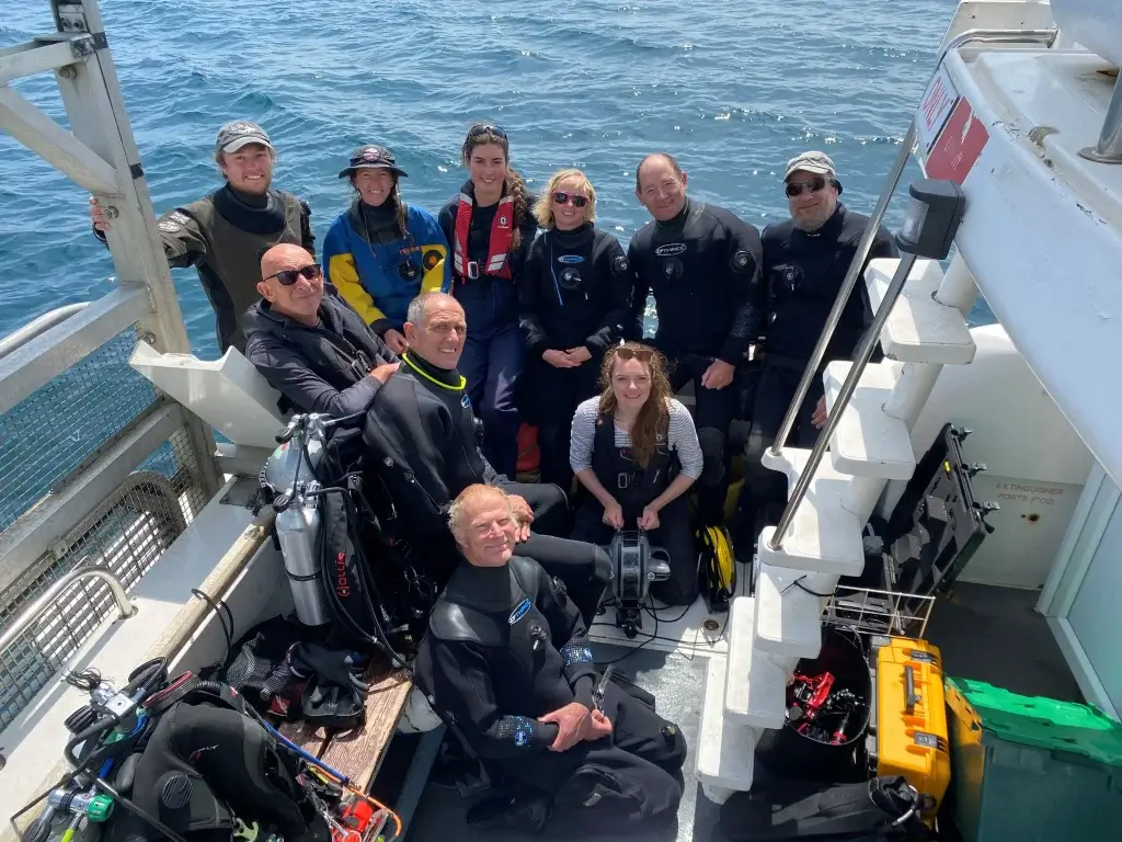
Maerl dive survey team. Credit © Natural England/Mike Anselmi
Using ROVs in Environmental Surveys and Habitat Mapping
Meg Hayward Smith, Marine Higher Officer for the Devon, Cornwall, and Isle of Scilly area team at Natural England, shared how the team first introduced the Deep Trekker ROV into their marine monitoring work, primarily to support exploratory surveys and ground truth existing habitat records. It was their first experience using an ROV, and while they were initially unfamiliar with its full range of capabilities, they quickly recognised the substantial benefits the technology provided. As the team gained hands-on experience, they saw the significant value it added to their monitoring efforts. Looking ahead, they hope to expand its use for more detailed habitat mapping.
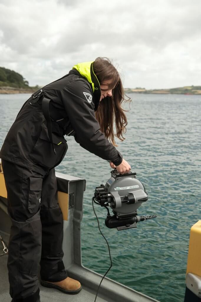
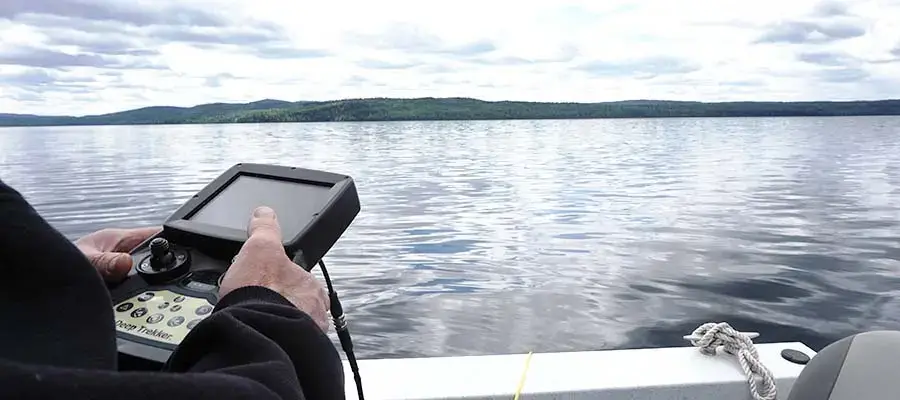
Meg Hayward Smith deploying the DTG3 ROV. Credit © Natural England/Mike Anselmi
Meg explained that this was the team’s first experience using an ROV. “We weren’t familiar with other systems, so in those early surveys, we focused on using it to support environmental monitoring – checking habitats, carrying out pre-dive assessments, and ground truthing locations before deploying divers.”
This functionality proved particularly valuable, allowing the team to assess underwater conditions efficiently and validate habitat records before committing diver time. With each deployment, the team became more confident in operating the ROV and more aware of its capabilities.
“After conducting several surveys back-to-back and learning how best to integrate the ROV, we realised it had much greater potential across our work,” Meg said. This prompted a shift in thinking – moving beyond initial applications toward exploring how the ROV could be more strategically embedded in their survey processes.
In particular, they started thinking about incorporating more advanced techniques, such as using the ROV for transects and deploying it to specific locations for more targeted data collection.
The team is now considering future applications such as conducting structured transects and targeted deployments to collect more consistent and high-resolution data. “We’re at the point where we see it as a valuable tool,” Meg explained. “Now the question is: how can we get the most benefit from it and apply it more widely across different surveys?”
Operational efficiency is also an important consideration. So far, both Natural England’s in-house dive team and regional area teams have utilised the ROV to support marine monitoring work. While the current model has proven effective for exploratory work and ground truthing, a more advanced system in the future could support detailed habitat mapping and provide stronger evidence to inform conservation decisions. This would help ensure that future surveys are carried out as effectively and efficiently as possible. The ROV already offers a cost-effective means of optimising survey time and resources, supporting more informed planning and decision-making across projects.
“The ROV provides valuable support to our surveys by enhancing our in-house capabilities, complementing the work of external contractors. As the first ROV in our organisation, it has already proven to be a useful tool in improving our monitoring efforts.”
To enhance flexibility and cost-efficiency in marine surveys, the ROV offers valuable support for exploratory work and effectively complements established survey programs.
“While we currently work within certain constraints, the ROV supports exploratory work by enabling us to survey potential new sites more flexibly and at a lower cost,” Meg explained. “This helps make our surveys more efficient and effective, working alongside our existing survey methods to enhance overall monitoring capabilities.”
Why Use an Underwater ROV for Marine Habitat Surveys?
Natural England is responsible for advising the UK government on environmental protection. A core component of their work involves monitoring MPAs to assess habitat types, health, and density along England’s coasts.
“At Natural England, we advise the government on environmental issues across England. As part of this role, we carry out marine monitoring to assess the condition of Marine Protected Areas along the English coastline. This includes improving our understanding of habitat types, evaluating their health, and identifying the extent of key habitats.”
According to Meg, the team typically conducts habitat monitoring using a combination of side scan sonar and diver surveys. However, many coastal sites are difficult or costly to access with divers or large vessels. The addition of an ROV created a new way to conduct environmental assessments in challenging or unverified areas.
Reducing Risk and Costs of Diver Deployments
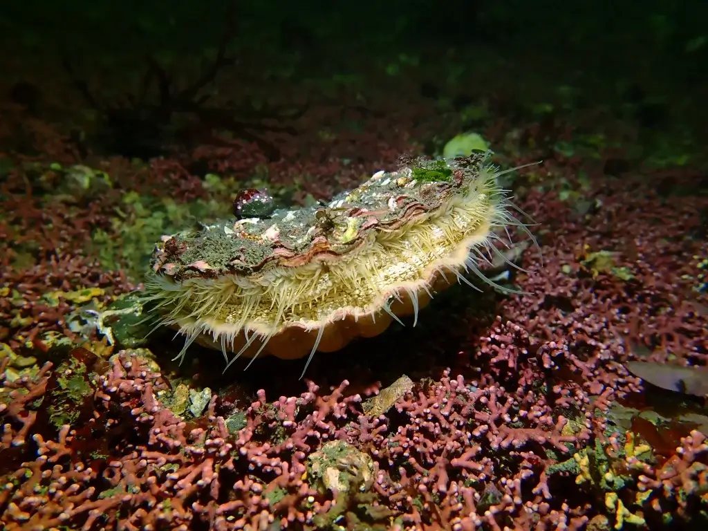
ROVs enabled Natural England to perform preliminary checks in uncertain locations where the presence of protected species or habitats – like maerl beds or seagrass – was unconfirmed.
“We pre-selected our sites based on previous records and data from Seasearch,” Meg explained. “In some cases, we weren’t entirely certain whether maerl was present. Records suggested it might be there, but confirmation was needed. Rather than deploying divers and using air resources – limiting their availability for the rest of the survey – we used the ROV to ground truth those records and verify the presence of maerl. This approach has already proven highly effective. It also allowed us to conduct exploratory surveys at potential new sites where we don’t yet have records. While we currently focus the ROV work on confirming known sites, we hope to expand its use for more detailed habitat mapping in the future.”
King Scallop Pecten maximus on Maerl. Credit © Natural England, Danielle Agnew
This approach provided several advantages:
- Minimized air consumption by divers during verification stages
- Reduced reliance on chartering survey boats
- Eliminated the need to contract external services for initial site assessments
“We usually conduct two dives a day, but divers need to observe their surface intervals before diving again to ensure safety,” noted Meg. “During these intervals, we use the ROV to inspect other sites, which greatly improves our efficiency. It has worked really well for us.”
Improved Survey Efficiency and Habitat Mapping
The team used the ROV to conduct “ground-truthing” passes, capturing video and imagery of seagrass beds and maerl habitats. This data helped them decide where to focus diver efforts and confirmed habitat presence in real-time.
“Our dive sites are pre-selected based on our methodology and previous Seasearch records,” Meg noted. “Once on site, we gather around the ROV screen to assess the habitat in real time. If we identify maerl using the ROV, we proceed to send divers down to survey the site; if the site isn’t suitable, we move to the next point. We can quickly redeploy the ROV to a different location, and when we confirm a promising site, we send the divers down. This approach has been invaluable for ground truthing and has saved us significant time.”
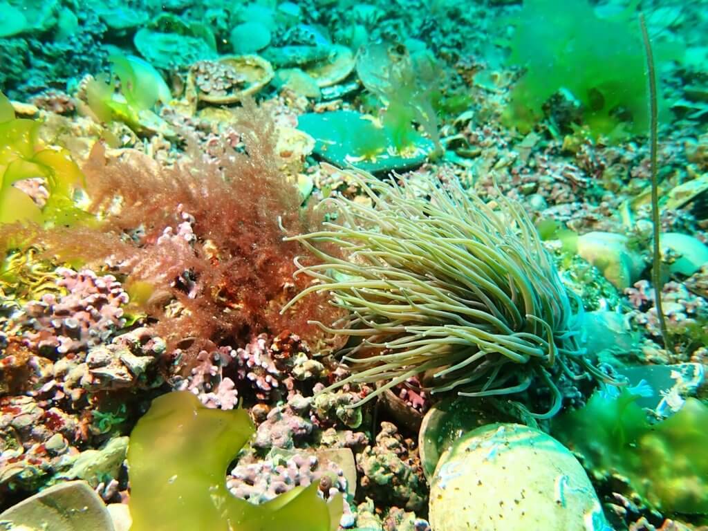
Maerl bed with snakelocks anemone and diverse seaweeds-Credit © Natural England, Angela Gall
Enabling Stakeholder Engagement
The ROV also improved stakeholder understanding during site visits. Natural England could show real-time underwater footage of sensitive habitats, offering transparency and educational value without requiring others to dive.
“The marine environment is largely hidden from view, making it difficult to convey what lies beneath the surface. The ROV enables us to directly show stakeholders and partners the specific habitats we are monitoring, helping them gain a clearer understanding of these areas and the importance of protecting them. This has been invaluable for building awareness and support.”
How Difficult Was It to Learn ROV Operations?
Natural England had no prior experience operating ROVs. According to Meg, the team learned basic skills quickly:
- Half-day familiarization session before deployment
- Guidance from a drone pilot on angles and positioning
- Trial runs before live projects
“This was our first time working with an ROV in the organisation, so there was a learning curve,” Meg explained. “With a short initial training session – about half a day – we were able to get comfortable with the system and begin integrating it into our survey work.
The technology proved intuitive and accessible, even with minimal formal training.
I also make time for additional learning and practice between surveys to maintain familiarity with its operation ahead of survey deployments. I had some prior experience with ROVs earlier in my career, though the model we use now is much more user-friendly and suited to our needs in the field.”

When asked which features of the ROV proved most beneficial, Meg highlighted the lights, high quality camera, and tether as key assets for their projects:
“The lighting was especially valuable – maerl has a distinctive bright pink colour when alive, but without proper illumination, it’s difficult to distinguish. The high-quality video and still imagery played a crucial role as well; we captured extensive footage that helped identify potential future dive sites and build a detailed visual record. This also allowed us to anticipate which species we might encounter before deploying divers. During deployments, we often observed cuttlefish, spider crabs, scallops, and other marine life. Additionally, the tether was an important feature, providing confidence and control by ensuring the ROV remained securely connected throughout the survey.”
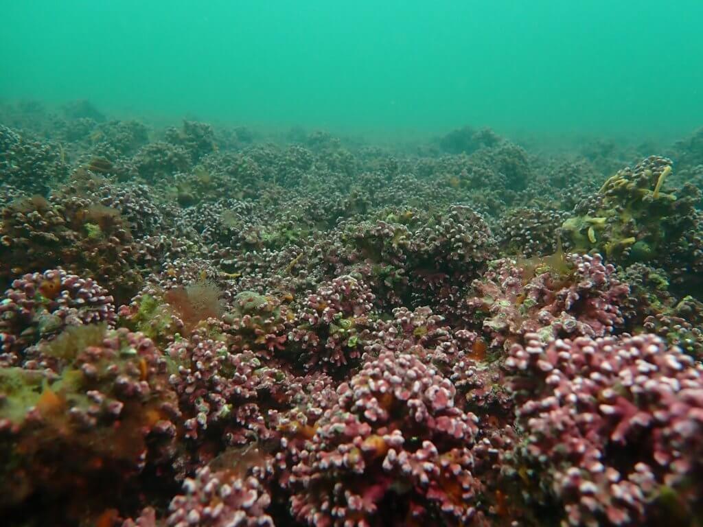
Typical maerl bed in the Fal estuary-Credit © Natural England, Angela Gall
What Species and Habitats Were Monitored?
The primary focus areas included:
- Seagrass beds: Vital habitats for fish nurseries and coastal protection
- Maerl beds: Rare, slow-growing pink calcified seaweed resembling coral, critical for biodiversity
Natural England used the ROV to locate and map maerl patches previously identified only by rough records, creating a clearer picture of species distribution in Cornwall’s coastal waters.
For a more detailed examination of Natural England’s research on seagrass and maerl beds, refer to the following publications from BBC and the UK government.
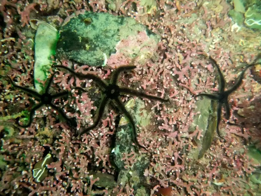
Brittlestars on a Maerl bed in St Austell Bay, Cornwall-Credit © Natural England, Angela Gall
Natural England’s Use of the ROV for Marine Protected Area Monitoring
Supporting Marine Protected Area Assessments
Natural England is responsible for monitoring and assessing the condition of England’s Marine Protected Areas to ensure habitats remain in favorable condition. As part of their approach, the team uses the Deep Trekker ROV to support environmental surveys and habitat mapping.
Meg illustrates how the ROV provides flexibility for validating areas of interest identified during acoustic surveys.
“We see the ROV as a complementary tool that works alongside our existing methodology, enhancing and aiding our data collection and monitoring efforts. It helps bridge the gap between diver-based surveys and broad-scale vessel mapping, allowing us to validate specific areas and make more informed decisions about when diver deployment is necessary.”
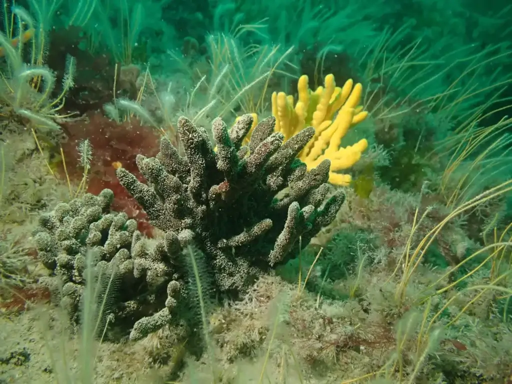
Sponges, Bideford to Foreland Point MCZ. Credit © Natural England, Angela Gall
The ROV is regularly used for ground-truthing habitats and pre-dive checks, providing live video feedback and reducing risks in challenging conditions. Its compact size and portability allow deployment in remote locations where larger equipment is impractical.
Mackenzie Normandeau, Account Executive at Deep Trekker, explains how the ROV fits into common environmental workflows:
“We’ve had people use it after a side-scan sonar run to narrow down areas of interest or to inspect a target that they weren’t able to confirm from the sonar. I’ve also seen folks use it for object detection and light retrievals – marine debris, sensors, or ghost gear that needs to come out of the water.”
Habitat Types and MPAs Surveyed
Natural England’s Deep Trekker ROV supports the survey of diverse habitat types including:
Rocky Reefs and Sedimentary Habitats
The ROV is often used to survey rocky reef ecosystems, which are critical for supporting marine life such as fish, crustaceans, and invertebrates. Rocky reefs provide shelter and food sources for a variety of species, making them a focus of conservation efforts in many MPAs. The ROV can precisely navigate rocky outcrops, capturing detailed footage of reef structure, flora, and fauna.
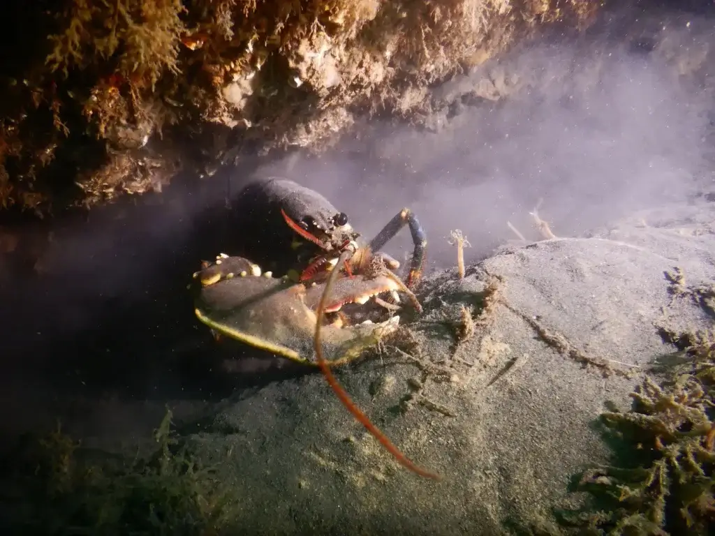
European Lobster Homarus gammarus on the wreck of the SS Rosalie within the Cromer Shoal Chalk Beds MCZ-Credit © Natural England, Sophie Sparrow
Sedimentary habitats, including sandbanks and mudflats, are also surveyed using the ROV. These areas are important for benthic organisms (such as worms, mollusks, and other invertebrates) and serve as feeding grounds for many fish species. The ROVs maneuverability allows it to navigate through different types of sediment, capturing footage that helps assess the health of these habitats and identify any potential threats, such as sediment disturbance or pollution.
Seagrass Beds
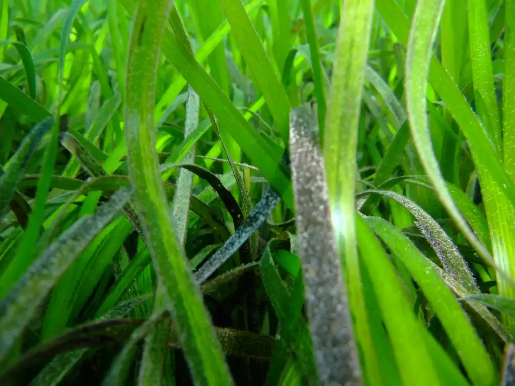
Seagrass meadow in the Isles of Scilly-Credit © Natural England, Emily Priestly
Seagrass meadows are among the most productive and valuable ecosystems in coastal waters, providing numerous ecosystem services such as carbon sequestration, water filtration, and habitat for juvenile fish. They are, however, highly susceptible to degradation from human activities, such as anchoring, trawling, and coastal development. The ROV’s high-definition video footage provides Natural England with the means to monitor seagrass health, identify changes in coverage or structure, and assess threats to these vital ecosystems.
The ROV’s ability to collect real-time visual data allows the team to evaluate seagrass density, coverage, and species composition, providing insights into the broader health of the ecosystem. This data is critical for maintaining the integrity of MPAs and for ensuring that conservation actions are appropriately focused.
Expanding Monitoring Capabilities
“We often get asked to confirm where there are seagrass beds, and the ROV’s good for that because you can get low and see the structure properly.”
Seagrass meadows, recognized for their importance in carbon sequestration and as fish nurseries, are also monitored. The ROV allows the team to gather footage of these sensitive habitats while minimizing physical disturbance.
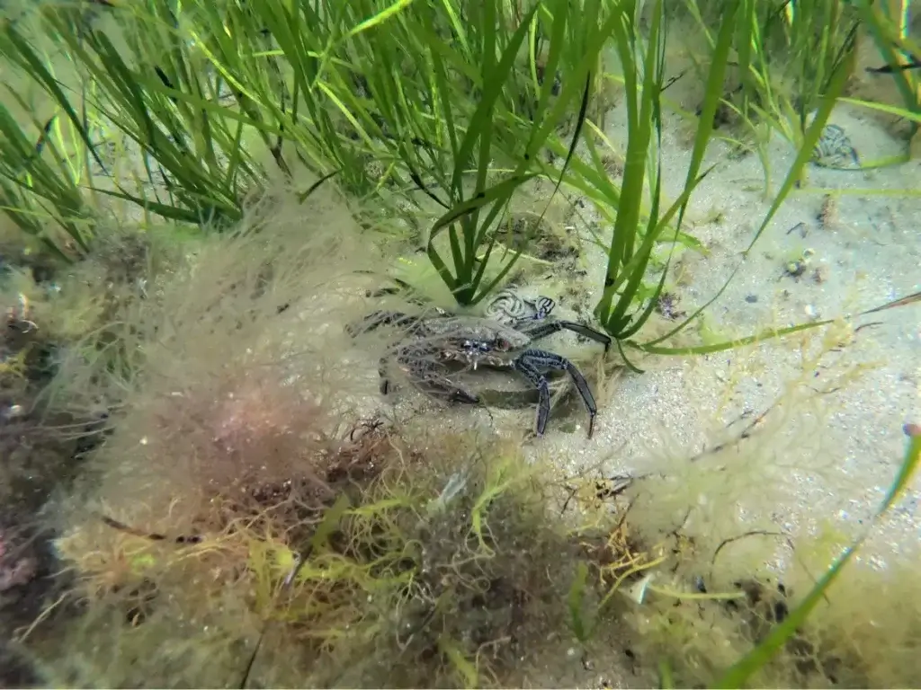
Velvet swimming crab (Necora puber) in seagrass beds, Bembridge MCZ, Isle of Wight. Credit: © Natural England/ Caitlin Napleton
Additionally, sedimentary environments such as mudflats and sandbanks are surveyed to assess changes due to natural processes or human activities. Footage from the ROV informs condition assessments required under national conservation objectives and contributes to England’s MPA monitoring program.
Future Applications
Natural England is now looking to expand its use of ROV technology to support more advanced and structured environmental monitoring strategies across England’s marine protected areas (MPAs). Building on the success of initial deployments for ground-truthing and exploratory work, the team is considering how underwater ROVs can be used to conduct standardized transects, improve data consistency, and strengthen long-term habitat assessments.
The use of Deep Trekker ROVs has already demonstrated significant potential to reduce the logistical and financial constraints associated with traditional marine surveys. By integrating ROVs into routine workflows, Natural England can increase survey frequency, improve spatial coverage, and minimize the need for chartering vessels or deploying divers to high-risk or remote areas. This is particularly relevant for hard-to-access parts of the UK coastline, where traditional survey methods are either cost-prohibitive or technically limited.
ROVs will play an increasingly central role in environmental monitoring initiatives over the next several years.
Key priorities include:
- Expanded mapping and trend detection: ROVs will support higher-resolution seabed mapping and repeated surveys to detect environmental changes over time, particularly in sensitive habitats such as maerl beds.
- Comprehensive marine condition assessments: Detailed visual and structural surveys using ROVs will be critical for conducting full condition assessments across designated Special Protection Areas (SPAs), enabling more targeted conservation actions.
- Public outreach and stakeholder engagement: Video footage and data collected by ROVs will be used in outreach initiatives to build local awareness and ownership, especially in regions with high ecological and economic stakes like Cornwall’s south coast.
- Support for scientific research: ROV-based sampling and observation will assist ongoing studies, including genetic research, by providing consistent, non-invasive access to underwater ecosystems.
- New partnership and investment models: ROV data will inform sustainable management strategies, helping to identify areas under pressure and supporting investment in ecosystem resilience, especially in vulnerable habitats.
Focusing efforts on ecologically significant areas with high conservation potential and existing stressors ensures that ROV technology contributes directly to measurable, system-level improvements in marine ecosystem health.
What are the Long-Term Benefits of ROV Adoption?
Natural England is now exploring further ROV applications to increase efficiency and reduce operational costs. Potential future uses include:
- Expanding habitat mapping programs
- Conducting repeat monitoring without external contractors
- Improving data collection for environmental impact assessments
“Going forward, we’re looking to integrate the ROV more fully into our methodology—not just for ground truthing, but as a key tool in mapping habitats and strengthening our overall understanding. This will help us build a more robust evidence base to support our survey work.”
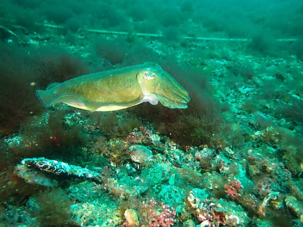
Cuttlefish swimming over a maerl bed during a maerl dive survey. Credit: © Natural England/Angela Gall
Real-World ROV Applications for Environmental Research
Natural England’s adoption of Deep Trekker ROV technology demonstrates how remotely operated vehicles enhance marine habitat monitoring.
The ROV provided:
- Cost savings
- Improved operational flexibility
- Increased survey efficiency
- Safer preliminary assessments
“For us, the greatest benefit is the capability it provides – it significantly reduces the time and effort required, while enabling us to collect additional data,” said Meg. “Using the ROV for ground truthing and habitat identification, rather than deploying a diver, is a game changer. If the target habitat isn’t present, we avoid unnecessary diver time, which not only improves safety but enhances the overall efficiency of our survey operations.”
By integrating ROVs, organizations like Natural England can strengthen their ability to protect sensitive marine ecosystems while optimizing budgets and resources.
Expert Guidance and Custom Solutions
Facing a unique underwater challenge? Our team of experienced experts is committed to helping you integrate submersible robots into your operations with ease. Whether your project involves environmental monitoring, marine research, infrastructure inspections, water tank maintenance, salvage operations, underwater surveys, search and recovery missions, aquaculture, or any other specialized application, we are equipped and ready to meet your specific needs and goals using our advanced ROV technology.
Secure Your Deep Trekker ROV Today
When you’re ready to secure your very own Deep Trekker vehicle, feel free to contact us. Incorporating Deep Trekker ROVs into your underwater operations ensures unmatched safety, efficiency, and success.